Alert
Alerts
Description
Map
Ratings and reviews
See around
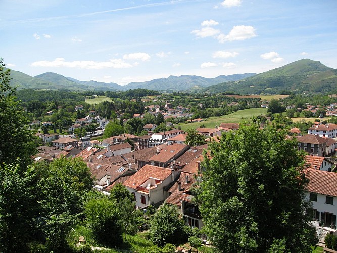
Saint-Jean-Pied-de-Port
Credit
: ©
Description
Longer un 1er poste de chasse puis un 2nd. Le sentier oblique en descendant sur une crête à droite. La quitter à gauche sous un 3ème poste. Le passage s’élargit, tourne à droite puis se rétrécit en longeant une grange. Suivre une route à droite sur 250 m, couper par un sentier à gauche et la rejoindre juste avant une barrière canadienne. Descendre ainsi jusqu’à Saint Etienne-de-Baïgorry que l’on traverse vers la droite ; depuis le pont sur la Nive des Aldudes, remarquer en enfilade le pont romain et le château d’Etchaux. Le GR10® se prolonge ensuite à gauche vers Saint-Jean-Pied-de-Port.
Technical Information
Lat, Lng
43.189685-1.359926
Coordinates copied
Uncertain state
Point of Interest updated on 01/01/1970
This point of interest hasn't been updated recently, which could compromise the reliability of this information. We recommend that you inquire and take all necessary precautions. If you're the author, please verify your information.
Altimetric profile
Data author

Ratings and reviews
To see around