Alert
Alerts
Description
Map
Ratings and reviews
See around
La traversée du plateau d'Aire Leku
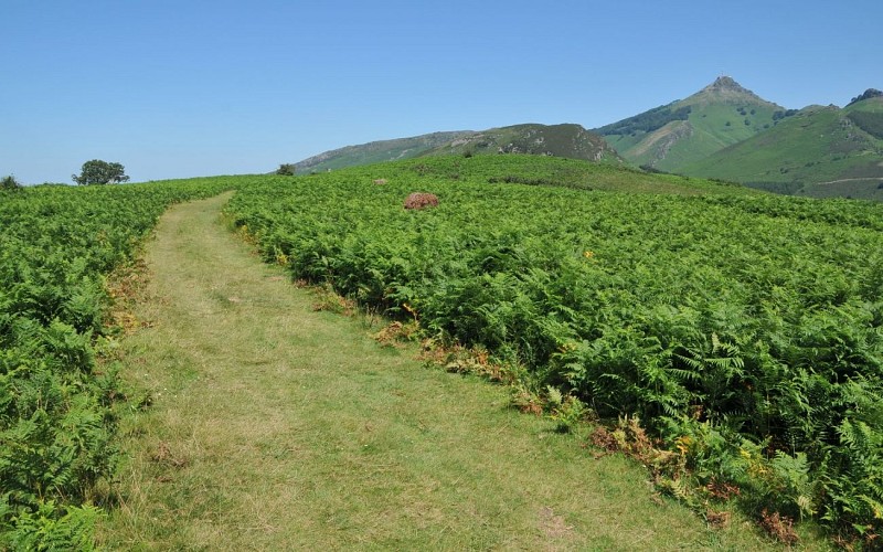
Credit
: B. Valcke
Description
Au col des Abeilles (244 m), ignorer la route du col d'Ibardin et choisir à droite le chemin fermé à la circulation par une barrière. Il sort de la forêt, découvre le sommet de la Rhune, et atteint une hauteur dégagée. Descendre 30 m vers un petit col herbeux (266 m), puis suivre le large chemin qui remonte à droite au milieu des fougères. Au sommet, traverser le plateau d'Aire Leku, passer près d'une ruine, puis descendre en face sur le sentier de crête, qui courbe vers la gauche."
Technical Information
Lat, Lng
-1.684192543.320929
Coordinates copied
Uncertain state
Point of Interest updated on 01/01/1970
This point of interest hasn't been updated recently, which could compromise the reliability of this information. We recommend that you inquire and take all necessary precautions. If you're the author, please verify your information.
Altimetric profile
Data author

proposed by
Office de Tourisme Pays Basque
64502 France
Ratings and reviews
To see around