Alert
Alerts
Description
Map
Ratings and reviews
See around
Du col de la chapelle d'Olhain au vallon d'Uhalde
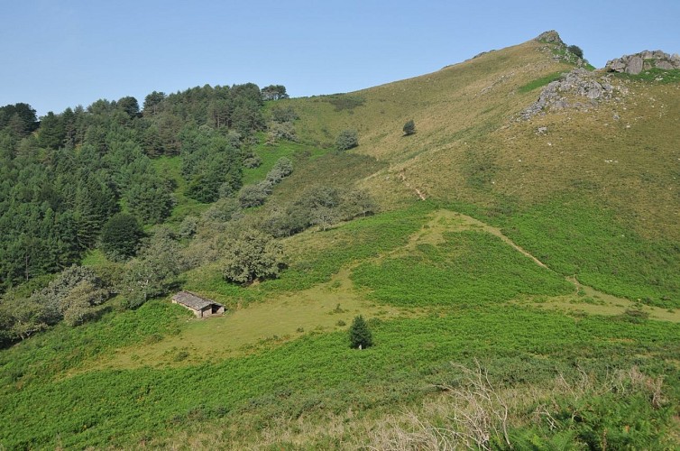
Credit
: B. Valcke
Description
Au col (348 m) situé sous le dôme de la chapelle d'Olhain, on peut faire un aller et retour jusqu'aux ruines ou s'accorder une pause près d'une belle bergerie à droite. Descendre ensuite à gauche par le bon chemin. Ignorer plus bas une borde sur la droite puis, juste après avoir traversé un ruisseau, attention à bien bifurquer à droite sur un sentier discret ; il borde le ruisseau puis s'en écarte progressivement. Parvenir ainsi dans le virage du chemin caillouteux d'Etxegarai (vue sur Sare) : descendre en face pour rejoindre vite une allée bétonnée (parking), que l'on descend à droite sur 300 m.
Technical Information
Lat, Lng
43.2947608-1.6050715
Coordinates copied
Uncertain state
Point of Interest updated on 01/01/1970
This point of interest hasn't been updated recently, which could compromise the reliability of this information. We recommend that you inquire and take all necessary precautions. If you're the author, please verify your information.
Altimetric profile
Data author

proposed by
Office de Tourisme Pays Basque
64502 France
Ratings and reviews
To see around