Alert
Alerts
Description
Map
Ratings and reviews
See around
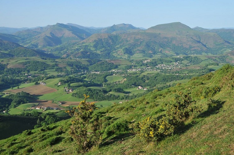
La descente vers Macaye
Credit
: B. Valcke
Description
Après avoir profité du panorama de l'Ursuia (681 m), face au Baigura, descendre 100 m sur la gauche (dans l'herbe) pour trouver sur la droite le départ d'un chemin. Après un virage sur le versant sud du sommet, il descend vers un col herbeux à l'est, puis s'en écarte pour descendre sur le flanc droit de la crête, en dominant Macaye. Il est relayé par un sentier entre les genêts. Tourner ensuite à droite sur un chemin plus large vers un bois de chênes, puis descendre à gauche en lisière des arbres. A l'intersection située entre deux granges, continuer à gauche (en refermant le portillon derrière vous).
Technical Information
Lat, Lng
43.3436648-1.3340221
Coordinates copied
Uncertain state
Point of Interest updated on 01/01/1970
This point of interest hasn't been updated recently, which could compromise the reliability of this information. We recommend that you inquire and take all necessary precautions. If you're the author, please verify your information.
Altimetric profile
Data author

proposed by
Office de Tourisme Pays Basque
64502 France
Ratings and reviews
To see around