To see around
See more
Open
Close
Show
Show
Show
Show
Show
Show
Show
Show
Show
Show
Show

Oups... It would appear that Cirkwi does not have permission to use your location.

Description
Map
Ratings and reviews
See around

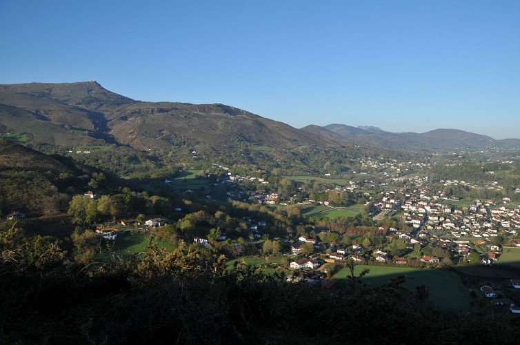
De Ascain au Bizkarzun

Le sentier des sommets
Credit : B. Valcke

Description

Au bas du parking de l'église (P1), suivre à gauche la rue du cimetière, puis tourner dans la première rue à droite (entre fronton et école Sainte-Marie, vers P2). Remonter la rue d'Arraioa jusqu'à son terme. En haut (ferme Arraioa), prendre en face un chemin creux (fléché « sentier des sommets »). Il rejoint une intersection en Y, proche d'un petit canal : descendre à gauche pour traverser un ruisseau (passerelle) et monter sur l'autre rive sur un chemin large et caillouteux. Après une traversée ascendante, quitter la piste dans le second lacet pour monter sur le sentier en face. Il coupe un nouveau chemin et continue tout droit le long d'un muret. Marcher entre les genêts jusqu'au sommet.

Technical Information

Lat, Lng
43.34458-1.61926
Coordinates copied
Altitude
-99999 m
Uncertain state
Point of Interest updated on 01/01/1970
This point of interest hasn't been updated recently, which could compromise the reliability of this information. We recommend that you inquire and take all necessary precautions. If you're the author, please verify your information.

Altimetric profile

Data author

64502 France

Ratings and reviews

To see around
See more
Open
Close
Show
Show
Show
Show
Show
Show
Show
Show
Show
Show
Show
Caution!
We have no information on the difficulty of this circuit. You may encounter some surprises along the way. Before you go, please feel free to inquire more and take all necessary precautions. Have a good trip! 🌳🥾