To see around
See more
Open
Close
Show
Show
Show
Show
Show
Show
Show
Show
Show
Show
Show

Oups... It would appear that Cirkwi does not have permission to use your location.

Description
Map
Ratings and reviews
See around

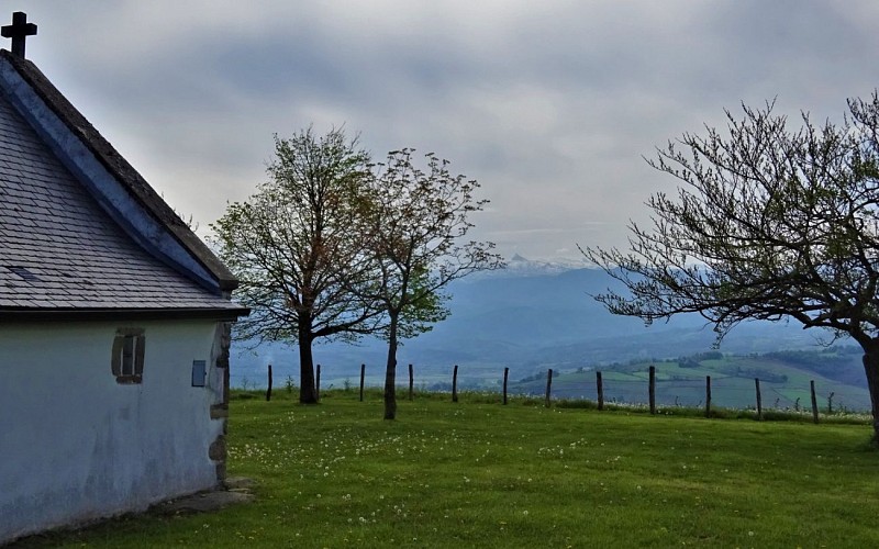
Chapelle Saint-Grégoire (426 m)

Chapelle Saint-Grégoire
Credit : OTPB

Description

Depuis la chapelle, repasser le portillon et tourner à gauche. Descendre tout droit avec la chapelle Saint-Antoine en point de mire, jusqu’à un col. De là, possibilité de monter jusqu’au site protohistorique de Gaztelüzarre à 250 m (15 mn aller-retour). Au col, après les abreuvoirs ne pas prendre le premier sentier à gauche qui part à flanc. Prendre la deuxième sente bien marquée qui descend puis passe à une source avec un abreuvoir. Le sentier rentre dans la forêt, d’abord horizontal, pour devenir une piste qui descend jusqu’à la ferme Urrütiagerria. Passer entre les bâtiments agricoles et suivre tout droit la petite route goudronnée qui rejoint bientôt l’itinéraire de l’aller jusqu’au point de départ.

Technical Information

Lat, Lng
43.2144249-0.951972
Coordinates copied
Altitude
-99999 m
Uncertain state
Point of Interest updated on 01/01/1970
This point of interest hasn't been updated recently, which could compromise the reliability of this information. We recommend that you inquire and take all necessary precautions. If you're the author, please verify your information.

Altimetric profile

Data author

64502 France

Ratings and reviews

To see around
See more
Open
Close
Show
Show
Show
Show
Show
Show
Show
Show
Show
Show
Show
Caution!
We have no information on the difficulty of this circuit. You may encounter some surprises along the way. Before you go, please feel free to inquire more and take all necessary precautions. Have a good trip! 🌳🥾