Alert
Alerts
Description
Map
Ratings and reviews
See around
Croisement
Credit
: OTPB
Description
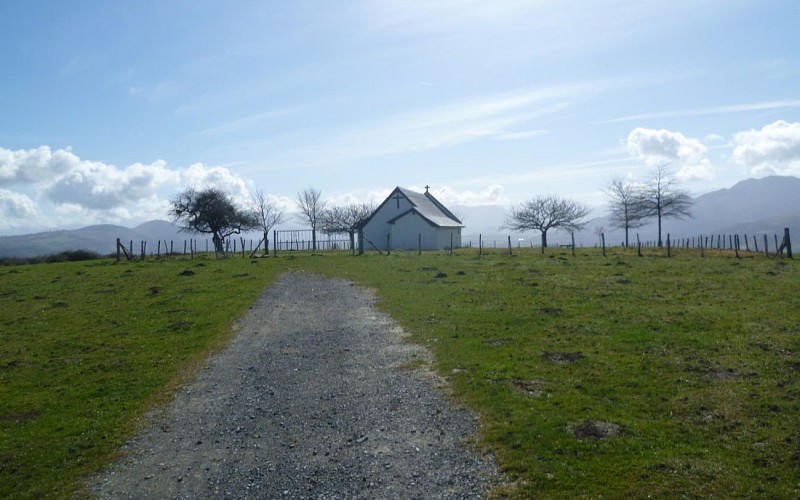
Du croisement, remonter légèrement sur 100 m puis laisser le GR 78 sur la droite pour monter tout droit jusqu’à un chemin horizontal. Prendre à gauche, rejoindre une petite route. Descendre sur la route jusqu’à un replat. Dans le virage, quitter la route pour continuer tout droit sur un chemin de terre (parfois boueux). Longer une prairie et retrouver bientôt la route de Lambarre. La traverser et prendre la petite route qui monte vers Saint-Grégoire. Laisser la route du lac à droite. Au sommet, tables de pique-nique dans l’enclos ombragé de la chapelle. Au besoin, un petit porche avec bancs permet de pique-niquer à l’abri. Par contre, il n’y a pas de point d’eau.
Technical Information
Lat, Lng
43.2096602-0.9308843
Coordinates copied
Uncertain state
Point of Interest updated on 01/01/1970
This point of interest hasn't been updated recently, which could compromise the reliability of this information. We recommend that you inquire and take all necessary precautions. If you're the author, please verify your information.
Altimetric profile
Data author

proposed by
Office de Tourisme Pays Basque
64502 France
Ratings and reviews
To see around