Alert
Alerts
Description
Map
Ratings and reviews
See around
Du quartier Garai à la crête de Sagorre
Credit
: B. Valcke
Description
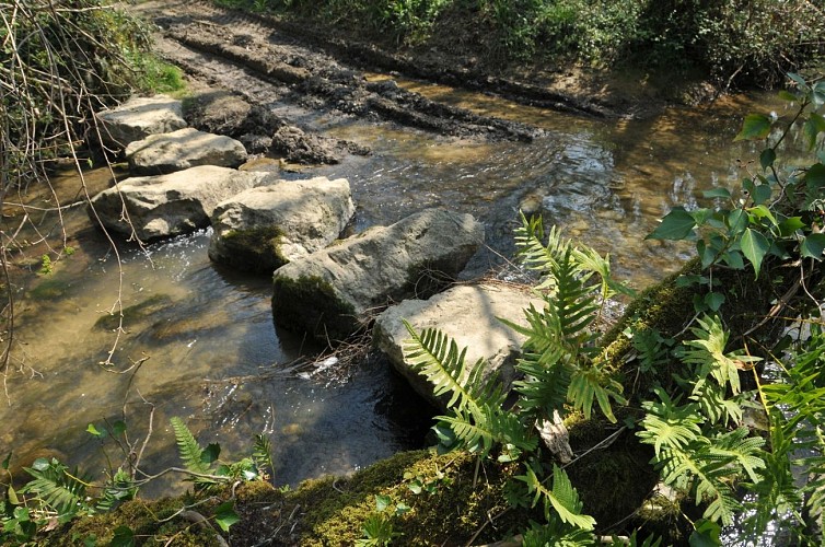
A l'intersection de Garai, proche d'un hangar, continuer en face sur la voie goudronnée, dite chemin de Larraldotte. Descendre ainsi jusqu'au lit de la rivière Louhirasse, que l'on traverse à gué par un alignement de blocs (ou une passerelle 50 m en amont). Sur l'autre rive, monter par le large chemin forestier. Aller à droite à la première intersection et monter raide dans le bois. Sur la crête boisée de Coudain (palombière en face), tourner cette fois à gauche et sortir de la forêt sous de beaux chênes. Poursuivre sur le chemin évident qui longe les prés du sommet de la colline (portions goudronnées).
Technical Information
Lat, Lng
43.4438771-1.0575763
Coordinates copied
Uncertain state
Point of Interest updated on 01/01/1970
This point of interest hasn't been updated recently, which could compromise the reliability of this information. We recommend that you inquire and take all necessary precautions. If you're the author, please verify your information.
Altimetric profile
Data author

proposed by
Office de Tourisme Pays Basque
64100 France
Ratings and reviews
To see around