Description
Map
Ratings and reviews
See around
Variantes au parcours pour explorer la vallée de l'Ouzoum
Credit
: ©Yann Mondot
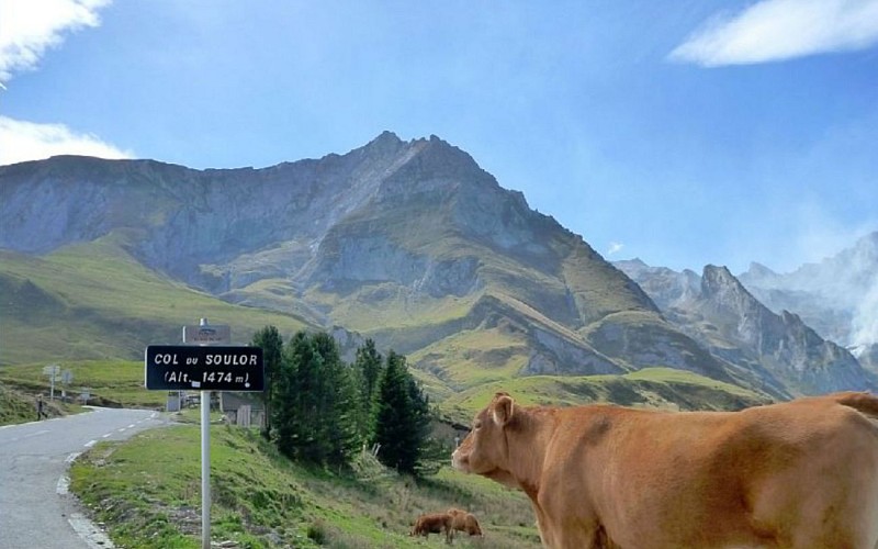
Description
A partir de la mairie, deux possibilités de variantes au parcours s’offrent à vous : aller jusqu’à Ferrières par la D126 (20km AR) ou monter jusqu’au col du Soulor (46km AR), col mythique du Tour de France. (jolis panoramas sur le cirque du Litor et le pic de Gabizos).
Technical Information
Lat, Lng
42.960861-0.261165
Coordinates copied
Altitude
-99999 m
Uncertain state
Point of Interest updated on 01/01/1970
This point of interest hasn't been updated recently, which could compromise the reliability of this information. We recommend that you inquire and take all necessary precautions. If you're the author, please verify your information.
Altimetric profile
Data author

Ratings and reviews
To see around