To see around
See more
Open
Close
Show
Show
Show
Show
Show
Show
Show
Show
Show
Show
Show

Oups... It would appear that Cirkwi does not have permission to use your location.

Description
Map
Ratings and reviews
See around

Departure - Town hall car park

rando-pau-aussevielle-ligne-vielle-06
Credit : Pau Pyrénées Tourisme / LA

Description

From the car park, go past “Aussevieille-info”.
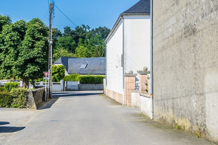
At the "Give way" sign, turn left and walk along the stone wall. Continue 200m and take the first street on the right “Chemin des sources”.
Continue on the asphalted road and cross the railway line. The road rises slightly.
100m after the railway line turn right and take the path lined with plane trees. This track is in fact the first route of the railway line between Tarbes and Bayonne before the Empress Eugénie asks for a passage through Lourdes.
At the crossroads of the D633, turn left on the road that goes up. After the right-angle bend, take an immediate right towards Poey-de-Lescar, via Chemin de la Serre.
At the next bend continue straight on the Chemin du Camp Romain.

Technical Information

Lat, Lng
43.35441-0.48308
Coordinates copied
Altitude
-99999 m
Uncertain state
Point of Interest updated on 01/01/1970
This point of interest hasn't been updated recently, which could compromise the reliability of this information. We recommend that you inquire and take all necessary precautions. If you're the author, please verify your information.

Altimetric profile

Ratings and reviews

To see around
See more
Open
Close
Show
Show
Show
Show
Show
Show
Show
Show
Show
Show
Show
Caution!
We have no information on the difficulty of this circuit. You may encounter some surprises along the way. Before you go, please feel free to inquire more and take all necessary precautions. Have a good trip! 🌳🥾