Alert
Alerts
Description
Map
Ratings and reviews
See around
La Chapelle de Cagnes
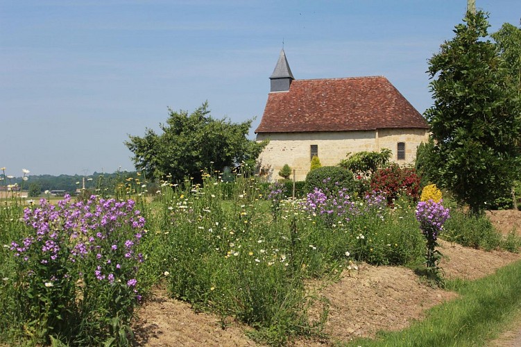
Credit
: OTCDB
Description
Continuer jusqu’à la Chapelle de Cagnes. Poursuivre ensuite sur 130m puis tourner à gauche sur 600m. Près d’une maison, bifurquer à droite et longer le bois. 200m plus loin, entrer à gauche, sur le sentier en sous-bois jusqu’au premier lac. Parvenir au complexe sportif. Partir à droite, longer le petit lac puis de nouveau à droite pour franchir le ruisseau. Tourner à gauche le long de la lisière. Après une petite passerelle, prendre à gauche puis à droite le long du champ. A la piste, remonter à gauche pour retourner sur Arthez-de-Béarn. En haut, revenir à gauche sur la D233. Traverser la route et rejoindre l'église. Retour au départ.
Technical Information
Lat, Lng
43.444229-0.611382
Coordinates copied
Uncertain state
Point of Interest updated on 01/01/1970
This point of interest hasn't been updated recently, which could compromise the reliability of this information. We recommend that you inquire and take all necessary precautions. If you're the author, please verify your information.
Altimetric profile
Data author

proposed by
Office de tourisme Cœur de Béarn
Ratings and reviews
To see around