Alert
Alerts
Description
Map
Ratings and reviews
See around
Hôpital-Saint-Blaise
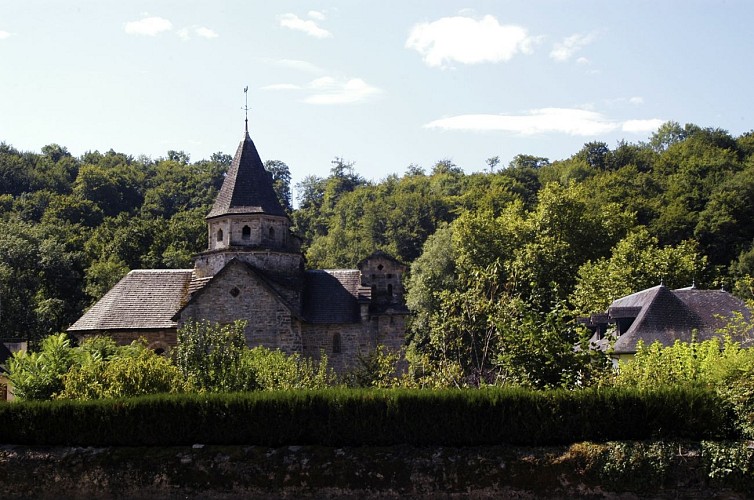
Credit
: © adt64
Description
Remonter par le chemin qui tourne vers le nord. À la fourche, prendre à droite. Au carrefour en T, à droite et, 20 m après, à gauche. Monter vers le coteau jusqu’à une route forestière. Continuer tout droit et traverser une plantation récente (direction nord-ouest) puis descendre par une ligne forestière (même direction). En bas, obliquer à gauche pour atteindre une passerelle en déclivité. La franchir et obliquer tout de suite à droite. Le sentier aboutit à une route. Remonter cette route à gauche environ 100 m et prendre à droite une voie forestière qui mène à la passerelle donnant accès à l’église de l’Hôpital-Saint-Blaise.
Technical Information
Lat, Lng
43.240316-0.755043
Coordinates copied
Uncertain state
Point of Interest updated on 01/01/1970
This point of interest hasn't been updated recently, which could compromise the reliability of this information. We recommend that you inquire and take all necessary precautions. If you're the author, please verify your information.
Altimetric profile
Data author

proposed by
Communauté de Communes du Haut-Béarn
12 place Jaca 64400 Oloron-Sainte-Marie Cedex France
Ratings and reviews
To see around