To see around
See more
Open
Close
Show
Show
Show
Show
Show
Show
Show
Show
Show
Show
Show

Oups... It would appear that Cirkwi does not have permission to use your location.

Description
Map
Ratings and reviews
See around

From the port to the Baluard marsh

Cabanes Talais - © Médoc Atlantique (1)
Credit : OT MEDOC ATLANTIQUE

Description

Once you reach the port of Talais, cross it to the left and follow the cycle path for 800m towards the D1E4.
In season, you can take a picnic break at the port (you can eat at the guinguette). The port is served by a cycle path leading to the Baluards oyster marsh and to the dyke along the estuary.
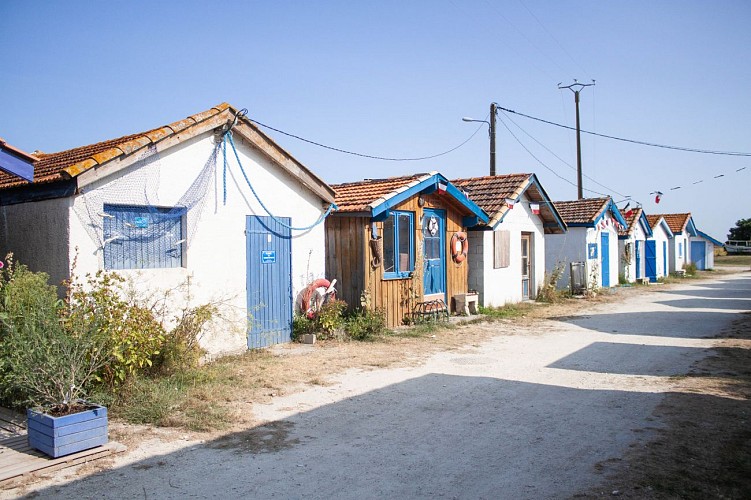
Built by fishermen to exploit an ancient deposit of Portuguese oysters, this port once enjoyed a high level of activity, which declined and died out in the 1970s.
The development of the banks of the estuary access channel and the renovation of the huts have enhanced this site, which is now open to visitors. When the weather is fine, you can enjoy a meal here, and why not try some of the oysters produced here.

Technical Information

Lat, Lng
45.4877845-1.0615451
Coordinates copied
Altitude
-99999 m
Uncertain state
Point of Interest updated on 01/01/1970
This point of interest hasn't been updated recently, which could compromise the reliability of this information. We recommend that you inquire and take all necessary precautions. If you're the author, please verify your information.

Altimetric profile

Data author

33590 France

Ratings and reviews

To see around
See more
Open
Close
Show
Show
Show
Show
Show
Show
Show
Show
Show
Show
Show
Caution!
We have no information on the difficulty of this circuit. You may encounter some surprises along the way. Before you go, please feel free to inquire more and take all necessary precautions. Have a good trip! 🌳🥾