Alert
Alerts
Description
Map
Ratings and reviews
See around
Bois Notre-Dame
Description
Au bout du ru de la Fontaine de Villiers, vous arrivez à la croisée des chemins entre le Parc de la Garennière et le Bois Notre-Dame, un domaine forestier de 2 056 hectares qui s'étend sur une dizaine de communes et deux départements (1 431 hectares en Val-de-Marne et 625 hectares en Seine-et-Marne).
Pour information, le Comité Départemental du Tourisme, le Conseil général du Val-de-Marne et l'Office National des Forêts ont édité une carte spécifique intitulée "Massif de l'Arc Boisé".
Prenez à droite, traversez le Parc de la Garennière et tournez à droite dans l'avenue Charles de Gaulle jusqu'au rond-point.
Technical Information
Lat, Lng
48.766122.53977
Coordinates copied
Altitude
95 m
Uncertain state
Point of Interest updated on 01/01/1970
This point of interest hasn't been updated recently, which could compromise the reliability of this information. We recommend that you inquire and take all necessary precautions. If you're the author, please verify your information.
Altimetric profile
IGN cards

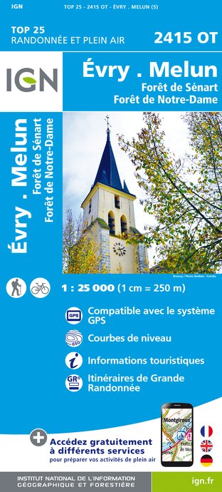
2415OT - ÉVRY MELUN FORÊT DE SÉNART FORÊT DE NOTRE-DAME
Editor : IGN
Collection : TOP 25 ET SÉRIE BLEUE
Scale : 1:25 000
13.90€

2414ET - MARNE-LA-VALLÉE FORÊT D'ARMAINVILLIERS FORÊTS DE FERRIÈRES ET DE CRÉCY
Editor : IGN
Collection : TOP 25 ET SÉRIE BLEUE
Scale : 1:25 000
13.90€

2314OT - PARIS FORÊT DE MEUDON FORÊT DE FAUSSES REPOSES
Editor : IGN
Collection : TOP 25 ET SÉRIE BLEUE
Scale : 1:25 000
13.90€

119 PARIS SENS PNR DU GÂTINAIS FRANÇAIS
Editor : IGN
Collection : TOP 100
Scale : 1:100 000
8.40€

190 PARIS CHANTILLY FONTAINEBLEAU
Editor : IGN
Collection : TOP 100
Scale : 1:100 000
8.40€

118 PARIS CHARTRES PNR DE LA HAUTE VALLÉE DE CHEVREUSE
Editor : IGN
Collection : TOP 100
Scale : 1:100 000
8.40€

108 PARIS ROUEN BEAUVAIS PNR DU VEXIN FRANÇAIS
Editor : IGN
Collection : TOP 100
Scale : 1:100 000
8.40€

109 PARIS COMPIÈGNE PNR OISE-PAYS DE FRANCE
Editor : IGN
Collection : TOP 100
Scale : 1:100 000
8.40€

D75-95 ÎLE-DE-FRANCE OUEST
Editor : IGN
Collection : CARTES DÉPARTEMENTALES IGN
Scale : 1:150 000
5.90€

D77 SEINE-ET-MARNE
Editor : IGN
Collection : CARTES DÉPARTEMENTALES IGN
Scale : 1:150 000
5.90€

NR05 GRAND EST RECTO/VERSO MASSIF DES VOSGES ALSACE LORRAINE
Editor : IGN
Collection : CARTES RÉGIONALES IGN
Scale : 1:250 000
6.80€

NR08 CENTRE-VAL DE LOIRE
Editor : IGN
Collection : CARTES RÉGIONALES IGN
Scale : 1:250 000
6.80€

NR04 - GRAND EST RECTO/VERSO ARDENNE CHAMPAGNE
Editor : IGN
Collection : CARTES RÉGIONALES IGN
Scale : 1:250 000
6.80€

NR03 ÍLE DE FRANCE
Editor : IGN
Collection : CARTES RÉGIONALES IGN
Scale : 1:250 000
6.80€

NR01 HAUTS-DE-FRANCE
Editor : IGN
Collection : CARTES RÉGIONALES IGN
Scale : 1:250 000
6.80€

801 FRANCE NORD OUEST
Editor : IGN
Collection : CARTES NATIONALES IGN
Scale : 1:320 000
6.10€

EUROPE
Editor : IGN
Collection : DÉCOUVERTE DES PAYS DU MONDE IGN
Scale : 1:2 500 000
7.00€
Data author

proposed by
Tourisme-val-de-marne
16 Rue Joséphine de Beauharnais 94500 Champigny France
Ratings and reviews
To see around