Alert
Alerts
Description
Map
Ratings and reviews
See around
Refuge Plan Lombardie

Credit
: APTV
Description
Enjoying an ideal location, this mountain hut provides outstanding panoramic views over the La Platière stream at the foot of the majestic Cheval Noir. Rising to 2,832 metres, the Cheval Noir’s summit provides a magnificent view of the Madeleine Pass and the Grand Pic de la Lauzière. In the summer, the site becomes an extensive area of pastureland shared between several farmers. In the Middle Ages, the word “ Lombard” was used to refer to mountain pastures used by herdsmen from Lombardy who kept their livestock on them. In those days, the Savoyards tended to call anywhere beyond the Alps “Lombardy”.
Technical Information
Lat, Lng
45.40026.43097
Coordinates copied
Altitude
1784 m
Point of Interest updated on 20/11/2025
Altimetric profile
IGN cards
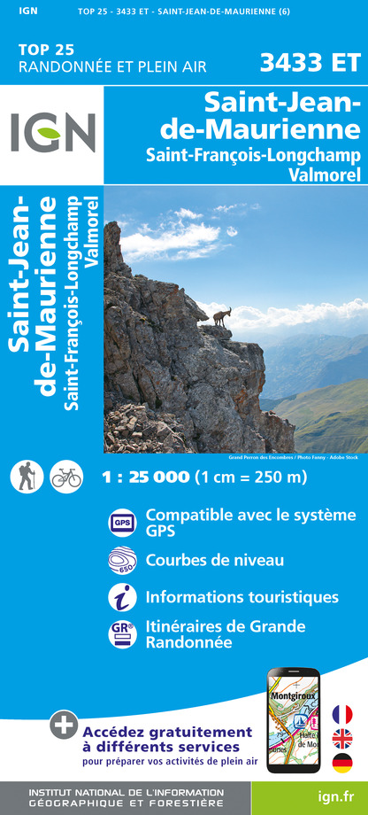
3433ET - SAINT-JEAN-DE-MAURIENNE SAINT-FRANCOIS-LONGCHAMP VALMOREL
Editor : IGN
Collection : TOP 25 ET SÉRIE BLEUE
Scale : 1:25 000
13.90€

TOP75003 - MASSIF DE LA VANOISE
Editor : IGN
Collection : TOP 75
Scale : 1:75 000
9.80€

TOP100D38 - ISÈRE GRENOBLE VIENNE PARC NATIONAL DES ÉCRINS PARC NATUREL RÉGIONAL DU VERCORS
Editor : IGN
Collection : TOP 100
Scale : 1:100 000
8.40€

TOP100D73 - SAVOIE CHAMBÉRY ALBERTVILLE PARC NATIONAL DE LA VANOISE PNR DU MASSIF DES BAUGES
Editor : IGN
Collection : TOP 100
Scale : 1:100 000
8.40€

202 JURA ALPES DU NORD
Editor : IGN
Collection : TOP 200
Scale : 1:200 000
6.80€

D38 ISÈRE
Editor : IGN
Collection : CARTES DÉPARTEMENTALES IGN
Scale : 1:150 000
5.90€

NR15 AUVERGNE-RHÔNE-ALPES RECTO/VERSO MASSIF ALPIN
Editor : IGN
Collection : CARTES RÉGIONALES IGN
Scale : 1:250 000
6.80€

NR14 AUVERGNE-RHÔNE-ALPES RECTO/VERSO MASSIF CENTRAL
Editor : IGN
Collection : CARTES RÉGIONALES IGN
Scale : 1:250 000
6.80€

EUROPE
Editor : IGN
Collection : DÉCOUVERTE DES PAYS DU MONDE IGN
Scale : 1:2 500 000
7.00€
Data author

proposed by
Parc national de la Vanoise
Ratings and reviews
To see around