Alert
Alerts
Description
Map
Ratings and reviews
See around
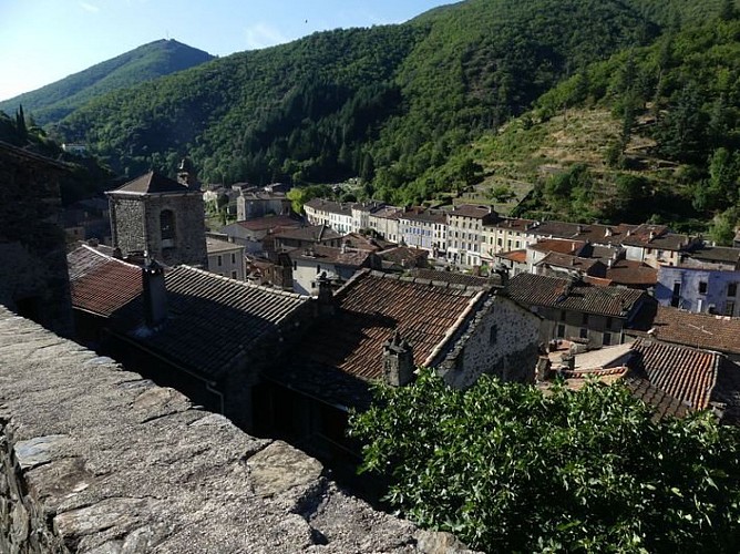
Valleraugue
Credit
: nathalie.thomas
Description
Valleraugue is believed to derive from "vallis eraugia", the Hérault valley. With its 7,834 hectares, the town extends from the Hérault valley to the summit of Mont Aigoual. Valleraugue is located on an important transportation route between the garrigues and the uplands, and once had up to 4,192 inhabitants (1851). Just over a century ago, in 1907, Abbot Fesquet wrote in his monograph on the village: "The population has been reduced to 2,500 souls. There was a time when it was difficult to find lodgings, says a 1773 town council deliberation. Nowadays, accommodation is plentiful...". In the 2007 census, the population was 1,081.
Technical Information
Lat, Lng
44.08117213.6381857
Coordinates copied
Uncertain state
Point of Interest updated on 16/11/2022
This point of interest hasn't been updated recently, which could compromise the reliability of this information. We recommend that you inquire and take all necessary precautions. If you're the author, please verify your information.
Altimetric profile
Data author

proposed by
Parc national des Cévennes
Ancienne gare 48400 Florac-trois-Rivières France
Ratings and reviews
To see around