Alert
Alerts
Description
Map
Ratings and reviews
See around
Le Montgrillet
Credit
: JF.RAULET
Description
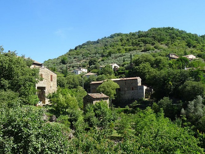
Le Montgrillet is the hillock above the village. The population of Meyrannes used to be overwhelmingly farmers, who lived on what they grew. Le Montgrillet is exposed to the sun and close to the village, and was the ideal spot for farming. Evidence for this can be seen all along the path. The grove of olive trees above the path indicates one of the crops once grown in Meyrannes, along with grapes and mulberry trees (for leaves to feed to silkworms). (B. Mathieu)
Technical Information
Lat, Lng
44.27227424.166678
Coordinates copied
Uncertain state
Point of Interest updated on 16/11/2022
This point of interest hasn't been updated recently, which could compromise the reliability of this information. We recommend that you inquire and take all necessary precautions. If you're the author, please verify your information.
Altimetric profile
Data author

proposed by
Parc national des Cévennes
Ancienne gare 48400 Florac-trois-Rivières France
Ratings and reviews
To see around