Alert
Alerts
Description
Map
Ratings and reviews
See around
Les Commandeurs
Credit
: Nathalie Thomas
Description
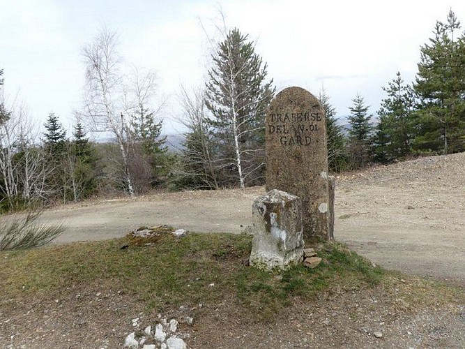
Vous êtes sur le chemin de crêtes dit des « cimes des Commandeurs ». C'est l'ultime trace qui témoigne d'une terre ayant appartenu dès 1312 aux Hospitaliers de Saint-Jean puis aux chevaliers de l'ordre de Malte, basés au hameau tout proche de Servillières. C'était « la commanderie de Meyrueis et de Servillières ». Vous êtes ici sur la limite entre le Gard et la Lozère, matérialisée par cette pierre plantée. Ce chemin de crête est appelé la draille du parc à loup, variante millénaire du chemin de transhumance de la « collectrice de la Lusette » entre l'Espérou et Meyrueis. Les troupeaux faisaient une halte dans un espace fermé et sécurisé des loups.
Technical Information
Lat, Lng
44.13757113.4324499
Coordinates copied
Uncertain state
Point of Interest updated on 16/11/2022
This point of interest hasn't been updated recently, which could compromise the reliability of this information. We recommend that you inquire and take all necessary precautions. If you're the author, please verify your information.
Altimetric profile
Data author

proposed by
Parc national des Cévennes
Ancienne gare 48400 Florac-trois-Rivières France
Ratings and reviews
To see around