Alert
Alerts
Description
Map
Ratings and reviews
See around
The Camisards' path
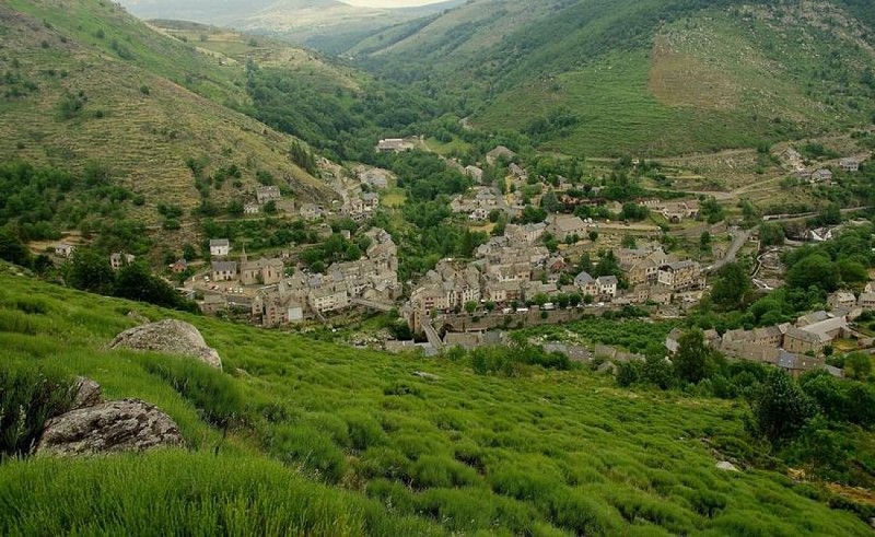
Credit
: © Brigitte Mathieu
Description
Marker 11This path used to be an important communication route linking Le Pont-de-Montvert with Barre-des-Cévennes. On 24 July 1702, it was used by a gathering of Huguenots coming from the Col des Trois Fayards, who intended to liberate their fellow Protestants being held by Abbot du Chayla in Le Pont-de-Montvert. These men thus used the path on which you stand. The tragic events that followed (including the Abbot’s violent death) triggered the Camisard War. The landscape surrounding the village is the result of intense agricultural activity. All neighbouring slopes were cultivated, especially with rye, on man-made terraces called bancels.
Technical Information
Lat, Lng
44.35954733.7413123
Coordinates copied
Uncertain state
Point of Interest updated on 16/11/2022
This point of interest hasn't been updated recently, which could compromise the reliability of this information. We recommend that you inquire and take all necessary precautions. If you're the author, please verify your information.
Altimetric profile
Data author

proposed by
Parc national des Cévennes
Ancienne gare 48400 Florac-trois-Rivières France
Ratings and reviews
To see around