Alert
Alerts
Description
Map
Ratings and reviews
See around
Cassini
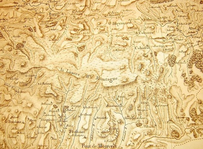
Credit
: © Archives départementales de la Lozère
Description
The first geometrical map of the Kingdom of France was realised, at a scale of 1:864,000, on the initiative of Louis XV. It is known as the Cassini Map. The Cassini family produced four generations of scholars. The first Cassini, an astronomer, began to apply a geodesic system that consisted of measuring the position of a point on Earth using bearings, namely the polar axis and the Equator. His descendants established a precise map of France (180 sheets) by triangulating a large number of bearings, such as Pic Cassini. It was used as a model for France's Ordnance Survey maps and today has practical applications in many fields (toponymy, phytosociology, etc.).
Technical Information
Lat, Lng
44.40115513.8460737
Coordinates copied
Uncertain state
Point of Interest updated on 16/11/2022
This point of interest hasn't been updated recently, which could compromise the reliability of this information. We recommend that you inquire and take all necessary precautions. If you're the author, please verify your information.
Altimetric profile
Data author

proposed by
Parc national des Cévennes
Ancienne gare 48400 Florac-trois-Rivières France
Ratings and reviews
To see around