Alert
Alerts
Description
Map
Ratings and reviews
See around
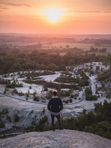
Panorama depuis le sommet du terril
Description
La petite montagne de 80 mètres qui se dresse au dessus de la campagne abbaroise n’a rien de naturel.
Le terril et l’étang sont les marques laissées par l’extraction de la cassitérite (dernière exploitation 1951-57). Les quelques 200 marches à gravir pour atteindre le sommet mènent à une vue imprenable.
Zone reconvertie en base de loisirs.
- Tables d’orientation au sommet du terril
- Ski nautique
- Tables de pique-nique à l’ombre
- Parcours permanent d'orientation
- Parcours numérique sur le patrimoine
Technical Information
Lat, Lng
47.5615849-1.5438795
Coordinates copied
Altitude
108 m
Uncertain state
Point of Interest updated on 19/12/2018
This point of interest hasn't been updated recently, which could compromise the reliability of this information. We recommend that you inquire and take all necessary precautions. If you're the author, please verify your information.
Altimetric profile
Data author

Ratings and reviews
To see around