Alert
Alerts
Description
Map
Ratings and reviews
See around
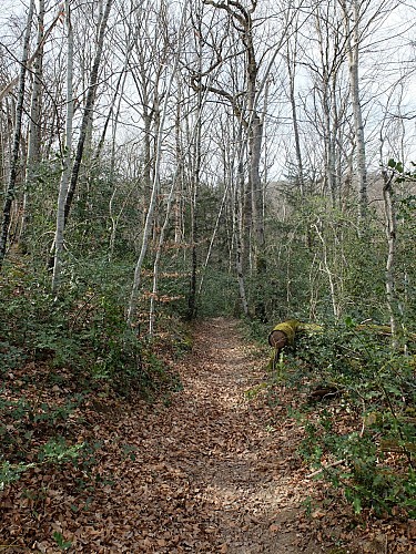
Le sentier vers la Treille
Credit
: OTOA
Description
Après la chaussée du moulin, prendre à gauche le sentier (source au départ) qui grimpe en sous-bois jusqu’au plateau. Arrivée à la route, tourner à droite et, 400m plus loin, arrivée à une intersection, à droite La Treille, s’engager à gauche. On trouve là l’antique voie romaine de Ségodunum à Divana que l’on suit sur 1200 m. Au carrefour, laisser à gauche le Boï, prendre en face la Route du Calvaire. Arrivée au pied de la butte de l’ancien oppidum. Prendre en face vers la chambre d'hôtes puis à droite, contourner la barrière par le passage prévu sur le chemin qui mène à la croix du sommet et au superbe point de vue sur la Bastide.
Technical Information
Lat, Lng
44.354562.07204
Coordinates copied
Altitude
296 m
Uncertain state
Point of Interest updated on 30/11/2022
This point of interest hasn't been updated recently, which could compromise the reliability of this information. We recommend that you inquire and take all necessary precautions. If you're the author, please verify your information.
Altimetric profile
IGN cards
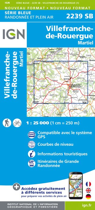
2239SB - VILLEFRANCHE-DE-ROUERGUE MARTIEL
Editor : IGN
Collection : TOP 25 ET SÉRIE BLEUE
Scale : 1:25 000
13.90€
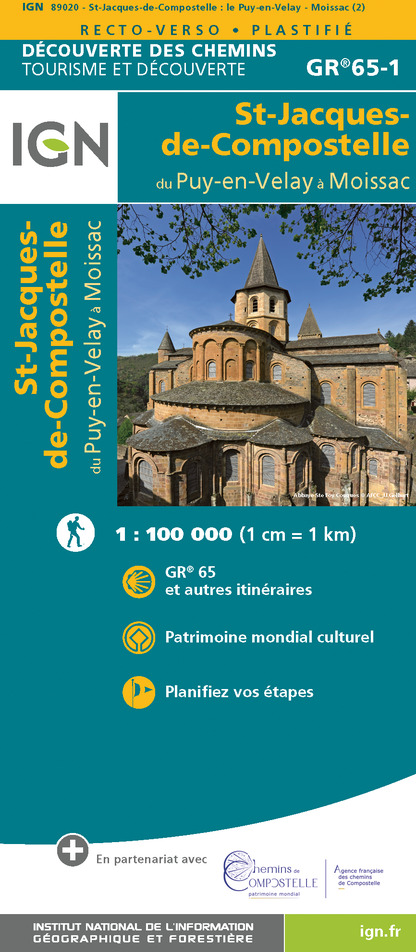
89020 - ST-JACQUES-DE-COMPOSTELLE GR®65-1 DU PUY-EN-VELAY A MOISSAC
Editor : IGN
Collection : DECOUVERTE DES CHEMINS
Scale : 1:100 000
9.10€

D46-47 LOT LOT-ET-GARONNE
Editor : IGN
Collection : CARTES DÉPARTEMENTALES IGN
Scale : 1:150 000
5.90€

D12-48 AVEYRON LOZÈRE
Editor : IGN
Collection : CARTES DÉPARTEMENTALES IGN
Scale : 1:150 000
5.90€

EUROPE
Editor : IGN
Collection : DÉCOUVERTE DES PAYS DU MONDE IGN
Scale : 1:2 500 000
7.00€
Data author

proposed by
Bastides et Gorges de l'Aveyron
Promenade du Guiraudet 12200 Villefranche de Rouergue France
Ratings and reviews
To see around