Alert
Alerts
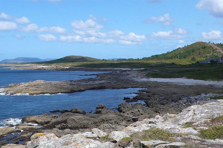
Miñarzos Reserve
Description
The Miñarzos, which is the first Reserve of Fishing Interest of the Atlantic coast in the Iberian Peninsula, was created on the initiative of the Lira fishermen's guild and marine biologists. The objective of the reserve is to regulate fishing activities in order to conserve the exploited species, with the aim of guaranteeing the sustainability of the marine ecosystem. By limiting access and regulating fishing activities, the species can reach larger sizes, which is important because the larger the species, the greater the number of eggs per clutch. In addition to the potential benefits related to fisheries, there are other advantages for the ecosystem, such as habitat conservation and increased biodiversity. To ensure the best management, there is a land-based maritime surveillance system, a catch control post in the port, and a census of vessels that can fish within the reserve, belonging to various fishermen's associations in the region.
Los Miñarzos covers an area of 2,074 hectares, and there are two integral reserves that occupy 79 hectares. Within the reserve zone, more restrictive measures are defined than those established by the general fishing regulations, referring to periods of activity, minimum sizes of specimens and catch quotas per boat. In the integral reserves, all extractive activities and underwater activities are prohibited; only activities for scientific purposes are allowed with express permission. Underwater fishing is prohibited throughout the marine reserve, but recreational, observation and, of course, photographic diving is permitted, except in the integral reserves. The Lira (Mardelira) fishermen's guild promotes the appreciation of fishing culture through the Mardelira project, which allows visitors to learn about a normal day's work at sea and the life of a small fishing port. It also organizes fishing workshops for schoolchildren, guided tours and boat trips for sport anglers in which no-kill fishing is practiced.
Technical Information
Altimetric profile

Data author
