Alert
Alerts
Description
Map
Ratings and reviews
See around
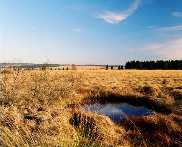
Les Hautes Fagnes
Credit
: MTPV
Description
Now is a timely moment to remind that Baelen is one of the 12 municipalities that is completely or partially incorporated into the Hautes Fagnes Natural Park. Many well-known places are scatteredthrough the territory of Baelen: Porfays, Le Noir Flohay, Durèt, Pavé de Charlemagne, Geitzbusch, La Fagne des Deux-Séries shared with the neighbouring municipality of Jalhay, as well as all the part of the Fagnes located on the left bank of the River Helle, which demarcates the limit of the municipality up to Eupen-Hütte. Here, there are also many varied possibilities for walks in all seasons through the supberb expanses of the Hautes Fagnes, a marvellous sanctuary for nature!
Technical Information
Lat, Lng
50.572416.09241
Coordinates copied
Altitude
511 m
Uncertain state
Point of Interest updated on 18/11/2022
This point of interest hasn't been updated recently, which could compromise the reliability of this information. We recommend that you inquire and take all necessary precautions. If you're the author, please verify your information.
Altimetric profile
Data author

proposed by
Maison du Tourisme du Pays de Vesdre
Ratings and reviews
To see around