Alert
Alerts
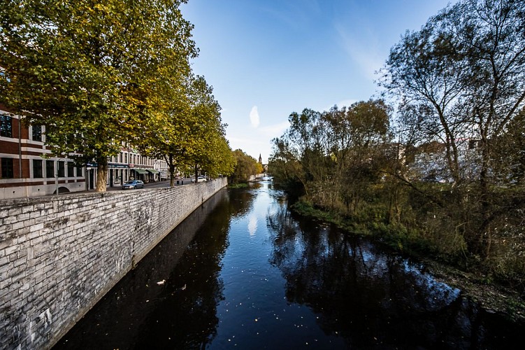
La Vesdre
Description
The waterway that runs through the town is called the Vesdre. The source of this 70-km torrential flow river is located on the Hautes-Fagnes plateau.It was downstream of this spring that the Vesdre Dam was built in 1950, creating a reservoir of twenty five million m³, to remedy the lack in quality and quantity fo water and to breathe new life into industry in Eupen.The River Vesdre flows from east to west in growing meanders, is joined by the River Gileppe and circumvents the rocky outcrop on which the stands the former capital of the Duchy of Limbourg in Dolhain.The river winds its way to Verviers where the valley broadens into different levels of terraces. The River Vesdre heads towards Pepinster and is joined by the River Hoëgne. It does not flow into the Meuse in Liège, but instead joins the Ourthe at Chênée.The release of organic matter, contained in the fleeces of the sheep that gambolled in the meadows of the antipodes, resulted in the blooming of vegetation that grew accidentally in a region to which it was foreign. Consequently, on the banks of the River Vesdre, more than 300 different species of exotic plants can be found, including the giant balsam from the Himalayas, which resembles orchids.The textile industry required plenty of water, not just as its driving force, used early on by the fulleries, but also for washing and other operations in the finishing process (finishing of woollen cloth). According to some, more than the exceptional quality of the river water (a point since contested by historians), the leading virtue of the River Vesdre was the quantity of water sufficient to power the industry, increased further by the construction of the Gileppe Dam (completed in 1878) which created a reservoir of water totalling 12 millions m³ whilst regulating the flow of the river.
Technical Information
Altimetric profile
Data author
