Tours
Activities
Places of interest
Where to eat
Where to sleep

Discover Valay, Haute-Saône, Franche-Comté and its charms

Are you in charge of the destination?
Nestled in the heart of Haute-Saône in Franche-Comté, the charming town of Valay serves as an ideal starting point for those keen on cultural and natural discoveries. Kick off your exploration with the ruins of the ancient Bucey-lès-Gy castle, providing a captivating glimpse into the region's medieval past. Hiking enthusiasts will find plenty of trails to explore, particularly those running along ...See more
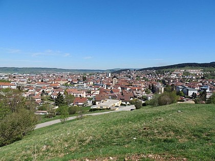
Walking around Valay

See more suggestions
Accessible hikes near Valay.
See more suggestions
Pontarlier
73 km

Pontarlier

Roaming along the roads of the historical centre, this city tour will take you on a discovery of Pontarlier’s emblematic locations: architectural, historical and symbolic city buildings, the banks of the Doubs and a viewpoint over the city. From the Tourist Office (), descend rue de la Gare to rue de la République.Head to Place d’Arçon, on your left. From here, you can see the Saint-Pierre gate at the end of the road.From the square, take rue de la Halle near the theatre. At the end of the road, head to the old barracks via place des Bernardines and place Cretin, on your right. Go to the bridge across the Doubs by heading through place Jules Pagnier and rue de Morteau.From here, make a round trop (1.2 km) to the Armand Guy distillery via rue des Lavaux.On returning to rue de Morteau, enter the park on the edge of the Doubs and follow the embankments on a little adapted path; this will take you to the other side of the park. Join up with rue de la République by leaving the park through rue Julez Mathez, where you will find the Jeanne d’Arc high school.   On arriving at rue de la République, head left until you reach another bridge over the Doubs. From here, make a round trip to the Hospital to observe its facade and the two chapels that can be seen from the road.On returning to rue de la République, after crossing the bridge once more, head down rue Montrieux and take rue Gambetta on your right to reach place Saint-Bénigne and the church. From the square, head to the train station vie rue Tissot. From here, you can head directly to the Tourist Office via rue de la Gare. You can also make a round trip of under 2 km to the Chapelle de l’Espérance, with a stunning viewpoint over the whole city. It can be accessed by heading down rocade George Pompidou until you come to rue du Stand, then head under the railway and take rue de la Chapelle (yellow waymarking) directly to the viewpoint.

2 h
5.1 km
Very easy
Show
Trip around Remoray lake
78 km

Trip around Remoray lake

A quick peddle around the National Natural Reserve of the Remoray lake and the Saint Point lake, a circuit with diverse relief and marked by a belvedere that opens onto both lakes in the green valley of the High Doubs. From the centre of REMORAY, ) take the “route des Grandes Plaines” to your right (red MTB waymarking no. 12), which gradually ascends to a forest massif towards La Côte. Take a small muddy trail to the left, and join up with a forest path, continuing again to the left for around 900 m. In the wide bend to the right, turn left (MTB crossing) and exit onto a pasture. Follow the path to your left and then the white path that leads to Sur la Côte. Head up the earthy path to the right, through the pastures, towards la Grande Combe. Branch off to the left on a white path that heads into the forest and, after around 600 metres, turn right onto a grassy trail. From here, follow a succession of small muddy, grassy or stony trails that soon meet up with a forest road. Head down the road to your left, head past the Les Trois Portes chalet and branch off to the right to follow a path along the forest for around 1 km.Branch off to the left again and follow the forest path that meets up with a forest road after 450 m. Follow this road to the left for 150 m and take the path to the right.Joining up with a wide forest path just before descending to the village of Boujeons, do not miss the trail that turns left straight away (MTB path) and crosses through the pastures until coming to the village of Boujeons. Take the main village road by turning left, then turn right down towards the village sawmill. Cross a small bridge and leave the village, taking the tarmac road that ascends to your left and turns into a white path through the pastures until you reach La Plaine à Chaillet. Cross the pasture by turning left, then take the forest trail that opens onto a white path. Shortly after, turn left (MTB path) and cross the pastures using a small grassy trail until you come to Les Brétilles, just above Le Brey. Take the road to the left, without heading all the way down to the main road, and then follow a stony path that ascends into the forest through a clearing. Branch off to the right on a forest track that heads up to the BELVEDERE OF THE TWO LAKES (BELVEDERE DES DEUX LACS). Head down a small muddy trail to a road, then turn right to reach theRF Marcel Goux Parking lot. Head left to the Buclet intersection on the road towards Remoray. Follow the road to your left for 100 m and take the parallel forest path that once again comes out onto this road. Head up to REMORAY after crossing the bridge over the Drésine, a small river that feeds the Remoray lake.

4 h
18 km
Easy
Show
Between Lemme and Saine
80 km

Between Lemme and Saine

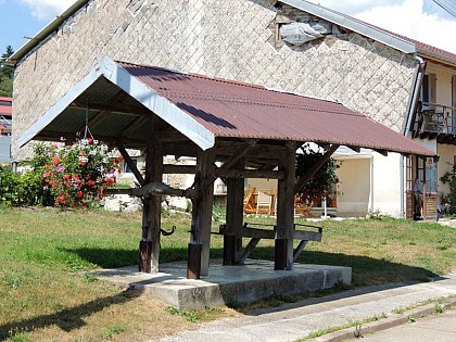
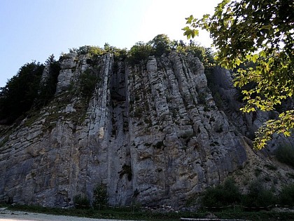
A succession of ascents and descents, paths, trails and little roads to reach the Morillon cliffs, the Langouette gorges and the belvedere of Les Prés Grillet. From CHAUX-DES-CROTENAY, head down the tarmac road (red MTB waymarking no. 69) towards Le Gros Tilleul. Turn right to reach La Fontaine Neuve and La Chaux Church. Branch off to the left on the tarmac road towards La Loye. Take the stony path that enters the forest to your right, towards La Côte Coulon and the Morillon cliffs in LE CERNOIS.Continue on the stony path that soon turns to tarmac and that runs along the cliffs and heads up to Le Rachet. Take the tarmac road to your right through the open combe of Entre-deux-Monts to reach the hamlet of Les Merets. Turn onto the road to your right and quickly turn left to take the stony path down towards the forest and up to the Étang des Drillettes (Drillettes lake). Continue on the muddy path that heads right up to Les Drillettes, and then take the long forest road along the Quenot rivulet to the road in Sous Grateloup. Carefully cross the départemental road and take the road opposite you that will lead you to the LAVOIR (washhouse) - LES PLANCHES-EN-MONTAGNE via La Fontenette and Le Girod. Continue on the main village road towards Bas du Village. Head down the road to your left and cross a bridge over the La Langouette gorges. Continue on the road, past LE MARTINET and reach Montliboz. Branch off to the right on a stony path that then heads up into the forest, towards Derrière la Montagne Ronde (“behind the round mountain”). Take the muddy path that follows along the right of the D 16 until you reach Chez Tatet, and then take the tarmac road down to La Feuillée au Loup. Turn left onto a small forest path towards La Voie Sacrée. Follow the white path to your right for 200 metres, and then turn left into an area with railings and a building. Follow a long and narrow trail through the forest. Exit onto a tarmac road, turn left and follow the trail to LES PRÉS GRILLETS. After the short out-and-back to the belvedere of Les Prés Grillets, continue on the tarmac road towards La Grande Cheminée. Descend to your left on the stony forest path and take the winding trail to your right to reach Les Messageries. Turn left on the tarmac road and reach the hamlet of Cornu. Continue left onto the road to the hamlet and then turn right just before the last farm. Head up the stony path through the pastures to reach Les Champs Montants. Turn right and return to your point of departure in CHAUX-DES-CROTENAY via a little stony path.

5 h
26 km
Easy
Show
Gorges of the Saine and the Langouette
81 km

Gorges of the Saine and the Langouette

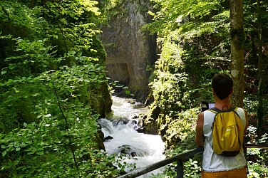
A lake, a stream, a river, waterfalls and gorges are on the naturally wealthy menu for this trail. For dessert, the works of the "tram" line and other quaint elements from the villages and hamlets you will pass through. The trail meets up the FONCINE-LE-BAS crossroads and ascends to the right (yellow waymarking) via the Grand-Vie farm road (oratory, former tramline crossing) before reaching Les Fumey. The grassy path to your right crosses the D 62. The road then serves the Fumey hamlet and leads to the Lac à la Dame crossroads. To your right, take the farm road uphill and follow along the Senge stream before fording the stream (pile of rocks). The trail skews off to the right into the forest (beautiful beech forest) and follows along a first clearing before descending towards the Cingernaux combe. Circumventing the combe, after a sharp turn, you will come to the D 127 in Malvaux (view onto the waterfalls of the la Ruine forebay). Cross the D 127, take the wide path below the road. Reach the LES-PLANCHES-EN-MONTAGNE WASHHOUSE by crossing the bridge over the Saine. The trail (white and red waymarking) follows the Landouette Gorges Trail to the left, which opens out onto le Martinet. The path then heads up the village following the road to the right (yellow waymarking) before reaching THE WASHHOUSE. To the left, the path heads along the Washhouse road (white and red waymarking) before heading up the Saine's right embankment and reaching the Fumey Badoz Factory Canal. To the right, the stony and shaded path (yellow waymarking) heads up the valley until it comes to the stream called la Pisse, which you will follow up to the left (passing under the viaduct) to reach Sous Bayard. The path heads up (white and red waymarking) the gorges of Malvaux, with a short section in the dark tunnel until it reaches the Douanets Viaduct. Cross the viaduct (yellow waymarking) to return to your starting point at the Champ de Mars.

3 h
9.7 km
Very easy
Show

What to do in Valay

See more suggestions
Relax and have fun with the available activities in Valay.
See more suggestions
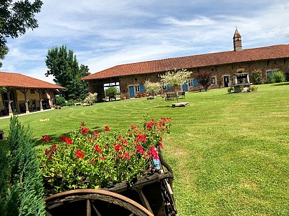
Camping*** Domaine de Mépillat
104 km

Camping*** Domaine de Mépillat

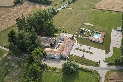
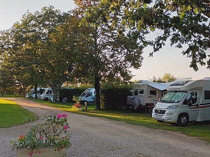
Valérie and Valentin welcome you to Saint-Nizier-le-Bouchoux, in a natural, peaceful setting planted with trees. This estate, on the edge of a lake, offers comfortable, unusual and unusual accommodation for a different kind of vacation! At the crossroads of Bresse, Burgundy, Mâconnais, Dombes, Bugey and Lyon, and ideally located 5 minutes from exit 10 of the A39 (le jura) and very close to the A6, you'll be staying at Saint-Nizier-le-Bouchoux, in a shady, relaxing estate. Whether you're a family, a couple or a group of friends, for a short or long stay, you'll be seduced by the charm of our wooded estate. You'll be able to recharge your batteries or go fishing on the banks of the lake that runs alongside the campsite, combining relaxation with cultural and gastronomic discoveries of our beautiful region. Heated swimming pool, inflatable structure, children's playground, homeball court, petanque court, fitness area for adults, ping-pong tables and our snack-bar area, will enable you to enjoy moments of pleasure or relaxation. For a peaceful stay with us, you can choose between large, perfectly delimited and shaded pitches, tent lodges, comfortable mobile homes, wooden Pods, original wooden chalets in the shape of comfortable teepees, or real Mongolian yurts of various sizes. During your stay, you'll be able to quickly discover the great cultural sites in the area, such as the Monastère de Brou, the Abbaye de Cluny, the towns of Bourg en Bresse, Louhans and its unmissable cattle market, the first mountain walks in the Jura and all the culinary and wine-producing riches of the region. Whether on site or in the surrounding area, you'll always find something to do or see. Come and discover all the cultural and gastronomic riches of our region! Valérie and Valentin look forward to welcoming you and doing their utmost to make your vacation unforgettable!

70 chemin de la Grange Maigre Petit Mépillat 01560 Saint-Nizier-le-Bouchoux
Book from 0 €Book
Show

What to visit in Valay

See more suggestions
Discover the local markets of Valay.
See more suggestions

Where to eat in Valay

See more suggestions
A wide selection of restaurants awaits you in Valay.
See more suggestions
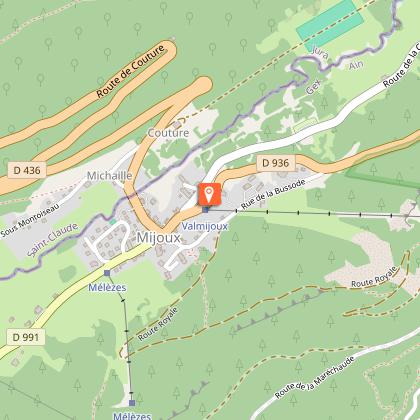
Where to sleep in Valay

See more suggestions
Choose a comfortable accommodation in Valay.
See more suggestions
Caution!
We have no information on the difficulty of this circuit. You may encounter some surprises along the way. Before you go, please feel free to inquire more and take all necessary precautions. Have a good trip! 🌳🥾