Tours
Activities
Places of interest
Where to eat
Where to sleep

Explore Saint-trinit, Vaucluse

Are you in charge of the destination?
Nestled in the heart of the enchanting Provence-Alpes-Côte d'Azur region, Saint-trinit, Vaucluse, invites you to lose yourself in the pastoral beauty of its landscapes and the richness of its traditions. Visitors can wander along winding paths through lavender-scented hills, offering breathtaking panoramic views to hikers.
Culture enthusiasts will enjoy exploring the region's architectural treas...
See more

Walking around Saint-trinit

See more suggestions
Embark on a hike in Saint-trinit.
See more suggestions
The Aiguiers (cistern from rock) of St-Saturnin-lès-Apt
16 km

The Aiguiers (cistern from rock) of St-Saturnin-lès-Apt

Short and clever combination of the "Sentier des Aiguiers'' which offers a beautiful glimpsecrafty and remarkable water supplies. Back facing the car park, go down across on the paved track. After the turn; go back up gently. At the 1st intersection, turn left and climbthe track. Leave behind several roads to the right then to the left leading to houses. Pass a sloping ledge and reach the Aiguiers Bessons. 1 - Rise to the right onto the path. At the 1st crossing, continue the winding paths across (new variant). At the path, still continue across. A little further, leave a track going to the right and continue on the rocky ledge. Reach a viewpoint and climb the edge to the east (marking hardly noticeable). Reach a small covered aiguier. Continue to the right, pass the orientation table and reach the Cluyer dome (mountain pass cycling milestone). 2 - Descend the trail due north, continue on the path under the pines and come out on La Liguière track. Follow right on 150m and take on the right the Lays track (ignore the sign'Sentier des Aiguiers'' to the left). Reach the Romanet track and go down to the right for 500m, then at the exit of a bend, turn left towards Travignon. After a ledge in the woods, turn left. 3  - Continue the path straight. Pass 2 turns and reach the Aiguiers upstream. Retrace your steps to point 3 by cutting through 2 turns by the stony path. Turn left and cross the ruins of Travignon. When leaving the hamlet, take a sharp right and immediately a left to go down the winding paths of the old mule track. When at the 2 large rocks, leave the GR® behind to the left and go down the path to the right. Go up slightly to come out on the Romanet track. Go down on the left for 1km / less than a mile. 4 - Do not miss the path that rises to the right (point 754m). 200m above, turn left and climb the path. Continue by following the marking carefully (private property!), then gradually rise to a track that leads to the Caulet farm. Go down to the left, go up slightly, then turn left (mountain pass cycling milestone).Go down the path to the south. Do not miss, at the exit of a corner, the trail rising to right and coming out on the corner of a fence. Turn left, walk along the fence and come out on the Romanes trail. Turn left to return to the starting point.

5 h
16 km
Medium
Show
The Aiguiers (cistern from rock) of St-Saturnin-lès-Apt
16 km

The Aiguiers (cistern from rock) of St-Saturnin-lès-Apt

Short and clever combination of the "Sentier des Aiguiers'' which offers a beautiful glimpsecrafty and remarkable water supplies. Back facing the car park, go down across on the paved track. After the turn; go back up gently. At the 1st intersection, turn left and climbthe track. Leave behind several roads to the right then to the left leading to houses. Pass a sloping ledge and reach the Aiguiers Bessons. 1 - Rise to the right onto the path. At the 1st crossing, continue the winding paths across (new variant). At the path, still continue across. A little further, leave a track going to the right and continue on the rocky ledge. Reach a viewpoint and climb the edge to the east (marking hardly noticeable). Reach a small covered aiguier. Continue to the right, pass the orientation table and reach the Cluyer dome (mountain pass cycling milestone). 2 - Descend the trail due north, continue on the path under the pines and come out on La Liguière track. Follow right on 150m and take on the right the Lays track (ignore the sign'Sentier des Aiguiers'' to the left). Reach the Romanet track and go down to the right for 500m, then at the exit of a bend, turn left towards Travignon. After a ledge in the woods, turn left. 3  - Continue the path straight. Pass 2 turns and reach the Aiguiers upstream. Retrace your steps to point 3 by cutting through 2 turns by the stony path. Turn left and cross the ruins of Travignon. When leaving the hamlet, take a sharp right and immediately a left to go down the winding paths of the old mule track. When at the 2 large rocks, leave the GR® behind to the left and go down the path to the right. Go up slightly to come out on the Romanet track. Go down on the left for 1km / less than a mile. 4 - Do not miss the path that rises to the right (point 754m). 200m above, turn left and climb the path. Continue by following the marking carefully (private property!), then gradually rise to a track that leads to the Caulet farm. Go down to the left, go up slightly, then turn left (mountain pass cycling milestone).Go down the path to the south. Do not miss, at the exit of a corner, the trail rising to right and coming out on the corner of a fence. Turn left, walk along the fence and come out on the Romanes trail. Turn left to return to the starting point.

5 h
15 km
Medium
Show
Underground water tanks in Travignon
19 km

Underground water tanks in Travignon

Starting at the hilltop village of Saint-Saturnin-lès-Apt, a great trip on the Sentier des Aiguiers, the top of Mount Cluyer and the ruins of Travignon. Back turned to the ''Information Point", next to the post office and pharmacy, go left then right onto the Rue Victor Hugo on 50m. Begin to the left on the Rue de la Combe and take a quick left under the puppet. Climb the cobblestone to the mill. Go up the path to the right on the edge of the plateau. Then take a right, cross the dam, pass through the castrum and turn left into the castle. Bypass the chapel on the left. 1 - At the crossroads, go straight across. Continue to the right and climb to the Chemin des Gavaniols. Continue straight. Leave several roads to your left and right leading to houses. Pass a sloping ledge and reach the Aiguiers Bessons. 2 - Rise to the right onto the path. At the 1st (new alternative route) then 2nd crossing, continue on the path in front. Leave a track going to the right and reach the rocky ledge. Climb the East ridge (markings barely visible), reach a small covered aiguier (Provençal underground water tank) and continue right to the Mount Cluyer dome. Pass the viewpoint and reach the summit plateau (milestone). 3 - Descend the trail due north, continue on the path under the pines and come out on La Liguière track. Follow the track for 150m and at the Y-like crossroad, continue left on the Chemin de la cassette (private pathway!). Bypass the farm to the right (gate) and reach the track below. Turn right (GR®) and after the aiguiers of Gayeoux, turn right. Go down 400m and leave a path to the left. 4 - Take a sharp left (milestone). Climb the small mountain pass of Travignon and switch to the aiguiers upstream the hamlet. Descend to the right on the rocky path, then turn left. Go through the ruins of Travignon, take a sharp right at the exit of the hamlet and immediately a left to go down the winding paths of the old mule track. 5 - Take a sharp left and immediately right (GR®). Hurtle down the trail which is very craggy down below. Continue at the valley bottom. Skip the narrow pass of the Rocher de la Cadière. At the crossroads "Puits du Geay", go straight. Pass the narrow gully of the Portes de Castor and go straight. 6 - look to the right for the 1st orchard along the track. Turn right, go up 100m along the field and climb the trail to the Bois du Defens. At the path, go across, descend and coming out of the scrubland, turn right. Go up the Rue de Fontaine de Guby to the right. Reach the Chemin de Romanet then the Cours de la Liberté to the left to go back to the village center.

6 h
20 km
Hard
Show
Tour du Riable
20 km

Tour du Riable

Tout à la fois riche de son héritage et de ses paysages agricoles, le tour de la montagne du Riable permet une immersion au cœur d’un patrimoine naturel appréciable. Depuis le centre de Lachau, rejoindre Notre-Dame de Chalma. Suivre la piste qui progresse à l’orée des champs derrière l’église. A la seconde intersection, s’infléchir tout à fait à droite sur la piste. Atteindre la pinède en poursuivant sur la piste et amorcer la montée dans la montagne. A proximité de la clue, traverser le mince ruisseau puis grimper en lacets jusqu’au col.  Du col, il est possible de faire l'aller-retour à la Tour du Riable offrant un superbe panorama sur les paysages sauvages de la Méouge. Au retour au col, entreprendre la descente via la piste qui part en direction d’une ferme en contrebas. Rejoignant une plus large piste caillouteuse, délaisser la direction d’Eourres et le GRP. Poursuivre sur la piste principale et suivre le balisage jaune jusqu’au hameau du Château. Du hameau, descendre à gauche par la route qui se dérobe sous la montagne sur environ 3 km coupant à travers la clue. Dépasser le lieu-dit « Malaric », et, à l’intersection, traverser le pont sur l'Auzance. Suivre à gauche la D 201 sur 1 km. Au lieu-dit « l’Adret », franchir à nouveau un pont similaire à gauche, puis s’infléchir immédiatement à droite sur le sentier qui longe les champs avant de retrouver la route goudronnée. Poursuivre sur ce chemin (chemin des Iscles) jusqu’au carrefour. Au carrefour, marqué par le poteau « le Canal », retrouver Notre-Dame de Chalma à gauche, ou la Mairie à droite. 

4 h
12 km
Easy
Show
Colorado tour by mountain bike
20 km

Colorado tour by mountain bike

Technically affordable but full of reminders, it's quite physical. But what a treat! Exit Rustrel following the GR® and the GTV®. Cross the D22 and at the crossroads ''Cornet'', turn left. Go along the former car park of Colorado and reach the start of the DFCI track. 1 - Turn right, cross the ford on La Doua, then rise by the track. Pass two winding paths and at the crossroads ''Barriès'', turn left on a rocky path. Cross a sandy narrow gully and continue straight. Come out on the paved track and reach further onto a road. Turn right and climb to the pass. 2 - Leave the GR® behind and the GTV® to the left and continue straight. Glide and go straight to the crossroads"Pradenques'' and"Ubac de Pradenques'', then climb to the plateau. Follow to the right the 1st track (RP). At the 2nd crossing, turn right on the path. After a ledge, turn right and then immediately left to reach the edge of the plateau. Then, go along a big field and reach the"Croix de Christol''. 3 - Take a left and 50m further, turn right. Continue straight on the trail, and then down the slope to the road. Follow it to the right, cross the hamlet of Haute-Blace and continue for 1.5km. At the exit of left turn, turn right and go down to La Doua. At the bottom, turn right, cross the D22 with caution andturn left on the track at the entrance of Jean-Jean. At the next crossroads continue straight. Above, follow the small road to the small mountain pass of Trécassats (marking"The Ochres by bike"). 4 - Take on the right, the coloured trail parallel to the path (GTV® marking), then climb right to the top of La Bruyère (interpretation panels). At the crossroads ''Trou des Américains'', follow to the right the GR® and thus through all the ochre massif. Coming out on the road ''La Glaurivette'', follow the D214 to the right and 550m further turn left, cross the hamlet of Viaux, cross the D179 and climb a gravel path. 5 - Go down the road for 400m and take the first road to the left. Go up gently, turn right on the ledge and then embark on a beautiful rocky single track that falls between oaks and scrubs. Lower down, after a last turn, follow the opposite path along the foot of the massive and return quietly to Rustrel.

4 h
23 km
Medium
Show
The Provençal Colorado
20 km

The Provençal Colorado

A break in the vast ocher gathering, both intimate and panoramic. Facing the Restreou Hostel, take the Route de Saint-Christol (D30) to the right. 100m further, turn right and go down the Boulevard du Colorado (D30a). 430m further, take the Chemin de Saint-Joseph to the right and follow it. At the stop sign, cross the D22 (be careful!) and continue across. At the crossroads "Cornet", turn left. Then follow the old car park of Colorado. In a curve (refreshment area), immerse to the right on the DFCI track. Cross the Dôa (ford) and go up the long track of Barriès (GR® markings). 1- At the sign-post ''Barriès'' turn left onto the pretty trail (slab). Reach an area of ruts and continue straight (GR®). Then take the paved road "Chemin de l'Ubac". At the junction, go right onto Route de Gignac. 2- At the mountain pass, take the left track for 500m and reach the imprinted slabs. Turn around and go back to point 2. Back again on the pass, follow the road to the left. At the crossroads "Pradenques" and "Ubac de Pradenques" continue straight. On top of the hill, turn onto the right track. 1km away, take a right back into the woods. After a break, continue left onto the lower trail (PR). Go along a large field and reach the crossroads ''Croix de Christol '' (sign-post). 3- Pass the gate and hurtle down the trail (PR). The stones give way to ocher; take the time to make a landscape stop. Down, spin slightly to the left along the clearing, fording the Dôa, past the sewage treatment plant and reach the hamlet of Istrane. 4- Turn right and take small road. Skip two curves, go along a house and at the next intersection on the corner of a farm, turn left. Go up the small road. Cross the D22 (be careful!) and continue across. Pass the school parking lots and reach the center of the village of Rustrel.

4 h
15 km
Medium
Show
Tour du Défens
20 km

Tour du Défens

La montée régulière en sous-bois à l’ubac sera appréciée pour sa fraîcheur. Au sommet, le panorama sur le village d’Eourres et les crêtes seront une belle récompense. Le versant adret offre une merveilleuse descente en balcon. Face à la mairie, prendre la route à gauche, traverser le pont puis prendre tout de suite à gauche (Chemin de la Pinié). Après 300 m, la route devient piste et passe entre 2 maisons. Suivre celle-ci qui monte progressivement à travers la forêt de pins et contourne la montagne du Défens. A la première fourche en forêt, continuer sur la piste principale à droite. Faire de même à la prochaine intersection avant un petit raidillon.  Longer un vaste pâturage vallonné et clôturé à gauche (chevaux). Le chemin oblique à gauche, longe toujours la clôture et arrive à une fourche. Suivre la piste de droite (Le Défens) et poursuivre la montée à travers une jolie hêtraie. A l’intersection, monter à droite, longer une coupe forestière et atteindre la crête du Défens (zone en cours de repeuplement forestier). Plonger sur le versant adret en poursuivant son chemin par un joli petit sentier sillonnant à travers un sous-bois de chênes. Celui-ci dessine une belle traversée descendante sous la montagne du Défens pour rejoindre le fond de vallée. Rester vigilant et bien suivre le balisage et cairns en traversant la lande à genêts et lavandes sauvages, autrement le chemin se perd facilement. Arrivé en bas, traverser un chemin et poursuivre sur le sentier d’en face. Il tourne rapidement à gauche pour rejoindre 50 mètres plus loin la piste à prendre à droite pour rejoindre les quelques maisons visibles. Descendre la route jusqu’à la jonction avec la D 201. Prendre la passerelle en face, puis tourner de suite à droite pour regagner Lachau en longeant la rivière rive gauche. Continuer sur la route en face, puis, au poteau « Le Canal », à droite pour rejoindre le point de départ à la mairie.

3 h
8.1 km
Very easy
Show

What to do in Saint-trinit

See more suggestions
Explore the many bookable activities in Saint-trinit and make the most of every moment.
See more suggestions
Hôtel Les Arcades - Le Lion d'Or
25 km

Hôtel Les Arcades - Le Lion d'Or

A former private mansion dating from 1661, this charming hotel is located under the famous 15th-century arcades in the center of the village. Cosy, air-conditioned Provencal rooms & apartments. Heated pool, Spa, Bike room, Seminar room, Private garden. Ideally nestled for exploring the splendors of the Baronnies in complete tranquility, our former mansion invites you to enjoy a remarkable experience. Its timeless charm, verdant walled garden, sunny terraces and balconies provide an idyllic setting for your stay. Rated "Fabulous" by some guidebooks, our establishment offers excellent value for money. Our spacious, air-conditioned rooms with flat-screen TVs guarantee absolute comfort. To get your day off to a good start, our breakfast offers a gourmet selection of organic, local and homemade products, providing an authentic and tasty experience. What's more, our relaxation area invites you to indulge in total relaxation. Featuring a sauna, Jacuzzi and massage facilities, this area offers you a wellness interlude after a day of exploration. Take advantage of these moments to recharge your batteries and unwind in a soothing, warm setting. We also offer a secure garage for your car or motorcycle (reservation required) and a free lock-up for your bicycles. Take advantage of our free wifi. Please note that pets are not allowed. Finally, we are proud to have been awarded the "Valeurs Parc" label, a sign of our commitment to preserving the environment. We look forward to welcoming you for an authentic and memorable experience in the heart of the Baronnies. Whether you're looking for a romantic getaway, a wellness retreat or a wilderness adventure, our attentive team is on hand to make your stay unforgettable. Book now and let yourself be seduced by the charm and comfort of our hotel. We look forward to welcoming you soon!

7 place du Marché 26170 Buis-les-Baronnies
Book from 0 €Book
Show

IGN cards

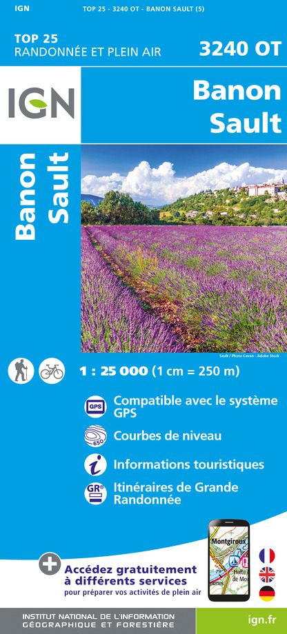
3240OT - BANON SAULT PLATEAU DE SAINT-CHRISTOL
Editor : IGN
Collection : TOP 25 ET SÉRIE BLEUE
Scale : 1:25 000
13.90€
TOP75034 - LUBERON MONT VENTOUX
Editor : IGN
Collection : TOP 75
Scale : 1:75 000
9.80€
VEL01 - LA DRÔME A VELO
Editor : IGN
Collection : DECOUVERTE A VELO
Scale : 1:105 000
9.10€
VEL03 - LE VAUCLUSE A VÉLO
Editor : IGN
Collection : DECOUVERTE A VELO
Scale : 1:100 000
9.10€
TOP100D04 - ALPES-DE-HAUTE-PROVENCE DIGNE MANOSQUE PNR DU VERDON LAC DE SERRE-PONÇON
Editor : IGN
Collection : TOP 100
Scale : 1:100 000
8.40€
TOP100D84 - VAUCLUSE AVIGNON CARPENTRAS PARCS NATURELS RÉGIONAUX DU LUBERON ET DU MONT-VENTOUX
Editor : IGN
Collection : TOP 100
Scale : 1:100 000
8.40€
TOP100D26 - DRÔME VALENCE MONTÉLIMAR DIE PNR DES BARONNIES PROVENÇALES PNR DU VERCORS
Editor : IGN
Collection : TOP 100
Scale : 1:100 000
8.40€
D13-84 BOUCHES-DU-RHÔNE VAUCLUSE
Editor : IGN
Collection : CARTES DÉPARTEMENTALES IGN
Scale : 1:150 000
5.90€
D04-05 ALPES-DE-HAUTE-PROVENCE HAUTES-ALPES
Editor : IGN
Collection : CARTES DÉPARTEMENTALES IGN
Scale : 1:150 000
5.90€
D07-26 ARDÈCHE DRÔME
Editor : IGN
Collection : CARTES DÉPARTEMENTALES IGN
Scale : 1:150 000
5.90€
D83 VAR
Editor : IGN
Collection : CARTES DÉPARTEMENTALES IGN
Scale : 1:150 000
5.90€
NR14 AUVERGNE-RHÔNE-ALPES RECTO/VERSO MASSIF CENTRAL
Editor : IGN
Collection : CARTES RÉGIONALES IGN
Scale : 1:250 000
6.80€
NR16 PROVENCE-ALPES-CÔTE D'AZUR
Editor : IGN
Collection : CARTES RÉGIONALES IGN
Scale : 1:250 000
6.80€
NR15 AUVERGNE-RHÔNE-ALPES RECTO/VERSO MASSIF ALPIN
Editor : IGN
Collection : CARTES RÉGIONALES IGN
Scale : 1:250 000
6.80€
EUROPE
Editor : IGN
Collection : DÉCOUVERTE DES PAYS DU MONDE IGN
Scale : 1:2 500 000
7.00€

What to visit in Saint-trinit

See more suggestions
Engage in outdoor activities in Saint-trinit.
See more suggestions

Where to eat in Saint-trinit

See more suggestions
Enjoy delicious dishes at Saint-trinit's restaurants.
See more suggestions

Where to sleep in Saint-trinit

See more suggestions
Find the perfect lodging for your visit to Saint-trinit.
See more suggestions
Hôtel Les Arcades - Le Lion d'Or
25 km

Hôtel Les Arcades - Le Lion d'Or

A former private mansion dating from 1661, this charming hotel is located under the famous 15th-century arcades in the center of the village. Cosy, air-conditioned Provencal rooms & apartments. Heated pool, Spa, Bike room, Seminar room, Private garden. Ideally nestled for exploring the splendors of the Baronnies in complete tranquility, our former mansion invites you to enjoy a remarkable experience. Its timeless charm, verdant walled garden, sunny terraces and balconies provide an idyllic setting for your stay. Rated "Fabulous" by some guidebooks, our establishment offers excellent value for money. Our spacious, air-conditioned rooms with flat-screen TVs guarantee absolute comfort. To get your day off to a good start, our breakfast offers a gourmet selection of organic, local and homemade products, providing an authentic and tasty experience. What's more, our relaxation area invites you to indulge in total relaxation. Featuring a sauna, Jacuzzi and massage facilities, this area offers you a wellness interlude after a day of exploration. Take advantage of these moments to recharge your batteries and unwind in a soothing, warm setting. We also offer a secure garage for your car or motorcycle (reservation required) and a free lock-up for your bicycles. Take advantage of our free wifi. Please note that pets are not allowed. Finally, we are proud to have been awarded the "Valeurs Parc" label, a sign of our commitment to preserving the environment. We look forward to welcoming you for an authentic and memorable experience in the heart of the Baronnies. Whether you're looking for a romantic getaway, a wellness retreat or a wilderness adventure, our attentive team is on hand to make your stay unforgettable. Book now and let yourself be seduced by the charm and comfort of our hotel. We look forward to welcoming you soon!

7 place du Marché 26170 Buis-les-Baronnies
Book from 0 €Book
Show
Caution!
We have no information on the difficulty of this circuit. You may encounter some surprises along the way. Before you go, please feel free to inquire more and take all necessary precautions. Have a good trip! 🌳🥾