Tours
Activities
Places of interest
Where to eat
Where to sleep

Explore Corravillers, Haute-Saône, Franche-Comté

Are you in charge of the destination?
Nestled in the heart of Haute-Saône, Franche-Comté, Corravillers is a charming town that beautifully blends nature and heritage. Begin your visit with a walk through the surrounding forests, perfect for hiking or mountain biking. The region also offers numerous hiking trails suitable for all levels. Take the opportunity to admire the local flora and fauna.

For history enthusiasts, don't miss the...
See more

Walking around Corravillers

See more suggestions
Walks and discoveries in Corravillers.
See more suggestions
Family walk - Mont de Fourche circuit
2.1 km

Family walk - Mont de Fourche circuit

Mont de Fourche circuit (Municipality of Rupt-sur-Moselle). Duration: 2h. Difficulty: easy (family walk with children). Lenght: 5 kilometers. Elevation: +106 meters. Markings: red ring, mountain bike circuit n ° 2. Places of interest: viewpoint of the Col du Mont de Fourche, forest chalet des Sapins, passage near a wild pond. Departure: parking lot at the top of the pass, on the left (picnic area). Access: From Le Thillot or Remiremont, follow the N66 to Rupt-sur-Moselle. At the traffic lights, follow the direction of Col du Mont de Fourche (left from Le Thillot, right from Remiremont). The pass is located 3 km from the traffic lights. Description of the route: The course merges completely with the mountain bike circuit n ° 2 of Rupt-sur-Moselle. Cross the main road (be careful, there is no pedestrian crossing) to join the small road on the left which overlooks the parking lot. The walk begins on this road at the start of the hiking signs. Take this road by following the direction "Chalet des Sapins 30mn" red ring markings. After 100 meters, you can admire the view of the city of Rupt-sur-Moselle and the Croix de Parier. Go to an intersection, turn left on the forest path marked with red ring circuit MTB n ° 2. Continue on this path for about 1.5 km. This portion of the GR7 is called “Chemin des Soldats” because it links the Fort de Rupt to the Fort de Chateau-Lambert. Except from the white and red markings of the GR, you will also see a red ring. Passage near the "Chalet des Sapins" which is below on the left at 20 meters. Free access chalet with tables and benches, managed by hunters. Continue for 700 meters. At the level of a clearing, do not go to the left MTB circuit 4. Do not go straight ahead, red ring markings and MTB circuit 3 and 4. Turn right onto the path towards MTB 2. This path bordered by ferns leads to a private pond (swimming prohibited). Continue on the right path which runs along the pond marked out mountain bike circuit 2-3. Do not turn left on the road side. Continue on this path: the descent is dangerous for 300 meters. Continue for approximately 1.5 km to reach the starting intersection. At the crossroads, take the road on the left over 100 meters to reach the pass and enjoy the last glimpses of the valley and the village of Rupt-sur-Moselle.

2 h
5 km
Easy
88360 RUPT SUR MOSELLE
Show
Stroller circuit at Rupt sur Moselle
4.3 km

Stroller circuit at Rupt sur Moselle

3.5 km loop circuit. Duration: 1h45. Departure: Rupt-sur-Moselle tourist information office. A route which allows you to discover a pretty pond in the heart of Rupt-sur-Moselle. 1. The Tourist Office is ideally located. It is surrounded by a skate park, 2 games, a water point, a picnic area and public toilets. 2. Turn your back on the tourist office and take the Voie Verte on the left. 3. You will see the restaurant “le Bolha” on the left as well as the Croix de Parier which overlooks the village. Then, you pass the Parelle motorhome area and its picnic area. Go straight to the next intersection. 4. Then take the small median on the left which leads to a car park between the old Aldi store and the old La Roche garage. 5. Cross the car park diagonally on the right towards the bins along the main road. 6. Cross straight ahead on the pedestrian crossing towards the bus shelter then turn right for 10 meters. 7. At the intersection, go straight on into “rue de la Roche”. Do not go to the left into “rue du Champ du Gé”. 8. You arrive at a roundabout, the Etang de la Roche is just behind. Take the road on the right to go around the pond. This charming site is ideal for stopping at the picnic tables and benches available to walkers. 9. Once you have gone around the pond, take the road on the right (“rue des Boulés”) and do not go back towards the roundabout. 10. Follow the road straight ahead as it passes through a residential area. You arrive at a new roundabout. 11. Go straight on “rue de la Dermanville” and at the next intersection, go straight again. Do not turn right into “Rue des 5 Frères Fresse”. 12. At the next crossroads, on the right, at 18 “rue Albert Creusot”, you can admire beehives and beekeeping equipment at “la Boîte à Ruches”. Round trip. 13. A little further on, you arrive at the Ascensement playground. It is equipped with a swing, a slide and a kiosk. 14. At the STOP, opposite the driving school, turn left. The town hall is on the right, 50 meters away: park, benches. 15. From the town hall, go straight towards the main road. At the crossroads, go opposite towards “Corravillers” using the pedestrian crossing. Go straight ahead, you pass the Kiou beauty salon. Then take the Voie Verte on the left to reach the tourist office.

2 h
3.5 km
Easy
Place du Souvenir - Quai de la Parelle Office de Tourisme Communautaire 88360 RUPT SUR MOSELLE
Show
Family walk - La Beuille
6.5 km

Family walk - La Beuille

Circuit de la Beuille (Municipality of Rupt-sur-Moselle). Duration: 2h. Difficulty: medium (family walk with children). Lenght: 5.8 kilometers. Elevation: +147 meters. Markings: red triangle, blue ring, mountain bike trail n° 4, unmarked parts. Places of interest: many panoramic views from La Beuille and Les Tronches over the Remiremont basin and the Rupt-sur-Moselle valley with the Ballon d'Alsace and the Ballon de Servance as a background. Departure: median just after the Blanche Croix (crossroads with the Route des Forts). Access: From Le Thillot, follow the N66 towards Epinal for 7 km. Pass the villages of Ramonchamp then Ferdrupt. At the roundabout, go straight on the D466 for 7 km direction "Rupt-sur-Moselle". In the center, follow the road straight ahead towards "Lépange" for 4 km. In Lépange, go under the bridge and take the 2nd road on the left towards "Le Girmont". It climbs for 4 km and joins the "Blanche Croix" (to the left of the road). Description of the route: From the car park, cross the road and take the small forest path opposite where you can see a terminal 10 meters away. Continue on this path for 300 meters, you will see 4 successive markers. After the 4th terminal, the path begins a descent for 400 meters. At the end of the descent, at the intersection, continue on the left path towards another terminal that can be seen in the distance. Continue on this trail for 300 meters. When you reach a crossroads, take the path opposite, following the red triangle markings. Continue on this path for 200 meters. Cross the paved road and take the path opposite the sign forbidden "all motor vehicles". Continue for 300 meters, the path arrives at an asphalt road and passes near a private pond. Continue on the tarmac road to the right following the sign "Plumenco". Do not take the road to the left which joins the D57 called "Route des Forts". The "Plumenco" farm is 100 meters away.You may be able to spot animals outside. The purpose of this place is to welcome children, teenagers or adults with disabilities or who may have behavioral difficulties. The farm is managed by an association which offers mediation by animals for therapeutic, educational, cultural and / or training in connection with nature. Continue on the asphalt road which climbs for 400 meters. At the intersection, at the sign indicating "La Barre de la Vigotte 20 min n ° 21", if you wish, you can make a return trip to the top of the hill (house n ° 4285) to admire the view on the Remiremont basin. To continue the walk, take the unmarked path on the right for 100 meters then go down the dirt track on the right for 200 meters. Passage near a farm, view of the ponds below. Continue on the path to house n ° 10 for 50 meters. Continue on this path to the right following the mountain bike markings n ° 4. Go down this trail to get to ponds. Continue following the mountain bike markings n ° 4. When you get to a farm, continue down the path to the left with mountain bike markings n ° 4. Passage between the farm and its garages. Take the path that descends into the forest for 200 meters, following the blue ring markings. At the end of the trail, you can go back and forth 100 meters on the road on the left to the Amis de la Nature chalet in La Beuille (panoramic view of Rupt-sur-Moselle, Ballon d'Alsace and Ballon de Servance). Continue on the tarmac road to the right following the mountain bike markings n ° 4 blue ring. The road climbs for about 800 meters and brings you back to the earlier crossroads. Take the left path already taken on the way out mountain bike markings n ° 4 and red triangle. Continue for 200 meters to reach the intersection passed earlier. Do not take the unmarked path taken on the outward journey but continue on the path following the mountain bike trail markings n ° 4 for 300 meters. Continue straight on for 300 meters following the red triangle (mountain bike trail markings n ° 4). The forest path arrives at the asphalt road. Take this road which goes up to the right for 500 meters to reach the starting point.

2 h
5.8 km
Easy
Dessus de Lépange La Blanche Croix 88360 RUPT SUR MOSELLE
Show
Hicking route : the 3 Chalets
6.5 km

Hicking route : the 3 Chalets

CIRCUIT N ° 2: The 3 chalets (Municipality of Ferdrupt) Duration: approximately 3h30 Difficulty: medium (occasional hiker) Distance: 12 kilometers Positive elevation: 450 meters Markings: yellow disc Places of tourist interest: This hike allows you to discover an essential element of the heritage of the Ballons des Hautes Vosges: the forest chalets. These chalets located along the hiking trails are open to all, free of charge and without prior reservation. They are popular picnic spots for walkers. Departure: parking lot of the town hall of Ferdrupt Access: Coming from Le Thillot, take the national road 66 towards Epinal. The second village crossed is called Ferdrupt. The town hall is in the center of the village on the right 300 meters after the church. Description of the route: Take rue André Duval then after 200 meters, turn right onto the road to Grebiay. After 60 meters, you arrive at the start of the loop. Continue on this road straight until the junction with Chemin des Briseux. Then, go right for 30 meters then left on the Château d´Eau road. Continue on this road for 140 meters and take the path leading to the left between a house and a shed. The trail climbs steeply through charming undergrowth before reaching an intersection lined with a ledge. Take the path on your left, it leads to Chalet du Grebiay through a maze of ferns. From the chalet, you can enjoy a lovely view of the Ballon d'Alsace and the upper valley of the Moselle. Continue straight on the same path until Col de la Sûre (altitude: 741 meters). At the pass, take the wide path that climbs to the right. After about 500 meters, go up on the left towards the Chalet de l'Homant which you gain after walking for 1 kilometer. This is the highest point of the course (altitude: 876 meters). After this chalet, retrace your steps for about 300 meters then fork to the right in the direction of the Chalet du Châtelet, from where you have a nice viewpoint over the valley of Grandrupt and the Haut de Bélué. Continue on the wide forest path which is on the left in order to descend to the village. The route passes near the farm inn "A la Colline", an establishment specializing in duck cuisine. From the farmhouse, continue down a tarmac road before entering the path on the right after about 400 meters. The path runs alongside the Ferdrupt stream and passes near the unusual accommodations at the Domaine du Châtelet which can be admired on the right before joining the intersection at the start of the hike. You must then take the same path as on your way, for 300 meters via rue André Duval, to reach the town hall of Ferdrupt.

4 h
12 km
Easy
88360 FERDRUPT
Show
Family walk - La Rochaule trip
6.5 km

Family walk - La Rochaule trip

Circuit de la Rochaule (Municipality of Ferdrupt). Duration: 2 hours. Difficulty: medium (family walk with children). Lenght: 6 kilometers. Elevation : +170 meters. Markings: blue ring, a short section on unmarked asphalt road. Places of interest: the mountain valleys of Grandrupt and the Colline de Ferdrupt, presence of a "haut-fer" at the halfway point. Departure: Ferdrupt town hall car park. Access: From Le Thillot, follow the N66 towards Epinal. The road crosses Ramonchamp before entering Ferdrupt. The town hall is on the right about 300 meters after the church. Description of the route: From the town hall car park, follow the indication "Domaine du Châtelet", take the road that climbs along the 200 meters fire station. At the first intersection, continue uphill following the direction "Domaine du Châtelet", "route du Châtelet". Continue to climb this road for 300 meters, do not turn right into "rue des Clos". At the hairpin, continue your walk by turning left "Chemin des Febvés" blue ring markings. At 20 meters, pass near a log cabin (log cabin) on the left. Continue on this road for about 1 km. Pass near a small, closed chalet with an outside bench that you will find on the left. At the end of the asphalt road, continue straight on the forest path (sign "dead end") following the blue ring markup. Passage next to a large farm. Cross the pastures and follow this path for about 1 km. Passage next to a private pond. Passing near a shed with a green roof next to a house, you see in the distance a "haut-fer" that looks like a mill. Passage next to the farm "Vlaemynck" (sale of goat cheese and meat). Take the path on the right above the farm, following the blue ring markings. Go through the fence and go up the path for 40 meters (do not go up to the hangar). Take the right path following the blue ring markings for 300 meters. Pass the fence and continue on this path, following the blue ring markings. It dominates the path you came from, below on the right. The path crosses a forest for 800 meters and offers many views over the valley. At the crossroads, leave the blue ring markings then go down to the right for 20 meters to reach the paved road. At the next crossroads, take the road on the right "Chemin des Galmanprés" for 800 meters. At the 2nd bend, take the left road towards "Domaine du Châtelet". Go through the huts and trailers then cross the blue bridge. Go down the path to the right along the stream, blue ring markings and yellow disc. The path joins a paved road that you have to follow on the right to reach the town hall and the starting point of the walk.

2 h
6 km
Medium
1 bis rue André Duval Mairie 88360 FERDRUPT
Show

What to do in Corravillers

See more suggestions
Activities for all tastes await you in Corravillers, book them today.
See more suggestions
Comprehensive Strasbourg rickshaw tour - 1 hr 20 mins
113 km

Comprehensive Strasbourg rickshaw tour - 1 hr 20 mins

Enjoy this guided rickshaw tour to discover all of Strasbourg! Your driver and tour guide will let you in on the city's secrets! Rickshaws are a unique way to get around and see all the key sites of Strasbourg in just 1 hour and 20 minutes! Your driver will do the pedalling while you enjoy the city's key sites. Once you are comfortably seated on your rickshaw, you will start your tour by discovering the Palais Rohan. This magnificent monument with a classical façade has been classified as a historic monument. In 2009, it opened its doors to the most powerful world leaders on a NATO summit. You will then be taken to the Place Broglie to marvel at Strasbourg's stunning opera house. You will be captivated by its neoclassical façade, which has been classified as a historic monument! Your visit will continue with the Place de la République, where you will admire the relics of German architecture. This stunning square is home to the German imperial district's most iconic monuments. You will then enter into the heart of the German neighbourhood to discover its Haussmann-style avenues, the European sites and the Orangerie district. You will also get a glimpse at the headquarters of the French-German cultural TV channel: Arte.   Your tour will end by a ride through the "Petite-France" neighbourhood, at the heart of the old town. Marvel at typical half-timbering houses built right above the water. You will enjoy an exceptional scenic view on the terrace of the Barrage de Vauban. Let this quaint neighbourhood - which is a UNESCO World Heritage Site - captivate you! Pick this tour and visit all the key places of Strasbourg in an unusual and pleasant way!

Book from 90 EURBook
Show

IGN cards

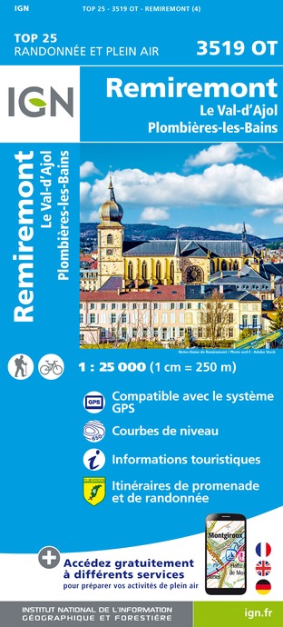
3519OT - REMIREMONT LE VAL-D'AJOL PLOMBIÈRES-LES-BAINS
Editor : IGN
Collection : TOP 25 ET SÉRIE BLEUE
Scale : 1:25 000
13.90€
TOP75028 - VOSGES DU SUD BALLON D'ALSACE LE HOHNECK
Editor : IGN
Collection : TOP 75
Scale : 1:75 000
9.80€
TOP100D68 - HAUT-RHIN TERRITOIRE DE BELFORT COLMAR MULHOUSE BELFORT PNR DES BALLONS DES VOSGES
Editor : IGN
Collection : TOP 100
Scale : 1:100 000
8.40€
130 VESOUL LANGRES VALLÉE DE LA SAÔNE
Editor : IGN
Collection : TOP 100
Scale : 1:100 000
8.40€
TOP100D88 - VOSGES ÉPINAL NEUFCHÂTEAU ST-DIÉ-DES-VOSGES GÉRARDMER PNR DES BALLONS DES VOSGES
Editor : IGN
Collection : TOP 100
Scale : 1:100 000
8.40€
TOP100D70 - HAUTE-SAÔNE VESOUL LURE VALLÉE DE LA SAÔNE
Editor : IGN
Collection : TOP 100
Scale : 1:100 000
8.40€
201 ALSACE MASSIF DES VOSGES
Editor : IGN
Collection : TOP 200
Scale : 1:200 000
6.80€
89026 - GRANDES TRAVERSÉES DU JURA - GTJ
Editor : IGN
Collection : DECOUVERTE DES CHEMINS
Scale : 1:105 000
9.10€
D70-88-90 HAUTE-SAÔNE VOSGES TERRITOIRE DE BELFORT
Editor : IGN
Collection : CARTES DÉPARTEMENTALES IGN
Scale : 1:150 000
5.90€
D67-68 BAS-RHIN HAUT-RHIN
Editor : IGN
Collection : CARTES DÉPARTEMENTALES IGN
Scale : 1:150 000
5.90€
NR09 BOURGOGNE FRANCHE-COMTÉ
Editor : IGN
Collection : CARTES RÉGIONALES IGN
Scale : 1:250 000
6.80€
SUISSE
Editor : IGN
Collection : DÉCOUVERTE DES PAYS DU MONDE IGN
Scale : 1:303 000
7.00€
ALLEMAGNE
Editor : IGN
Collection : DÉCOUVERTE DES PAYS DU MONDE IGN
Scale : 1:800 000
7.00€
EUROPE
Editor : IGN
Collection : DÉCOUVERTE DES PAYS DU MONDE IGN
Scale : 1:2 500 000
7.00€

What to visit in Corravillers

See more suggestions
Learn the history of Corravillers through its museums.
See more suggestions

Where to eat in Corravillers

See more suggestions
Experience Corravillers's gastronomy.
See more suggestions

Where to sleep in Corravillers

See more suggestions
Discover available accommodations around Corravillers.
See more suggestions
Chalet de la Combeaute - 45 personnes
8.1 km

Chalet de la Combeaute - 45 personnes

Gelegen op 700 meter hoogte is Chalet de La Combeauté een ideale plek voor natuurliefhebbers dankzij de wandelpaden, watervallen, vijvers en bossen in de directe omgeving. Het beschikt over een verwarmd zwembad (12 x 6 meter) dat het hele jaar door geopend is, een wellnessruimte met sauna en een fitnesscentrum. Chalet de la Combeauté, met een totale capaciteit van 45 personen, bestaat uit 15 kamers/appartementen voor 1 tot 6 personen, variërend in grootte van 40 tot 70 m², elk met comfortabele tweepersoons- of familiekamers, een volledig uitgeruste keuken, een badkamer met douche en een apart toilet. Op de begane grond bevinden zich de receptie, de bar, de eetkamer, een speelkamer (biljart, pingpong, airhockey), lounges en ontspanningsruimtes, evenals een eenpersoonskamer voor mindervaliden. Ter plaatse: fietsverhuur (5 mountainbikes, 6 elektrische hybride fietsen + 2 fietskarren en 3 kinderzitjes), terrassen en ligstoelen, 10.000 m² privéruimte, buitenspeeltoestellen, barbecuefaciliteiten en een visvergunning voor de vijver. In de winter zijn sneeuwschoen- en langlaufski's te huur. Gelegen in het hart van het landelijke dorpje Girmont-Val-d'Ajol, met een eigen ambachtelijke bakkerij, entertainment en activiteiten het hele jaar door, waaronder de beroemde lokale avondmarkten op vrijdagavond in juli en augustus. Een nieuw mountainbikestadion is vlakbij. Twee onafhankelijke chalets, één voor 6 tot 8 personen en één voor 4 personen, maken deel uit van de accommodatie.

41 Le Village 88340 GIRMONT VAL D AJOL
Show
Caution!
We have no information on the difficulty of this circuit. You may encounter some surprises along the way. Before you go, please feel free to inquire more and take all necessary precautions. Have a good trip! 🌳🥾