Tours
Activities
Places of interest
Where to eat
Where to sleep

Camping le Rhone ex Camping de Tournon HPA: Discover Tournon-sur-Rhône

Are you the owner?
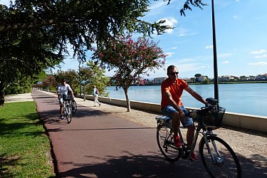
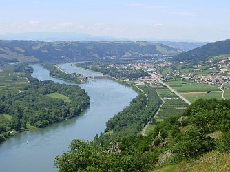
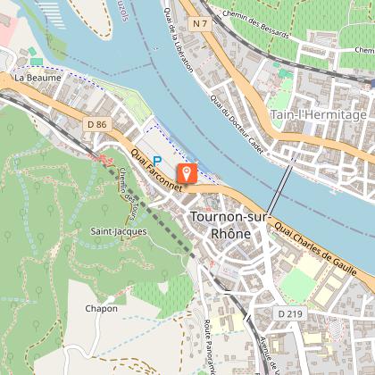
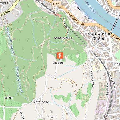
Welcome to Tournon-sur-Rhône, nestled in the heart of Ardèche in Rhône-Alpes, where Camping le Rhone ex Camping de Tournon HPA serves as the perfect launchpad for exploring a myriad of local activities and attractions. Embark on a rewarding adventure with breathtaking landscapes, scenic hikes, and cultural excursions. Discover the Château-Musée de Tournon, a medieval fortress offering panoramic vi...See more

Walking around CAMPING LE RHONE EX CAMPING DE TOURNON HPA

See more suggestions
Discover the walking paths of CAMPING LE RHONE EX CAMPING DE TOURNON HPA.
See more suggestions
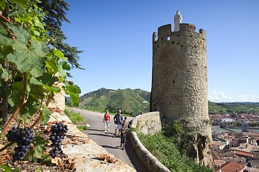
The heights of Hermitage
466 m

The heights of Hermitage

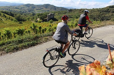
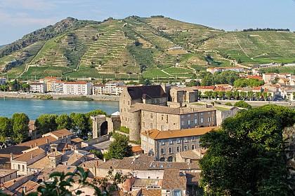
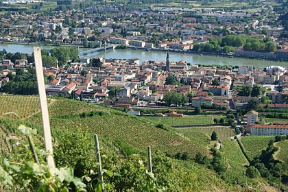
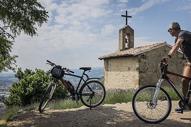
This trail is quite difficult therefore more suitable for the more experienced cyclist. The few uphill sections are steep and the downhill ones, although thrilling, are technical at the same time. Enjoy some magnificent tracks after the strenuous climb uphill towards the start. Take the time for a short detour to visit the chapel and admire the view over the valleys of Hermitage and area around Tournon. Going through vineyards, the terrific downhill section that follows is very technical. Go round the car park and under the railway bridge then turn right. 1 - Chemin de l'Hermitage - 125 m Continue ahead towards the winery (cave à vin). The uphill climb starts on the D241 to your left : Careful traffic ! On the bend come off the road onto the path straight ahead. About 500m further on, before the bend, turn right onto the steep uphill track. Once at the top turn right onto the lane. Follow the signs towards Larnage on the D241 : Careful traffic !2 - Larnage - 207 mIn the centre of the village turn left towards Crozes Hermitage then right uphill on the road towards the housing estate. The road then becomes a track. When you reach the road, turn right and carry on. 3 - Les Méjeans - 348 m Continue ahead. 4 - Les Méjeans Nord - 350 m Take the road on the left and continue for about 200m. Turn left onto the path : a pleasant, fast downhill slope through woodland with no particular difficulty. 5 - Val de Gervans - 190 m Turn left and continue downhill on the wide track. 6 - Gervans Rue du Ruisseau - 140 m Continue ahead.7 - Gervans - 140 m Turn left.8 - Chemin des Voussères - 130 m Take the path on the left going along the railway track for about 1km and leading to the D163. Turn left onto the D163 : Careful traffic ! Head for Crozes Hermitage.9 - Crozes Hermitage - 145 m Just before the bridge, near the townhall, take the road to your right. 10 - Les Pinets Here, the uphill trail starts along the heights of the town of Tain l’Hermitage 11 - L'Hermite - 239 m Continue ahead. Further on, the road becomes track. At the following junction carry on ahead along the path. Enjoy the beautiful panorama here. The downhill section is quite technical going through fields and heading towards Tain l’Hermitage. 12 - Chemin de l'Hermitage - 125 m Turn right back onto the same road as the beginning of the trail and head back to the Velodis car park.

3 h
19 km
Easy
Show
Tour de Pays Drôme des Collines
837 m

Tour de Pays Drôme des Collines

This trail is quite long and is usually performed in four stages enabling you to discover the culture and pleasures of the palate. You can make the trip shorter or longer depending on your level and preferences. The numerous landscapes and the scenery it has to offer make it extremely rich in diversity. The trail is for cyclists of all levels and ages, however, you need to practice the sport regularly. 1 - 0 km Here in Tain l’Hermitage, the great wines of northern Côtes du Rhône carry the national label Vignobles & Découvertes « d’Hermitage en Saint Joseph ». In addition to that, the chocolate fragrances emanating from the Cité du Chocolat ValRhona will titillate your senses. A real treat for your tastebuds, rich in tannins. But best to keep for the return journey…. 2 – 4.6 km Head for Larnage then Chantemerle les Blés surrounded by terraced vineyards.3 – 8.2 km In Chantemerle les Blés you can visit the church Notre Dame, a gem of Roman art dating back to 11th and 12th centuries.4 – 10.7 km The trail then takes you up and down hills and on the way, past the small lake of Mouchet in Chavannes. The pond is a sensitive nature reserve developed for learning about the fauna and flora of the wetlands and is also an ideal place for relaxing under some of the impressive trees there. 5 – 21.7 km In Saint Donat why not take a swim at the Lake Champos. A slide along with other activities will delight the young and not so young ones. Others may prefer visiting the old town with its collegiate cathedral where each year the Bach Festival takes place in June and July.6 – 36.9 km The trail then continues through the « green lung » of Drome des Collines along the valley of Herbasse to Peyrins near the town of Romans, famous for its industrial and craft heritage (leather and prêt à porter Made in France). 7 – 71.2 km It then carries on to Montrigaud with its pond named Joana Maria where fisherman and tranquillity make it a place to be appreciated. This section, more difficult physically than the two previous ones, has steep uphill inclines. All along, the magnificent views of the Vercors mountains add to its beauty. Worth seeing along the journey, in the neighbouring county Isère, is the medieval village of Saint Antoine l’Abbaye, classified as one of the most beautiful villages in France. As you leave Montrigaud the landscape becomes mainly forest land.8 – 77.2 km The trail then takes you through forests, one after the other, such as the forest of Thivollet and Chambaran, going as far as Roybon.9 – 95.4 km Arriving in le Grand Serre with its medieval market hall, you are back in Drôme. From here you head to Hauterives and the famous Palais Idéal du Facteur Cheval, a gem of art brut where music concerts, including jazz, take place every year in June and July. 10 – 118.6 km Some steep uphill sections and great downhill slopes will then take you to the town of Saint Vallier. Why not make a few stops on the way in Moras en Valloire for instance, a pretty medieval village at the heart of the region, granted the label « site remarquable du gôut » for its succulent pear. Another village is Anneyron with its frescoes in the choir of the church Notre Dame or its outlets like Lafuma or Jars pottery. 11 – 124.4 km You come next to Albon with its classified medieval watchtower. At that point you have plenty of time to warm up as it’s mostly downhill from here to Saint Vallier. 12 – 141.8 km Saint Vallier and the majestic meanders of the Rhône, is the beginning of a succession of views overlooking the great river, the hills of Ardèche and Pilat as well as the Galaure Valley. Another place worth seeing and only a few kilometres away, is the natural site of the Roches qui Dansent in Saint Barthélémy de Vals. Finally the trail zizags through many orchards and terraced vineyards heading towards Larnage then back to Tain l’Hermitage.

10 h
161 km
Easy
Show
From the vineyards of Tain to the Dancing Rocks
852 m

From the vineyards of Tain to the Dancing Rocks

Going through plains and hills, along the rivers Rhône and Isère, enjoy the different landscapes of vineyards and orchards that shape the character of the region. A sporty outing however it remains accessible to all levels. 1 - 0 km Starting from Tain l'Hermitage, the trail climbs up through the Hermitage hillsides giving you an exceptional view over both Valleys of the rivers Rhône and Isère. It then continues along the road on the plateau overlooking the ‘défilé de Saint Vallier” a succession of curves in the majestic Rhône river. 2 – 4.6 km Between dells, glens and gentle hills, the trail heads slowly towards the village of Larnage. 3 – 13.5 km Along the way you will go up and down the hills of Drôme to the Roches qui Dansent (dancing rocks). 4 – 22.1 km An easy journey towards Chantemerle les Blés, with its Roman church offering a remarkably decorative display, before coming to the first hilly areas on the way to Veaunes where you can admire the plains of Herbasse. 5 – 30.5 km After the village of Chanos Curson a route heads south downhill between vineyards and orchards before reaching the banks of the river Isère. 6 – 37.3 km From Châteauneuf sur Isère, the cycling track Vallée de l’Isère (V63) will take you to the edge of the river then along to Pont de l’Isère. 7 – 44.9 km The route follows the river Rhône as far as Tain l’Hermitage (leading to the ViaRhôna).

3 h
56 km
Easy
Show
The Planards
2.5 km

The Planards

In the heart of the famous vineyards hillsides climb a little to discover stunning views. From the church turn right onto the road leading to the Rhône Valley. 1. 1 km Turn right onto the small road straight after the bridge under the railway line. 2. 2,4 km At the stop sign turn right to enter Gervans. 3. 2,8 km Turn right towards “route des belvédères”. 4. 5,8 km At “les Planards” turn right and head for “belvederes des Méjeans and Pierre Aiguille”. 5. 6,2 km Turn right at the giveway sign. 6. 6,4 km Turn right onto “route des vins”. 7. 7,3 km Turn left at the stop sign onto “route des Méjeans”. 8. 8,3 km Turn right onto “route d’Erôme”. 9. 8,7 km Turn right at the stop sign towards “Larnage”. 10. 10,9 km Turn right onto “route des Côtes-de-Meyer”. 11. 11,3 km Turn right onto “route des Charrets”. 12. 12,6 km Turn left onto the tourist route. 13. 12,9 km Turn left towards the “belvedere de Pierre Aiguille” as far as Crozes. 14. 17,1 km Turn left when arriving in Crozes onto the “route du Creux-de- Saillat”. 15. 17,8 km Turn right onto “chemin de l’homme”. 16. 18,2 km Turn right onto “chemin de Fougearets” continue to the “belvedere de Pierre Aiguille”. 17. 19,9 km Continue to Hermitage chapel (road then path). 18. 20,6 km Walk down the pebbled path below the chapel then turn left onto the side-path further on becoming a road. 19. 21,6 km Return to Crozes.

2 h
23 km
Easy
Show

What to do in CAMPING LE RHONE EX CAMPING DE TOURNON HPA

See more suggestions
Organize your days in CAMPING LE RHONE EX CAMPING DE TOURNON HPA with bookable activities for the whole family.
See more suggestions

What to visit in CAMPING LE RHONE EX CAMPING DE TOURNON HPA

See more suggestions
Take a boat tour around CAMPING LE RHONE EX CAMPING DE TOURNON HPA.
See more suggestions
Chapel of  the "Lycée Gabriel Faure" (High school)
719 m

Chapel of the "Lycée Gabriel Faure" (High school)

The construction of this chapel lasted from 1673 to 1720. The plans were designed by the architect Martellange from Lyon. The facade is "Jesuit classic" style (classic). It is made of sandstone, which gives it its color. The work took a long time because it was often stopped. The workers , due to religion wars, were usually commandeered to fortify the ramparts. 1673- The first stone was settled. 1707 - Installation of the choir balustrade, altar steps and flagstones 1713: Construction of the bell tower. She is opened for the service because she is almost done. 1714- Capassin's paintings ( Jean Capassin, a pinter from Florence at the 16 century, was hired by the cardinal François de Tournon when he was in diplomatic missions in Roma for François 1er and Henri II) and the tapestry ( Aubuson and Flandres) are inside the chapel, which saved them from the fire of the College. 1720- The ashes of the Cardinal François II de Tournon are put behind the altar. The facade is in the classical Jesuit style, built in molasse, which gives it its colour. It is very elegant with its Doric columns at the base and composite at the top. The interior, with a total length of 26 metres, is in the Renaissance style. The great nave is flanked by chapels and the whole is decorated in trompe l'oeil, which means that this style is sometimes confused with 18th century Baroque. side galleries run above the chapels. The acoustics are remarkable, enhancing the sound of the classical organ installed in the 18th century.

Place Stéphane Mallarmé 07300 Tournon-sur-Rhône
Show
High school Gabriel Faure
758 m

High school Gabriel Faure

Teaching place since the Renaissance: the "collège" was founded in 1536 by the Cardinal of Tournon, high-school since 1548. Called Gabiel Faure becauce of a local literay man. Including a tapestries galery, a rich historical library and some paintings. Cardinal François de Tournon founded the college in his town in 1536. it was not until 1548 that the first stone of the building was laid; the Collège de Tournon took just six years to complete. In 1552, the institution became a University of Philopsophy and the Seven Liberal Arts. In 1551, François de Tournon entrusted his college to the Society of Jesus, making it the first French Jesuit teaching establishment and a means of countering Protestantism through education in the Scriptures. The buildings of the Collège were transformed. In 1560, a chapel was added to the north and a fifth building to the east of the four main buildings and the bell tower dating from 1554. A medicinal herb garden completed the college's layout untill April 3rd 1714. This was the date of a terrible fire. Far from discouraging the Jesuits, they continued their renovations. A third floor was added to the main building. Construction of a new chapel ( begun in 1673) was completed. The new chapel was larger than the old one, providing a more dignified setting for the Cardinal's remains and the faithful. The Jesuits were expelled from the College in 1762 and replaced by an administration office. Tournon became a Royal Military School, which ensured its longevity. In 1776, the Royal Military School ofr Paris was reformed. Twelve establishments in the kingdom retained the priviledge of training soldiers. The new administrators were the Oratorians. As the existing boarding school was deemed too small to accomodate the students, new buildings were constructed and work was undertaken. The Revolution and the events that followed did little to change the life of the college, apart from the fact that there was no longer any need to mention it as a royal college and the Military School section was abolished at the start of the Academic year in 1793. In 1819, the school once again became a royal college, under the supervision of the Minister of the Interiror: attached to the university, it was first gibven the tittle of Collège Communal and then that of College Royal de troisième classe. The college became the Imperial Lycee and then the Lycée under the Restoration. The Construction of the Rhone dykes in the mid-19th century altered the buildings, as evidenced by the cureent two-storey Cour des classes, the ground floor of which is located under Route Nationale 86. A few years earlier, the Grand Corridor and the lare terrace known as the Infirmary had been built. At the end of the century, part of the lycee grounds were amputated, allowing the construction of the girls lycée, Collège Mare Curie since 1998. It was over 400 years ago that the Lycee de Garçon got its baptismal name: that of a man from Tournon who worked actively to protect, maintain and preserve it. In 1967, it became the Lycee Gabriel Faure. Over the course of the 20th century, the school underwent further transformations with the construction of buildings D ( science buildings), E ( classrooms and new boarding school) and the gymnasium. Since the early 2000s, the lycee had been undergoing restructuring. In addition to the buildings, work has also been carried out on the grounds. Notably, the thirty-three metre long disused swimming pool has been filled in. All that remains of the work carried out in the park since 1781 are a few plane trees, which are now listed as historic monuments, and an idea of the size of the area at the time.

Place Mallarmé BP 116 07300 Tournon-sur-Rhône
Show
Tain l'Hermitage
955 m

Tain l'Hermitage

The old part of the city has kept some traces from its past. While ambling through the streets, you will find elegant buildings proving how well-off the inhabitants were at that time, and cellars where to discover its wines: Hermitage and Crozes Hermitage. Some historical buildings are to discover there: the former granary to store salt and its turret, or Courbis' private house and its beautiful Renaissance courtyard. An expiatory altar (Autel taurobolique: altar to celebrate a sacrifice called Taurobole) will take you back to ancient times, while some vestiges of a medieval gate will remind you of the walled city in the 12th century. The history of France was also written in Tain l'Hermitage in the 14th century when King Charles V's wedding at the Church Notre Dame de Tain set the seal on the incorporation of the Dauphiné into France. Other monuments such as the Marc Seguin cable suspension bridge or the Chapelle of Larnage still show today the technical, historical and social progress of the 19th century made here. You will end your discovery with a touch of nostalgia while crossing the mythical Route Nationale 7. Here are just a few of the buildings to explore on a stroll: the former 15th century salt storehouse with its wachtower, the Courbis mansion and its beautiful Renaissance courtyard, now home to the Palué Museum, a Taurobolic altar that will take you back to the ancient origins of the town, while the remains of a medieval gateway will take you back to the 12th century fortified town. French history made a stopover at Tain l'Hermitage in the 14th century, when the royal wedding of Charles V in the church of Notre Dame de Tain sealed the union of the Dauphiné with France. Other monuments such as the Marc Seguin suspension bridge and the Chapelle de Larnage still bear witness to the historic technical and social advances that were made here in the 19th century. You'll end your visit with a nostalgic stroll along the legendary Route Nationale 7, so celebrated by the Fou Chantant, an eternal holiday tune...

26600 Tain-l'Hermitage
Show

Where to eat in CAMPING LE RHONE EX CAMPING DE TOURNON HPA

See more suggestions
Discover the local flavors of CAMPING LE RHONE EX CAMPING DE TOURNON HPA.
See more suggestions
Where to sleep in CAMPING LE RHONE EX CAMPING DE TOURNON HPA

See more suggestions
Enjoy your stay with accommodations in CAMPING LE RHONE EX CAMPING DE TOURNON HPA.
See more suggestions
Caution!
We have no information on the difficulty of this circuit. You may encounter some surprises along the way. Before you go, please feel free to inquire more and take all necessary precautions. Have a good trip! 🌳🥾