Tours
Activities
Places of interest
Where to eat
Where to sleep

Auberge Le Saint Claude: Discovering Rioz Treasures

Are you the owner?
Nestled in the heart of Haute-Saône in Franche-Comté, Rioz welcomes you to unforgettable discoveries. Around Auberge Le Saint Claude, you can explore majestic natural sites like Lac de Vaivre, perfect for walks or a family picnic. History enthusiasts can visit the famous Luxeuil-les-Bains Abbey or stroll through the charming medieval towns such as Pesmes. Enjoy the many hiking trails that lead you...See more

Walking around AUBERGE LE SAINT CLAUDE

See more suggestions
Explore the natural surroundings of AUBERGE LE SAINT CLAUDE.
See more suggestions
Pontarlier
62 km

Pontarlier

Roaming along the roads of the historical centre, this city tour will take you on a discovery of Pontarlier’s emblematic locations: architectural, historical and symbolic city buildings, the banks of the Doubs and a viewpoint over the city. From the Tourist Office (), descend rue de la Gare to rue de la République.Head to Place d’Arçon, on your left. From here, you can see the Saint-Pierre gate at the end of the road.From the square, take rue de la Halle near the theatre. At the end of the road, head to the old barracks via place des Bernardines and place Cretin, on your right. Go to the bridge across the Doubs by heading through place Jules Pagnier and rue de Morteau.From here, make a round trop (1.2 km) to the Armand Guy distillery via rue des Lavaux.On returning to rue de Morteau, enter the park on the edge of the Doubs and follow the embankments on a little adapted path; this will take you to the other side of the park. Join up with rue de la République by leaving the park through rue Julez Mathez, where you will find the Jeanne d’Arc high school.   On arriving at rue de la République, head left until you reach another bridge over the Doubs. From here, make a round trip to the Hospital to observe its facade and the two chapels that can be seen from the road.On returning to rue de la République, after crossing the bridge once more, head down rue Montrieux and take rue Gambetta on your right to reach place Saint-Bénigne and the church. From the square, head to the train station vie rue Tissot. From here, you can head directly to the Tourist Office via rue de la Gare. You can also make a round trip of under 2 km to the Chapelle de l’Espérance, with a stunning viewpoint over the whole city. It can be accessed by heading down rocade George Pompidou until you come to rue du Stand, then head under the railway and take rue de la Chapelle (yellow waymarking) directly to the viewpoint.

2 h
5.1 km
Show
Randonnée - la vallée d'hamanxard et rapaumont
64 km

Randonnée - la vallée d'hamanxard et rapaumont

Access: From Remiremont go to Val-d'Ajol, go to the church. Parking: Park at Place du Sô. Distance: 11 km / Duration: 3 h 30 / Difference in height: 390m / Marking: Green disc. 1) From the church, follow the road to Saint-Bresson (former Gerbe d'Or brewery). Take the forest path and then a tarmac track leading off to the left to an inhabited clearing. Go around the dwellings by a forest track to the top of the mountain (old quarries on the left on the summit used to build the church). Follow the ridge path through the large Scots pines without leaving the forest. 2) At the junction with a tarmac path, head towards the farm on the left (fountain). At the first bend, a path on the left descends through a beech forest. Through a succession of small paths, reach the bottom of the Hamanxard valley (old workers' housing estate, school, farms). 3) The D20 at the bottom of the valley offers a shortcut in case of fatigue or unforeseen circumstances. If you choose to continue, cross the hamlet of Leyval straight ahead (several calvaries). A new ascent begins on a dirt track after a succession of fountains. 4) When you reach the hamlet of Les Granges de Leyval, turn sharply left after the last building. Continue along a grassy path in the direction of the television relay station on the other side (panoramic view of Faymont, Les Feuillées and the Val-d'Ajol). 5) Go down on a small road towards the village of Val-d'Ajol, which you can soon see. 6) Go down through the pastures on a grassy path. After crossing a wetland area often covered with periwinkle, take the path on the right. 7) At the hamlet of La Rochotte (17th century cross and viewpoint), follow the right-hand track which runs down the rest of the hill and leads back to the village by the road.

4 h
11 km
Medium
1 Place de l'église 88340 LE VAL D AJOL
Show
Randonnée - circuit découverte des croix
64 km

Randonnée - circuit découverte des croix

Access: From Remiremont, go to Val-d'ajol. Parking: opposite the Peugeot garage, route de Plombières. Distance: 7.5 km / Duration: 2 h 30 / Difference in height: 100m / Signs: green ring. 1) Leave the car park in the direction of the church. Turn right before the bridge and walk along the river to the next bridge. Cross the De Buyer bridge and head towards the Post Office (1719 cross on the right of the Post Office). Go back in the direction of the church. Go back to the small square in rue de Plombières (border marker). Continue to the small square at the foot of the church, opposite the bakery (a 17th century cross). Go up the main street for 200m, passing the war memorial. 2) In the middle of a small square, go towards the Gravel cross (named after a former tabellion general). Continue along the main road to the next crossroads. Follow the Rue du Prieuré d'Hérival which leads to the old station. Walk along the square on the right. At the next crossroads, turn left onto the D20 in the direction of Hamanxard or rue des Mousses. Along the wall of the hotel, a path leads to a place of meditation (imitation of the grotto at Lourdes). 3) Continue along rue des Mousses (D20). On the pavement on the right are three old calvaries (two from the 17th century, one from 1803). Then branch off onto the route de Rapaumont (the Jean Sauvé cross at the crossroads). 4) At the bottom of the hill after a small bridge, a 500m loop leads to the hamlet of La Rochotte (1636 cross and panoramic view of the Val-d'Ajol). Back at the bottom of the hill, walk along the meadow to the hamlet of Bouchâtel. Take the D23 on the right. 5) Stop at Les Chênes (three crosses to visit). After this small hamlet, follow the small road of La Banvoie to the left. 6) At the hamlet called le Pied du Mont (one cross) turn left. 7) At La Banvoie, go back 100m to the right (2 crosses). 8) At the Mésaubé (a cross on the left), go back 30m then head towards the Granges (a cross) and the Cross (a small calvary from 1601). 9) Turn right towards Le Moncel. 10) In the hamlet of Moncel (an old cross at the crossroads), go back 100m to the right (second cross) and return to the starting point by the left-hand street.

3 h
7.5 km
Easy
117 17 route de Plombières Départ depuis l'ancien Office de Tourisme 88340 LE VAL D AJOL
Show

What to do in AUBERGE LE SAINT CLAUDE

See more suggestions
Make your stay in AUBERGE LE SAINT CLAUDE special by booking activities.
See more suggestions

What to visit in AUBERGE LE SAINT CLAUDE

See more suggestions
Engage in outdoor activities in AUBERGE LE SAINT CLAUDE.
See more suggestions

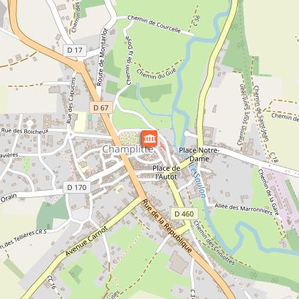
Where to eat in AUBERGE LE SAINT CLAUDE

See more suggestions
Explore the culinary traditions of AUBERGE LE SAINT CLAUDE.
See more suggestions

Where to sleep in AUBERGE LE SAINT CLAUDE

See more suggestions
Choose a comfortable accommodation in AUBERGE LE SAINT CLAUDE.
See more suggestions
Caution!
We have no information on the difficulty of this circuit. You may encounter some surprises along the way. Before you go, please feel free to inquire more and take all necessary precautions. Have a good trip! 🌳🥾