Tours
Activities
Places of interest
Where to eat
Where to sleep

Discover fun at DOMAINE DES PLANESSES in Ramonchamp, Vosges

Are you the owner?
Welcome to DOMAINE DES PLANESSES, your perfect starting point to uncover the treasures of Ramonchamp, located in the heart of the Vosges mountains in Lorraine. This region is brimming with activities for everyone. Begin your adventure with a hike on the marked trails surrounding the camping grounds, offering breathtaking views of the Vosges' mountains and forests. Cycling enthusiasts can take adva...See more

Walking around DOMAINE DES PLANESSES

See more suggestions
Explore the hiking trails around DOMAINE DES PLANESSES.
See more suggestions
STROLLER CIRCUIT IN RAMONCHAMP
1.5 km

STROLLER CIRCUIT IN RAMONCHAMP

3.2 km loop circuit. Duration: 1h40. Departure: Ramonchamp town hall. A route which allows you to discover the pretty village of Ramonchamp and the banks of the Moselle. 1. From the town hall square, take the road on the right between the Post Office and the church. 2. You then walk along the cemetery. Follow the road to the right between the war memorial and the cemetery. 3. Continue straight ahead until the Voie Verte to take it on the left. Go straight. 4. 200 meters further, you may see chickens on the left. 5. You then cross a tarmac road which you must follow on your left. Immediately take the 2nd street on the right “Rang du Moulin”. 6. Continue on the right at the bottom of the descent. You pass along workers' towns which are on your right. 7. You pass over a canal where you will undoubtedly be able to admire small ducks splashing in the water. On the right, you will see a henhouse populated with geese. 8. 50 meters further on, on the right, you will see the old “Tissages de l’Est” factory and its clearly visible chimney. It now houses commercial units. 9. The road bends slightly to the left then leads to a blue bridge which spans the Moselle. Go straight after the bridge. 10. You leave “rue du Vieux Moulin” just before Route Nationale 66 to turn on your left into “rue des Breuches”. This pleasant street is lined with many flower-filled houses on sunny days. 11. Always follow the main road. You will see a small bench on the right if you want to rest. Do not take the dead end on the right. 12. The road turns left at the trash bins. You can then see the church tower in the background. Go straight without turning left. 13. At the STOP, go down left towards the center of the village. You will see on your left a bus shelter then a blue bridge. Go straight ahead, crossing the road “rue du Clos Martin”. 14. You pass next to the old campsite and 300 meters further, turn left “rue des Champs de l’Epine” and follow the sign “pedestrian footbridge”. 15. Go straight towards the Moselle (dead end). The path runs along the river where you can see ducks. Cross the footbridge then turn left (before crossing the footbridge, a picnic table is on your left). 16. You arrive at the large playground called “les Berges de la Moselle” which offers games for all ages (weight training area for adults, pétanque court, children's playground and city park). Very pleasant site at the water's edge which provides picnic tables in a bucolic setting. To reach the town hall, all you have to do is go straight on the road towards the church.

2 h
3.2 km
Very easy
1 Grande Rue Mairie de Ramonchamp 88160 RAMONCHAMP
Show
FAMILY WALK - CIRCUIT DE LA ROCHE JOLIE
1.6 km

FAMILY WALK - CIRCUIT DE LA ROCHE JOLIE

Circuit de la Roche Jolie (Municipality of Ramonchamp). Duration: 2h30. Difficulty: easy (family walk with children). Lenght: 5.4 kilometers. Elevation: +110 meters. Signposting: most of the route is not signposted, a portion of mountain bike trail n ° 1 and a portion of red ring signposting. Places of interest: 2 play areas for children, one in the forest and the other by the river; point of view over the village from the heights. Departure: Parking lot at the church of Ramonchamp. Access: From Le Thillot, follow the N66 towards Epinal. The next village crossed is called Ramonchamp. Take the road on the left at the pharmacy to reach the center of the village and the church. Description of the route: From the car park, turn right to go down the "rue de l'Etat" and join the "Grande Rue". Pass between the church on your right and the town hall on the left. Continue for about 40 meters to reach the blue bridge where the Moselle passes. Take the 1st road on the right after the bridge "rue des Brasseries" for 200 meters. At the 1st crossroads, continue on the same road (do not follow "rue des Breuches"). Continue on the same road at the 2nd intersection then take the left road at the sign "forbidden" to join the N66. Pass next to the "Auto Plaisir" garage. Take the pedestrian crossing to cross the N66. Take the road opposite direction "Le Ménil". Continue on this road for 100 meters then turn left at the 2nd crossroads "rue du Murgis" mountain bike trail n ° 1. You pass in front of the GAEC des Gourmets farm. At number 6 of the street, take the left road which goes up. Continue for 200 meters then take the forest path on the left, marked with mountain bike trail n ° 1. Continue uphill for about 600 meters. Arrived at the ULM platform, nice view. Walk along the ULM platform to join the road. When you get to the road, follow it to the left along the same microlight take-off area, this time on the other side, for 40 meters. At the crossroads, continue on the left road that goes down. Passage near a pretty private pond on your left. At the crow's feet, take the road straight ahead (not the "rue des Fontaines") and continue for 300 meters. At the crossroads, go straight for 200 meters and you will arrive at the "La Roche Jolie" holiday center (large white building on your left). Continue on this road for 250 meters. After the big left turn, continue for 20 meters and turn on the right path at the sign "prohibition for motorcycles ..." just before the viewpoint and its bench. Orientation table. Follow this path, it leads to an arboretum then to the Maix playground. At the end of the path, you come to a parking lot. Take the street that goes down to the left. Continue straight for 500 meters to join the N66 (sawmill on your left). Go right for 50 meters to reach the pedestrian crossing "rue de la Maix". Cross it, turn left to join the intersection then the right road direction "pedestrian bridge". Go straight for 200 meters until you reach the "dead end" sign, pass the chicane and follow the path along the Moselle. Cross the footbridge that leads you to the Berges de la Moselle playground. Go straight through the playground then the car park behind the barrier. The gymnasium is on the right. Continue on this road towards the church. At the "give way", you have to take the pedestrian crossing to cross the road and then reach the starting point on your right.

3 h
5.5 km
Very easy
Grande Rue Eglise 88160 RAMONCHAMP
Show
FAMILY WALK - GREBIAY CIRCUIT
1.7 km

FAMILY WALK - GREBIAY CIRCUIT

Circuit of Grebiay (Municipality of Ferdrupt). Duration: 1 hour. Difficulty: easy (family walk with children). Lenght: 3 kilometers. Elevation: +114 meters. Marking: red ring, a short unmarked section on a forest road. Places of interest: the Chalet du Grebiay and its viewpoint. Departure: Col de la Sûre. Access: From Le Thillot, take the RN66 for 5 kilometers to Ferdrupt. Continue for 300 meters and take the right road before the town hall. Continue on this road for 2.7 kilometers,go straight. The road turns into a carriage way for about 200 meters and then it is paved again. The Col de la Sûre is 100 meters away. Description of the route: From the car park, take the forest path to the right of the cross. Follow the signs "Le Grebiay" chalet red ring and yellow disc. Continue on this forest path, always following the markings yellow disc for 1.4 km. This path leads to the Grebiay chalet from where you can admire a beautiful point of view of the Haute Moselle valley with the Ballons d'Alsace and Servance as a background. You arrive at the chalet du Grebiay (open chalet) which is on your left. Take time to stop for a meal or snack break and to enjoy the calm of nature. To continue your walk, follow the red ring by the forest path to the left of the chalet. Continue on this forest path for about 1 km, always following the red ring markings to join an asphalt road. When you get to the road, stop following the markings and go up this road for 300 meters to reach the Col de la Sûre.

1 h
2.9 km
Very easy
route du Châtelet Col de la Sûre 88360 FERDRUPT
Show
STROLLER CIRCUIT AT FERDRUPT
2.4 km

STROLLER CIRCUIT AT FERDRUPT

3.4 km loop circuit. Duration: 1h45. Departure: Ferdrupt town hall. A rural route which allows you to discover a village full of charm. 1. Turn your back on the town hall and face the main road. Go right towards the red bridge which spans the Moselle (Pont de Libauxaire). 2. Follow the “Voie Verte” sign on the left and cross the bridge. Continue straight ahead. 3. You arrive at the intersection of 3 roads: take the middle one straight on (do not follow the “Xoarupt” direction on the left nor the “Voie Verte” direction on the right). 4. At the end of the street, continue straight for 20 meters to join the Voie Verte at fire hydrant no. 26. Do not take “rue de la Libération” on the left. Go straight along the left side of the house. 5. Follow the cycle path on the left (Voie Verte sign). There is a small slope on the left to join the Voie Verte without skipping any steps. 6. You then see a cow pen on the right. On the left edge of the cycle path, you may have the opportunity to admire chickens and ducks. 7. The Voie Verte then crosses a road. Go straight on the cycle path. In July-August, it is possible to picnic on the left, at a bend in the Moselle which forms a small body of water. 8. Then pass near a large meadow located on the left. 500 meters further, leave the Voie Verte and turn left, at a small garden, on the dirt road, at the sign “except cyclists”. This is communal land, this path is suitable for strollers. 9. At the left turn, go straight and cross the small footbridge. 10. Continue straight ahead, without deviating from the path (private meadows on either side). You thus arrive at the Ferdrupt bridge which spans the Moselle. There are often ducks in this place in summer. 11. Cross the bridge to join the national road. Then take the pedestrian crossing before going straight on “chemin des Briseux”. A slight climb in 3 stages on the asphalt road then begins. 12. A little further on, on your left, at street number 24, you will discover an original mailbox in the shape of a bee (sale of honey at home). 13. At the next crossroads, continue straight and do not take the dead end on the left. The road climbs slightly (level 2) before a flat area then a final climb (level 3). At the top of the hill, a lovely view of the village awaits you on the left. 14. You then arrive at an intersection located on a bend. Go down the road on the left. A small playground on the left will allow children to have fun. 15. Then continue on the road, straight ahead. At number 3, on the right, you will see a house that is particularly flowery in summer. This is the Jardin des Baussottes, a garden dedicated to conifers (guided tour possible by appointment). 16. At the “STOP” sign, take the road which goes down on the left to reach the town hall.

2 h
3.4 km
Very easy
1bis Rue André Duval Mairie de Ferdrupt 88360 FERDRUPT
Show
HICKING ROUTE : THE 3 CHALETS
2.4 km

HICKING ROUTE : THE 3 CHALETS

CIRCUIT N ° 2: The 3 chalets (Municipality of Ferdrupt) Duration: approximately 3h30 Difficulty: medium (occasional hiker) Distance: 12 kilometers Positive elevation: 450 meters Markings: yellow disc Places of tourist interest: This hike allows you to discover an essential element of the heritage of the Ballons des Hautes Vosges: the forest chalets. These chalets located along the hiking trails are open to all, free of charge and without prior reservation. They are popular picnic spots for walkers. Departure: parking lot of the town hall of Ferdrupt Access: Coming from Le Thillot, take the national road 66 towards Epinal. The second village crossed is called Ferdrupt. The town hall is in the center of the village on the right 300 meters after the church. Description of the route: Take rue André Duval then after 200 meters, turn right onto the road to Grebiay. After 60 meters, you arrive at the start of the loop. Continue on this road straight until the junction with Chemin des Briseux. Then, go right for 30 meters then left on the Château d´Eau road. Continue on this road for 140 meters and take the path leading to the left between a house and a shed. The trail climbs steeply through charming undergrowth before reaching an intersection lined with a ledge. Take the path on your left, it leads to Chalet du Grebiay through a maze of ferns. From the chalet, you can enjoy a lovely view of the Ballon d'Alsace and the upper valley of the Moselle. Continue straight on the same path until Col de la Sûre (altitude: 741 meters). At the pass, take the wide path that climbs to the right. After about 500 meters, go up on the left towards the Chalet de l'Homant which you gain after walking for 1 kilometer. This is the highest point of the course (altitude: 876 meters). After this chalet, retrace your steps for about 300 meters then fork to the right in the direction of the Chalet du Châtelet, from where you have a nice viewpoint over the valley of Grandrupt and the Haut de Bélué. Continue on the wide forest path which is on the left in order to descend to the village. The route passes near the farm inn "A la Colline", an establishment specializing in duck cuisine. From the farmhouse, continue down a tarmac road before entering the path on the right after about 400 meters. The path runs alongside the Ferdrupt stream and passes near the unusual accommodations at the Domaine du Châtelet which can be admired on the right before joining the intersection at the start of the hike. You must then take the same path as on your way, for 300 meters via rue André Duval, to reach the town hall of Ferdrupt.

4 h
12 km
Easy
88360 FERDRUPT
Show
FAMILY WALK - LA ROCHAULE CIRCUIT
2.4 km

FAMILY WALK - LA ROCHAULE CIRCUIT

Circuit de la Rochaule (Municipality of Ferdrupt). Duration: 2 hours. Difficulty: medium (family walk with children). Lenght: 6 kilometers. Elevation : +170 meters. Markings: blue ring, a short section on unmarked asphalt road. Places of interest: the mountain valleys of Grandrupt and the Colline de Ferdrupt, presence of a "haut-fer" at the halfway point. Departure: Ferdrupt town hall car park. Access: From Le Thillot, follow the N66 towards Epinal. The road crosses Ramonchamp before entering Ferdrupt. The town hall is on the right about 300 meters after the church. Description of the route: From the town hall car park, follow the indication "Domaine du Châtelet", take the road that climbs along the 200 meters fire station. At the first intersection, continue uphill following the direction "Domaine du Châtelet", "route du Châtelet". Continue to climb this road for 300 meters, do not turn right into "rue des Clos". At the hairpin, continue your walk by turning left "Chemin des Febvés" blue ring markings. At 20 meters, pass near a log cabin (log cabin) on the left. Continue on this road for about 1 km. Pass near a small, closed chalet with an outside bench that you will find on the left. At the end of the asphalt road, continue straight on the forest path (sign "dead end") following the blue ring markup. Passage next to a large farm. Cross the pastures and follow this path for about 1 km. Passage next to a private pond. Passing near a shed with a green roof next to a house, you see in the distance a "haut-fer" that looks like a mill. Passage next to the farm "Vlaemynck" (sale of goat cheese and meat). Take the path on the right above the farm, following the blue ring markings. Go through the fence and go up the path for 40 meters (do not go up to the hangar). Take the right path following the blue ring markings for 300 meters. Pass the fence and continue on this path, following the blue ring markings. It dominates the path you came from, below on the right. The path crosses a forest for 800 meters and offers many views over the valley. At the crossroads, leave the blue ring markings then go down to the right for 20 meters to reach the paved road. At the next crossroads, take the road on the right "Chemin des Galmanprés" for 800 meters. At the 2nd bend, take the left road towards "Domaine du Châtelet". Go through the huts and trailers then cross the blue bridge. Go down the path to the right along the stream, blue ring markings and yellow disc. The path joins a paved road that you have to follow on the right to reach the town hall and the starting point of the walk.

2 h
5.9 km
Easy
1 bis rue André Duval Mairie 88360 FERDRUPT
Show
STROLLER CIRCUIT LE THILLOT
2.4 km

STROLLER CIRCUIT LE THILLOT

4.4km loop circuit. Duration: 2 hours. Departure: Etang de Chaume parking lot. A route that allows you to enjoy the rural side of Thillot, between ponds, meadows and streams, all enhanced by numerous viewpoints. 1. From the car park, go left until you reach the STOP sign. Turn left and walk on the sidewalk. 2. Take the first street on the left “rue du Clos Jacquot” and continue on the sidewalk. At the STOP sign, turn left and walk on the sidewalk. 3. Take immediately right onto “Chemin des Bourguignons”. 4. After 300 meters, continue on the sidewalk on the right side of the road. At the next crossroads, turn left onto “Chemin des Bourguignons”. 5. On the way up, on the right, you will see a small football field. Further on, at the “give way”, turn right. 6. You are in the Ayès housing estate. You then pass in front of the Ayès chalets. 7. Going down, take the first street on the right “chemin des Echalandes”. 8. You then find yourself at the crossroads of “chemin des Echalandes” and “chemin des Bourguignons”. You return to a section of road taken on the outward journey which you will follow straight on for 300 meters. 9. Leave the section of road shared with the first part of the route to turn left into the street which goes down to the level of the safety mirror. 10. At the intersection located 30 meters further, turn left onto the dead end road “chemin du Clos de la Mule”. 11. The road turns into a path then follows the stream. Take the footbridge which spans the watercourse then turn right. 12. At the STOP sign, turn right. At the next intersection, turn left into “rue du Pré Gérard”. 13. At the end of the street, at the STOP lane, turn left towards the pond and walk on the sidewalk opposite. 14. After 50 meters, take the path that runs alongside the pond. All you have to do is follow it to go around the body of water, passing successively in front of the aquatic complex then the campsite to reach the starting point of the walk.

2 h
4.4 km
Very easy
Chemin de la Chaume Étang de Chaume 88160 LE THILLOT
Show

What to do in DOMAINE DES PLANESSES

See more suggestions
Find the best activities in DOMAINE DES PLANESSES and book easily online.
See more suggestions
Comprehensive Strasbourg rickshaw tour - 1 hr 20 mins
106 km

Comprehensive Strasbourg rickshaw tour - 1 hr 20 mins

Enjoy this guided rickshaw tour to discover all of Strasbourg! Your driver and tour guide will let you in on the city's secrets! Rickshaws are a unique way to get around and see all the key sites of Strasbourg in just 1 hour and 20 minutes! Your driver will do the pedalling while you enjoy the city's key sites. Once you are comfortably seated on your rickshaw, you will start your tour by discovering the Palais Rohan. This magnificent monument with a classical façade has been classified as a historic monument. In 2009, it opened its doors to the most powerful world leaders on a NATO summit. You will then be taken to the Place Broglie to marvel at Strasbourg's stunning opera house. You will be captivated by its neoclassical façade, which has been classified as a historic monument! Your visit will continue with the Place de la République, where you will admire the relics of German architecture. This stunning square is home to the German imperial district's most iconic monuments. You will then enter into the heart of the German neighbourhood to discover its Haussmann-style avenues, the European sites and the Orangerie district. You will also get a glimpse at the headquarters of the French-German cultural TV channel: Arte.   Your tour will end by a ride through the "Petite-France" neighbourhood, at the heart of the old town. Marvel at typical half-timbering houses built right above the water. You will enjoy an exceptional scenic view on the terrace of the Barrage de Vauban. Let this quaint neighbourhood - which is a UNESCO World Heritage Site - captivate you! Pick this tour and visit all the key places of Strasbourg in an unusual and pleasant way!

Book from 90 EURBook
Show

IGN cards

3619OTR - BUSSANG RESISTANTE BALLON D'ALSACE GRAND BALLON
Editor : IGN
Collection : TOP 25 RÉSISTANTE
Scale : 1:25 000
17.20€
3619OT - BUSSANG BALLON D'ALSACE GRAND BALLON
Editor : IGN
Collection : TOP 25 ET SÉRIE BLEUE
Scale : 1:25 000
13.90€
3520ET - BALLON D'ALSACE KRUTH GIROMAGNY
Editor : IGN
Collection : TOP 25 ET SÉRIE BLEUE
Scale : 1:25 000
13.90€
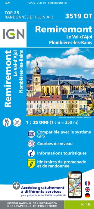
3519OT - REMIREMONT LE VAL-D'AJOL PLOMBIÈRES-LES-BAINS
Editor : IGN
Collection : TOP 25 ET SÉRIE BLEUE
Scale : 1:25 000
13.90€
TOP75028 - VOSGES DU SUD BALLON D'ALSACE LE HOHNECK
Editor : IGN
Collection : TOP 75
Scale : 1:75 000
9.80€
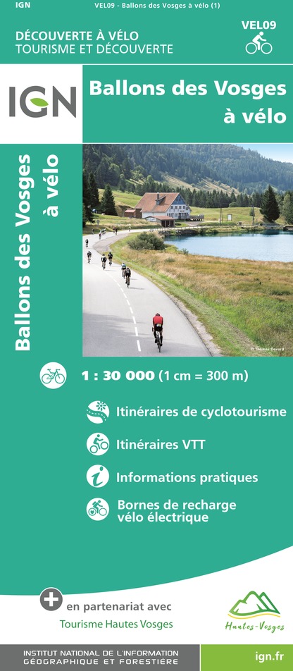
VEL09 - BALLONS DES VOSGES A VELO
Editor : IGN
Collection : DECOUVERTE A VELO
Scale : 1:30 000
9.10€
130 VESOUL LANGRES VALLÉE DE LA SAÔNE
Editor : IGN
Collection : TOP 100
Scale : 1:100 000
8.40€
TOP100D70 - HAUTE-SAÔNE VESOUL LURE VALLÉE DE LA SAÔNE
Editor : IGN
Collection : TOP 100
Scale : 1:100 000
8.40€
TOP100D68 - HAUT-RHIN TERRITOIRE DE BELFORT COLMAR MULHOUSE BELFORT PNR DES BALLONS DES VOSGES
Editor : IGN
Collection : TOP 100
Scale : 1:100 000
8.40€
TOP100D88 - VOSGES ÉPINAL NEUFCHÂTEAU ST-DIÉ-DES-VOSGES GÉRARDMER PNR DES BALLONS DES VOSGES
Editor : IGN
Collection : TOP 100
Scale : 1:100 000
8.40€
201 ALSACE MASSIF DES VOSGES
Editor : IGN
Collection : TOP 200
Scale : 1:200 000
6.80€
89032 - LA TRAVERSEE DES VOSGES
Editor : IGN
Collection : DECOUVERTE DES CHEMINS
Scale : 1:100 000
9.10€
89026 - GRANDES TRAVERSÉES DU JURA - GTJ
Editor : IGN
Collection : DECOUVERTE DES CHEMINS
Scale : 1:105 000
9.10€
D67-68 BAS-RHIN HAUT-RHIN
Editor : IGN
Collection : CARTES DÉPARTEMENTALES IGN
Scale : 1:150 000
5.90€
D70-88-90 HAUTE-SAÔNE VOSGES TERRITOIRE DE BELFORT
Editor : IGN
Collection : CARTES DÉPARTEMENTALES IGN
Scale : 1:150 000
5.90€
NR09 BOURGOGNE FRANCHE-COMTÉ
Editor : IGN
Collection : CARTES RÉGIONALES IGN
Scale : 1:250 000
6.80€
EUROPE
Editor : IGN
Collection : DÉCOUVERTE DES PAYS DU MONDE IGN
Scale : 1:2 500 000
7.00€
ALLEMAGNE
Editor : IGN
Collection : DÉCOUVERTE DES PAYS DU MONDE IGN
Scale : 1:800 000
7.00€
SUISSE
Editor : IGN
Collection : DÉCOUVERTE DES PAYS DU MONDE IGN
Scale : 1:303 000
7.00€

What to visit in DOMAINE DES PLANESSES

See more suggestions
Learn the history of DOMAINE DES PLANESSES through its museums.
See more suggestions

Where to eat in DOMAINE DES PLANESSES

See more suggestions
Establishments in DOMAINE DES PLANESSES offer dishes for all tastes.
See more suggestions

Where to sleep in DOMAINE DES PLANESSES

See more suggestions
Discover available accommodations around DOMAINE DES PLANESSES.
See more suggestions
Caution!
We have no information on the difficulty of this circuit. You may encounter some surprises along the way. Before you go, please feel free to inquire more and take all necessary precautions. Have a good trip! 🌳🥾