Tours
Activities
Places of interest
Where to eat
Where to sleep
University Campers Group - Explore Comps-sur-Artuby
Are you the owner?Welcome to Comps-sur-Artuby, a hidden gem in Provence-Alpes-Côte d'Azur. This charming Var village is an ideal starting point to explore a region rich in heritage and natural beauty. For outdoor enthusiasts, the Verdon Regional Natural Park is a must-visit with its spectacular landscapes and hiking trails that offer breathtaking adventures for all ages. Just a few kilometers away, the Gorges du Ve...See more
Walking around GROUPEMENT CAMPEURS UNIVERSITAIRES GCU
See more suggestionsHiking trails in the GROUPEMENT CAMPEURS UNIVERSITAIRES GCU area.
See more suggestions


What to do in GROUPEMENT CAMPEURS UNIVERSITAIRES GCU
See more suggestionsFind the best activities in GROUPEMENT CAMPEURS UNIVERSITAIRES GCU and book easily online.
See more suggestions


")
")
")


IGN cards
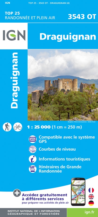
3543OT - DRAGUIGNAN
Editor : IGN
Collection : TOP 25 ET SÉRIE BLEUE
Scale : 1:25 000
13.90€
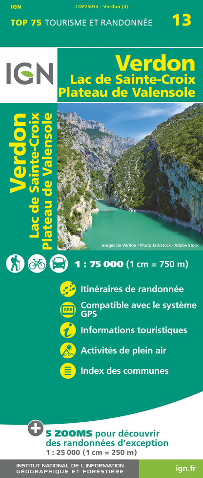
TOP75013 - VERDON LAC DE SAINTE-CROIX PLATEAU DE VALENSOLE
Editor : IGN
Collection : TOP 75
Scale : 1:75 000
9.80€

VEL06 - LE VAR A VELO
Editor : IGN
Collection : DECOUVERTE A VELO
Scale : 1:110 000
9.10€

TOP100D04 - ALPES-DE-HAUTE-PROVENCE DIGNE MANOSQUE PNR DU VERDON LAC DE SERRE-PONÇON
Editor : IGN
Collection : TOP 100
Scale : 1:100 000
8.40€

TOP100D06 - ALPES-MARITIMES NICE CÔTE D'AZUR PARC NATIONAL DU MERCANTOUR PNR DES PRÉALPES D'AZUR
Editor : IGN
Collection : TOP 100
Scale : 1:100 000
8.40€

TOP100D83 - VAR TOULON FRÉJUS MASSIFS DES MAURES ET DE L'ESTEREL PARC NATUREL RÉGIONAL DU VERDON
Editor : IGN
Collection : TOP 100
Scale : 1:100 000
8.40€

D04-05 ALPES-DE-HAUTE-PROVENCE HAUTES-ALPES
Editor : IGN
Collection : CARTES DÉPARTEMENTALES IGN
Scale : 1:150 000
5.90€

D06 ALPES-MARITIMES
Editor : IGN
Collection : CARTES DÉPARTEMENTALES IGN
Scale : 1:150 000
5.90€

D83 VAR
Editor : IGN
Collection : CARTES DÉPARTEMENTALES IGN
Scale : 1:150 000
5.90€

NR16 PROVENCE-ALPES-CÔTE D'AZUR
Editor : IGN
Collection : CARTES RÉGIONALES IGN
Scale : 1:250 000
6.80€

EUROPE
Editor : IGN
Collection : DÉCOUVERTE DES PAYS DU MONDE IGN
Scale : 1:2 500 000
7.00€
What to visit in GROUPEMENT CAMPEURS UNIVERSITAIRES GCU
See more suggestionsVisit the iconic landmarks of GROUPEMENT CAMPEURS UNIVERSITAIRES GCU.
See more suggestions


Where to eat in GROUPEMENT CAMPEURS UNIVERSITAIRES GCU
See more suggestionsExperience GROUPEMENT CAMPEURS UNIVERSITAIRES GCU's gastronomy.
See more suggestions
 ® Le Cheval Blanc (The White Horse)")


Where to sleep in GROUPEMENT CAMPEURS UNIVERSITAIRES GCU
See more suggestionsDiscover popular accommodations in GROUPEMENT CAMPEURS UNIVERSITAIRES GCU.
See more suggestions


")
")