Tours
Activities
Places of interest
Where to eat
Where to sleep

Unique Discoveries at Camping Municipal Les Pouverels, Cotignac

Are you the owner?
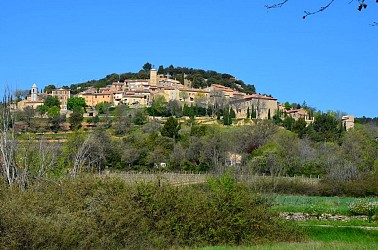
Welcome to Cotignac, a hidden gem in Var located in Provence-Alpes-Côte d'Azur. From Camping Municipal Les Pouverels, immerse yourself in local discoveries and exciting activities. Cotignac is renowned for its troglodyte houses nestled in an impressive cliff. Stroll through charming alleys, visit picturesque squares, and discover the famous Quatre Saisons fountain. Hiking enthusiasts will love the...See more

Walking around CAMPING MUNICIPAL LES POUVERELS

See more suggestions
Enjoy outdoor walks in CAMPING MUNICIPAL LES POUVERELS.
See more suggestions
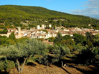
La Croix des Pins
12 km

La Croix des Pins

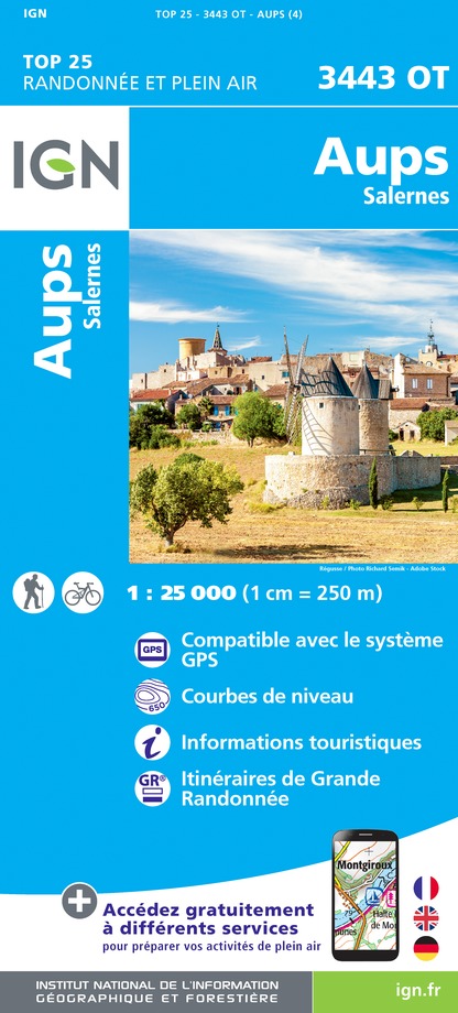
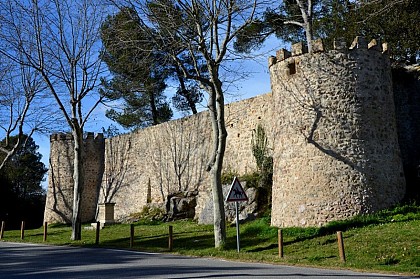
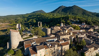
Aups, character village nestled at the foot of the Espiguières mountain in a privileged environment with rich heritage. From the tourist office, pass the St-Pancrace church and walk up Aups through the medieval streets (attention, the yellow markings begins at point (1). Pass at the foot of the Tour de l'Horloge, follow the Aires street and exit the ramparts through Aires Portal Turn left and follow the road to the chapel of Notre-Dame de la Délivrance and then, on the other side of the road, on the rural path of Devensaux. 1- At 150 m, leave the small road and turn right on chemin de la Trinité. The dirt road becomes tarred after college. Climb up by the path to the chapel Sainte-Trinité, pass below, and join a dirt road to the first caves of Aups. Continue on the road for another 300 m to reach, nestled in the wall, the Sainte-Magdeleine chapel. Continue the route under the green oaks, and follow a low wall to reach an intersection. 2 - Go back along the path to the valley on the left and access the forest track. Take the track on the right. Continue for 1 km, then join a cistern and the junction with the track of the Grand Colle. Follow it on the left. It is tarred for 400 m, then continue on the dirt road to the Col de Brès. 3 - Just before the Col de Brès, climb on the path to the left. The climb lasts 800 m to the top of the Espiguières mountain. The path continues on the plateau up to a tank (1 km). 4 - Take a small path on the left in the woods to quickly reach the Croix des Pins (round trip). Return to the track and continue the crossing. Go down the path through the forest and then join the forest path of Croix des Pins at 1.7 km. 5 - On the track turn to the right and 800 m later turn left on the small Devensaux road. Return by the latter to the village and lead in point 1. Continue on the road up to the Aups’s doors. Return to the starting point by the small streets of the village.

5 h
12 km
Medium
Show
La Croix des Pins
12 km

La Croix des Pins

Aups, character village nestled at the foot of the Espiguières mountain in a privileged environment with rich heritage. From the tourist office, pass the St-Pancrace church and walk up Aups through the medieval streets (attention, the yellow markings begins at point (1). Pass at the foot of the Tour de l'Horloge, follow the Aires street and exit the ramparts through Aires Portal Turn left and follow the road to the chapel of Notre-Dame de la Délivrance and then, on the other side of the road, on the rural path of Devensaux. 1- At 150 m, leave the small road and turn right on chemin de la Trinité. The dirt road becomes tarred after college. Climb up by the path to the chapel Sainte-Trinité, pass below, and join a dirt road to the first caves of Aups. Continue on the road for another 300 m to reach, nestled in the wall, the Sainte-Magdeleine chapel. Continue the route under the green oaks, and follow a low wall to reach an intersection. 2 - Go back along the path to the valley on the left and access the forest track. Take the track on the right. Continue for 1 km, then join a cistern and the junction with the track of the Grand Colle. Follow it on the left. It is tarred for 400 m, then continue on the dirt road to the Col de Brès. 3 - Just before the Col de Brès, climb on the path to the left. The climb lasts 800 m to the top of the Espiguières mountain. The path continues on the plateau up to a tank (1 km). 4 - Take a small path on the left in the woods to quickly reach the Croix des Pins (round trip). Return to the track and continue the crossing. Go down the path through the forest and then join the forest path of Croix des Pins at 1.7 km. 5 - On the track turn to the right and 800 m later turn left on the small Devensaux road. Return by the latter to the village and lead in point 1. Continue on the road up to the Aups’s doors. Return to the starting point by the small streets of the village.

5 h
12 km
Medium
Show
The Pelenc forest from Moissac Bellevue
13 km

The Pelenc forest from Moissac Bellevue

This hike from a village with character will be done in a gentle landscape and pine forest environment. From the fountain, engage in the Rue de l'eglise and go down the first staircase on the left. Continue on the path to the Reynouard house (shaded path between walls), then cross the D30. Continue straight to the next intersection and turn left. Then after 200m, reach the "Chemin du Plan" to the right. Continue on this small road lined with clearings and pass a countryside basketry workshop. Continue for 1.7km to the field of the Gros Bec domain. 1- Continue straight on the dirt road entering the forest of Pélenc. Leave behind the different fires track to the sides and continue straight for 2km. 2- Commit to the right on the "Chemin du Vallon de Bolle". Follow it for 1km and head back through the green oak forest, the valley until the crossroads of Chemin de Moissac and Chemin de Régusse. 3- Follow the direction of Moissac (not shown) to the right. Proceed on the second track. Follow the path, under the oaks in front of the old coal and the tank of the Maquisards then go down for 500m until the track "Baquis". Follow it to a tank. Continue straight in the middle of the pines. At the next intersection (800m), leave to the right the "Piste de l'Auviduery" and take the second path to the left. The path goes back up the plateau and to reach at a barrier a junction of routes to Moissac and Régusse. 4- Descend by the right track towards the village. Reaching out of the woods, go up the path to the main road. Follow it to the right for 50m and then turn left into the "Chemin de la Croix Vieille". It goes directly to the village of Moissac- Bellevue.

4 h
12 km
Medium
Show
The Pelenc forest from Régusse
13 km

The Pelenc forest from Régusse

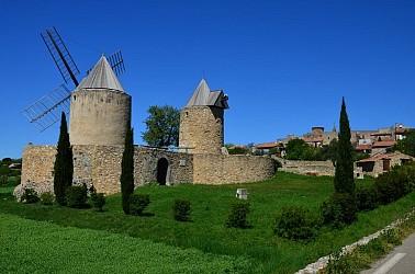
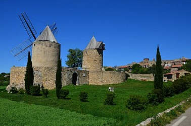
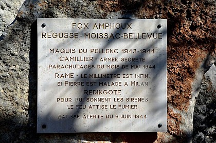
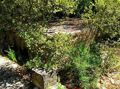
You will go through the state-owned forest of Pelenc to meet a past filled with history, that of coal and that of the Members of the French Resistance. Cross the village by the Grand Rue and head down to the windmills by the Rue des Moulins. Pass the two mills and follow the small road (CD 260) for 800m. Continue straight to the intersection with the Chemin de la Sine. Take a right on the Avenue Jean Giono (paved road on 600m). Continue on a dirt road in the middle of the forest for 2.3km. 1- In the woods, reach by the track the Commemorative Rock of the maquis of Pélenc. Turn left on the "Piste de Moissac". The roadside is lined with stone markers indicating the limits of the state-owned forest. At the "Valley de Bolle" track (not shown), reach by the route the intersection between Moissac and Régusse. 2- Follow the direction of Moissac. Leave a first track behind, then proceed on the second one ("Piste du Cadastre "). Follow the path that passes by the old coal burners in front of the Maquis tank. Go down for 500m to the "Baquis" track. Follow it to a tank. Continue straight in the middle of the pines. At the next intersection (800m), leave to the right the "Piste de l'Auviduery" (not shown) and take the second path to the left. Go back up the plateau (viewpoint of the village) and reach at a barrier a junction of the routes to Moissac and Régusse. 3 - Turn left on Chemin de Régusse. Leave a path starting on the left, past a ruin then, at the forest exit, reach a small road. Follow it for 100m and at the intersection turn left on the road. Come out at the St. Eloy oratory on the Avenue Frédéric Mistral. Enter the village by the road (for your security, walk on the left side of the road).

4 h
14 km
Medium
Show
The Pelenc forest from Régusse
13 km

The Pelenc forest from Régusse

You will go through the state-owned forest of Pelenc to meet a past filled with history, that of coal and that of the Members of the French Resistance. Cross the village by the Grand Rue and head down to the windmills by the Rue des Moulins. Pass the two mills and follow the small road (CD 260) for 800m. Continue straight to the intersection with the Chemin de la Sine. Take a right on the Avenue Jean Giono (paved road on 600m). Continue on a dirt road in the middle of the forest for 2.3km. 1- In the woods, reach by the track the Commemorative Rock of the maquis of Pélenc. Turn left on the "Piste de Moissac". The roadside is lined with stone markers indicating the limits of the state-owned forest. At the "Valley de Bolle" track (not shown), reach by the route the intersection between Moissac and Régusse. 2- Follow the direction of Moissac. Leave a first track behind, then proceed on the second one ("Piste du Cadastre "). Follow the path that passes by the old coal burners in front of the Maquis tank. Go down for 500m to the "Baquis" track. Follow it to a tank. Continue straight in the middle of the pines. At the next intersection (800m), leave to the right the "Piste de l'Auviduery" (not shown) and take the second path to the left. Go back up the plateau (viewpoint of the village) and reach at a barrier a junction of the routes to Moissac and Régusse. 3 - Turn left on Chemin de Régusse. Leave a path starting on the left, past a ruin then, at the forest exit, reach a small road. Follow it for 100m and at the intersection turn left on the road. Come out at the St. Eloy oratory on the Avenue Frédéric Mistral. Enter the village by the road (for your security, walk on the left side of the road).

4 h
14 km
Medium
Show
La Colle (hill)
13 km

La Colle (hill)

The climb to La Colle hill has beautiful and diverse viewpoints in all seasons and generates as many different atmospheres. Leaving the car park, turn right and head down the main street for about 120m, turn left on the Rue de la Paix. Go straight until the D30 road, cross it and take the Rue Pasteur across. Pass the St-Roch oratory. Go along the walls of the Faïsses (cultivated terraces), having crossed the Chemin des Paouves and the Chemin du Bas des Faïsses, continue straight on the paved road of Chemin de Régusse in Bauduen. 500m, cross the road and enter a dirt road in the communal forest of Régusse. Regain through the path, bordered by a dry stone wall, a crossroads 300m further. Take the right track and follow a narrow path starting left in the woods (yellow markings). Reach a dirt road. Turn left to the P50 track of "Puits de Riquier". Follow it for 1km until the D9 road. 1 - Continue on the track across from the "Puits de Riquier" track. 200m further, leave to the right the L7 track, and continue towards La Colle hill. At the next crossroads 1km further, leave the main trail and follow the path to the right. Leave behind another path on the right and continue up to the summit of La Colle hill. At 1km, the route meets a track in a curve. Follow the marked path on the right. Go up the valley, and pass at the foot of former coal burners (flat land with very dark dirt) and at the well of Verin. The end of the climb is steep. Reach the ridge, then the highest point of the hike (932m). 2- Exit the wood by the trail and descend through the hill to the slopes of the "Puits de Verin" and "la Ferme de Bondil" tracks. Continue straight. Pass the ruins of the Clau Farm and reach the D9 road down below. 3- Turn left, then take the first right. Pass the horse farm of the Puits de Riquier, go straight and 1km further, cross the track called "Piste des quatre chemins". Reach the Chemin de Régusse in Bauduen followed to go. Head back to the village by the same route.

5 h
15 km
Medium
Show

What to do in CAMPING MUNICIPAL LES POUVERELS

See more suggestions
Discover surprising activities in CAMPING MUNICIPAL LES POUVERELS and book the ones you like.
See more suggestions
Natur'Evasion - Cyclisme
12 km

Natur'Evasion - Cyclisme

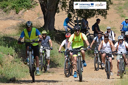
Located in Saint Antonin du Var, halfway between Carces and Lorgues, Natur’Evasion has been offering outdoor adventures for 35 years Natur'Evasion offers a range of cycling services: -bike hire for individuals and groups (up to 100 participants) of standard and electric bikes, as well as all accessories for the family, and offers beautiful routes for all levels to discover the region, -guided tours with qualified guides adapted to each person's level, from mountain biking to cycling holidays combining cycling, discovery, heritage and/or gastronomy, -a repair workshop (standard and electric bikes), -a shop selling new and second-hand bikes and a BIKE PARK for the whole family. Natur'Evasion offers a wide range of routes around Saint Antonin du Var along the Euro Vélo 8 cycle route, as well as throughout the Var department and a specific route linking the Verdon Natural Park to the Mediterranean. Natur'Evasion organises tailor-made touring holidays in the Var department and discovery trips to meet local producers (wine, honey, cheese, figs, etc.). Natur'Evasion has a fleet of all types of bicycles available. These are very recent models, selected for their technical qualities, durability and comfort, mainly from the TREK and BIANCHI brands. Trained and qualified staff carry out maintenance and repairs. Cyclists of all types will find a warm welcome and all the necessary amenities on site: facilities for washing clothes for those on the road, and even a place to pitch a tent for the night, recharge electric bike batteries or get minor repairs done. Chat with fellow cyclists, get advice on nearby routes, enjoy a coffee or a refreshing break... Don't hesitate to stop by, especially as it's in a beautiful location on the banks of the Argens river, surrounded by nature! A small snack bar is open to all in July and August. Natur'Evasion has been awarded the Accueil Vélo, Qualité Tourisme, Vignobles et Découvertes labels. Natur'Evasion is a member of the Vélo Loisir Provence and MCF networks and is listed on the SRAV website.

93 route de Carcès RD 562 83510 Saint-Antonin-du-Var
Book from 0 €Book
Show

What to visit in CAMPING MUNICIPAL LES POUVERELS

See more suggestions
Savor the local cuisine of CAMPING MUNICIPAL LES POUVERELS.
See more suggestions
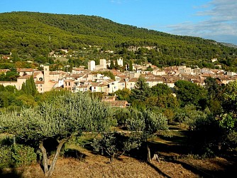
Where to eat in CAMPING MUNICIPAL LES POUVERELS

See more suggestions
Restaurants in CAMPING MUNICIPAL LES POUVERELS are ready to welcome you.
See more suggestions
Natur'Evasion - Cyclisme
12 km

Natur'Evasion - Cyclisme

Located in Saint Antonin du Var, halfway between Carces and Lorgues, Natur’Evasion has been offering outdoor adventures for 35 years Natur'Evasion offers a range of cycling services: -bike hire for individuals and groups (up to 100 participants) of standard and electric bikes, as well as all accessories for the family, and offers beautiful routes for all levels to discover the region, -guided tours with qualified guides adapted to each person's level, from mountain biking to cycling holidays combining cycling, discovery, heritage and/or gastronomy, -a repair workshop (standard and electric bikes), -a shop selling new and second-hand bikes and a BIKE PARK for the whole family. Natur'Evasion offers a wide range of routes around Saint Antonin du Var along the Euro Vélo 8 cycle route, as well as throughout the Var department and a specific route linking the Verdon Natural Park to the Mediterranean. Natur'Evasion organises tailor-made touring holidays in the Var department and discovery trips to meet local producers (wine, honey, cheese, figs, etc.). Natur'Evasion has a fleet of all types of bicycles available. These are very recent models, selected for their technical qualities, durability and comfort, mainly from the TREK and BIANCHI brands. Trained and qualified staff carry out maintenance and repairs. Cyclists of all types will find a warm welcome and all the necessary amenities on site: facilities for washing clothes for those on the road, and even a place to pitch a tent for the night, recharge electric bike batteries or get minor repairs done. Chat with fellow cyclists, get advice on nearby routes, enjoy a coffee or a refreshing break... Don't hesitate to stop by, especially as it's in a beautiful location on the banks of the Argens river, surrounded by nature! A small snack bar is open to all in July and August. Natur'Evasion has been awarded the Accueil Vélo, Qualité Tourisme, Vignobles et Découvertes labels. Natur'Evasion is a member of the Vélo Loisir Provence and MCF networks and is listed on the SRAV website.

93 route de Carcès RD 562 83510 Saint-Antonin-du-Var
Book from 0 €Book
Show

Where to sleep in CAMPING MUNICIPAL LES POUVERELS

See more suggestions
Choose from a variety of lodgings in CAMPING MUNICIPAL LES POUVERELS.
See more suggestions
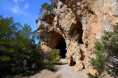
Terres de France - Résidence Côté Provence
32 km

Terres de France - Résidence Côté Provence

Stay in Gréoux-les-Bains, Between Provence and Verdon: Accommodation & Must-See Attractions Gréoux-les-Bains, a charming spa town nestled between the Verdon Natural Park and the Luberon, is the perfect destination for a getaway combining relaxation, wellness, and exploration. With its renowned thermal baths, stunning Provençal landscapes, and picturesque villages, Gréoux-les-Bains offers a truly unique experience in the heart of Provence. Accommodation in Gréoux-les-Bains – Résidence Côté Provence The Résidence Côté Provence – Terres de France welcomes you to a warm and elegant setting, just a short walk from the thermal baths and town center. Its fully equipped and comfortable apartments are ideal for spa retreats, Provence getaways, or family vacations. Enjoy a residence featuring a swimming pool, wellness area, and all the amenities for a relaxing stay. Places of Interest The Gréoux-les-Bains Thermal Baths: Experience the therapeutic benefits of these renowned healing waters. The Verdon Gorges: Explore Europe’s largest canyon, perfect for rafting, hiking, and paddleboarding. The Valensole Plateau: Marvel at the famous lavender fields in full bloom between June and July. The Templar Castle: A historic landmark overlooking the town, offering a glimpse into medieval history. Esparron Lake: A beautiful setting for swimming, canoeing, and nature walks. Book your stay at Gréoux and immerse yourself in the charm of Gréoux-les-Bains and Provence!

11 Avenue des Thermes 04800 Gréoux-les-Bains
Show
Caution!
We have no information on the difficulty of this circuit. You may encounter some surprises along the way. Before you go, please feel free to inquire more and take all necessary precautions. Have a good trip! 🌳🥾