Tours
Activities
Places of interest
Where to eat
Where to sleep

Gites Le Creux: Nature and Activities around Fresse

Are you the owner?
Welcome to Gites Le Creux! Discover the charms of Fresse and its surroundings, a true natural haven in Haute-Saône, Franche-Comté. Nestled in lush landscapes, this area is perfect for nature lovers and outdoor enthusiasts. Take walks in the forest of Fresse, follow hiking trails meandering through the hills and valleys, or explore local waterfalls and rivers. During your stay, don't miss visiting ...See more

Walking around GITES LE CREUX

See more suggestions
Discover the nature of GITES LE CREUX on foot.
See more suggestions
FAMILY WALK - PONDS CIRCUIT FROM THE BLACK POND
14 km

FAMILY WALK - PONDS CIRCUIT FROM THE BLACK POND

Circuit des Etangs from the Etang Noir (Municipality of Ramonchamp). Duration: 2h. Difficulty: easy (family walk with children). Lenght: 5 kilometers. Elevation: +54 meters. Signposting: blue ring on the outward journey and unmarked departmental road on the return. Places of interest: viewpoint of the Etang Noir, wild landscapes of the Noirs Etangs and the Etang de la Peau, wooden footbridge and peat bog of the Etang de la Chaussée Pingant. Departure: Etang Noir car park. Access: From Le Thillot, follow the road towards Lure and Servance. At the top of the Col des Croix, turn right onto the D57 for 4 kilometers. Description of the route: From the car park, take the path on the left which runs along the pond and follow the direction "Sentier des Etangs" blue ring markings. After 50 meters, pass over a belvedere protected by wooden barriers. Continue on this path, you walk along the Etang Noir before crossing the road. When you get to the road, turn left, continuing for 30 meters, then take the path to the right in the forest, following the blue ring markings. Cross the blue bridge and continue on this path for about 300 meters. Once again on the road, cross it and take the path opposite the blue ring markings. Continue for 50 meters then turn right, still following the same blue ring markings. You pass at a place called "Les Noirs Etangs" whose name is indicated on a sign at the edge of the footpath. At the crossroads, still follow the direction "Sentier des Etangs" blue ring markings. Walk along the dry pond then at the end of the path, take the path opposite the blue ring markings. Do not turn right onto the asphalt road. Pass by a private pond and house on the left. The land is fenced. Arrived at the end of this private pond, you come out on a pond called "Etang de la Chaussée Pingant". Take the blue ring signposted path to the right. Cross the bridge which leads to a pretty chalet with picnic table open all year round. Possibility of fishing on site (fishing license compulsory). Head to the right behind the chalet, follow the sign "Sentier des Etangs" signposted blue ring and walk along the bog. Continue the walk following the direction "direction advised". Find another pond on your right with a chalet. Walk along it following the blue ring markings. When you arrive at a new pond (large house) called "Etang de la Peau", turn right then walk along this pond via the path to join a forest path before turning left to join the road. In front of you is a pond bordered by stones. Follow the road on your right for 2 km to finish the walk and reach the starting point (caution, busy road).

2 h
4.6 km
Very easy
88160 RAMONCHAMP
Show
FAMILY WALK - VIRGIN CIRCUIT
16 km

FAMILY WALK - VIRGIN CIRCUIT

Circuit de la Vierge (Municipality of Le Thillot). Duration: approximately 1h30. Difficulty: easy (family walk with children). Lenght: 4 kilometers. Elevation : +84 meters. Signposting: yellow triangle, mountain bike trail n ° 14, unmarked parts. Places of interest: the Hautes-Mynes Museum, the view over the valley from the Virgin of the Liberation. Departure: parking lot at the Omnisport hall (Maurice Schoenacker), next to the Hautes-Mynes Museum. Access: from the center of Le Thillot, follow direction Lure. The Hautes-Mynes Museum is 500 meters further on on the right. Description of the route: From the car park, go behind the Hautes Mynes Tourist Office and Museum building to find the Voie Verte. Continue on the Voie Verte alongside the factory that you will see on your left with its large fireplace. When you reach the 1st barrier of the Voie Verte, take the small road to the left and continue for about 300 meters where you will pass between the old workers' towns. At the end of the road, pass the red chicane and take the small path that leads to a small bridge that spans the Vacceux stream. Children may have the chance to observe small fish ... Continue on this path which climbs up to a second red chicane. Continue straight for 200 meters. On your right, you will see a house and join the asphalt road. Go to the left and continue on this road. After 30 meters, take the dirt road on the right and follow the yellow triangle markings indicating "Le Pré Martin / Etang de la Peau". You can take a short break on the bench and discover the village of Le Thillot in front of you. Follow this path for approximately 800 meters. At the intersection, turn right and follow the direction "Point de vue de la Vierge". When you arrive at the Virgin, you can enjoy a breathtaking view of Le Thillot with its church overlooking the town, of the village of Ramonchamp on your left or of the Ménil valley opposite. Retrace your steps for about 200 meters. At the first intersection, at the end of the descent, take the small grassy path that goes down to the right. Continue on this path at the edge of the forest which will bring you at a farm at the end of the road. When you get to the tarmac road, go down for about 600 meters then take the first right. Follow the mountain bike markings n° 14. You come to a house which is located in a dead end with a henhouse on your right. Turn left and follow the mountain bike markings n° 14 on the grassy path. Take the tarmac road to the right as far as the crossroads to join the Voie Verte. Take the Voie Verte to the right and continue straight for about 200 meters to finish the walk and find the starting point.

2 h
3.9 km
Very easy
47 rue de la Gare Musée des Hautes Mynes 88160 LE THILLOT
Show
FAMILY HIKE AT THE BALLON D'ALSACE
16 km

FAMILY HIKE AT THE BALLON D'ALSACE

Take advantage of the quietness of the forest and the amazing views during this hike that will offer you all the charms of the Ballon d'Alsace, highest point of the southern Vosges. Warning: this walk passes through the protected area of the Ballons Comtois Nature Reserve, dogs are forbidden, even on a leash. Duration: 2h - Length: 6 km - Elevation: +140 m - Markings: Yellow point - Red rectangle - Blue ring - Red point. Access: National 66, at the tourist office of St Maurice sur Moselle take the D486 which is just opposite and go up to the top of the pass. Departure: Maison du Tourisme at the top of the Col du Ballon d'Alsace. Route: - From the car park of the Maison du tourisme, go towards the forest behind the monument "L'Homme projeté" by following the path between the chalet dedicated to cross-country skiing and the sign "Réserve naturelle des Ballons Comtois" (yellow point/red rectangle GR5). - Pass in the forest - At the first crossing (after the board "Forêt Domaniale du Ballon d'Alsace"), turn right and follow the blue ring markings "Chemin Colas". At the crossroads 30m further on, turn right again following the same marks: "Ballon d'Alsace 1h30 par le Chemin Colas - Jumenterie 0h45". - Follow this path for about 1km. Look at the Ballon de Servance on your left, which is characterized by its antenna at its top. - You arrive at a small cleared area bordering the road. Follow the path which leads up on the right (blue ring "Jumenterie") - Go up during almost 200m on this rather steep short part, it leads to the cow park in which you pass. - Cross the field and then follow the road, staying in the meadow until you reach the building in front of you (the "Jumenterie"). - Cross the road, pass in front of the building and go along on its right side following the path (red point, direction "Sommet du Ballon") - You arrive at a small chalet (the red point is on its left side). You can have a break at the picnic table and the look at the cows (depending on the season). - The picnic table in your back , take the uphill path that goes under the ski lift. - Leave the cow park by following the path, continue for about 600m, through the forest and the blueberries. - When you reach the clearing, follow the path that leads along the meadow on your right. Depending on the weather and the season, you may see horses. - You can reach the path on your left "le Sentier Découverte" that lead up to the statue of Jeanne d'Arc. Otherwise turn right and reach your starting point. IGN map reference 3520 OT available in the tourist offices. The GPX route and the description in french of the walk are downloadable above.

2 h
4.9 km
Very easy
Route du Ballon d'Alsace Ballon d'Alsace 88560 SAINT MAURICE SUR MOSELLE
Show
FAMILY WALK - FRAC POND CIRCUIT
16 km

FAMILY WALK - FRAC POND CIRCUIT

Circuit of Frac Pond (Municipality of Fresse-sur-Moselle). Duration: approximately 1 to 2 hours. Difficulty: easy (family walk with children). Lenght: 2 kilometers (long version 4km). Elevation : +47 meters or +101 meters. Markings: red ring, end of the unmarked walk. Places of interest: Etang du Frac and panorama of Col de Couard. Departure: Etang du Frac car park. Access: when you arrive in Fresse-sur-Moselle from Le Thillot, take the first road on the right after the restaurant "Le Mandarin de Chine". Cross the bridge over the Moselle and follow the direction "Etang du Frac". Description of the route: From the car park near the chalet, return to the tarmac road for about 50 meters. Walk towards the path below the pond. Path along the forest and not the path along the pond. Follow the markup red ring indication "Notre-Dame de Fresse". At the 1st intersection, continue to the left following the red ring markings, mountain bike n ° 1. Follow this path which climbs for about 300 meters. Arrived at the top of the path, at a crossroads: you will discover on the path of left at 50 meters the chalet de la Vierge (closed chalet) equipped with a table and benches outside for a break. Then retrace your steps to continue the walk. If you wish to extend the walk ... You can go up to "Notre-Dame de Fresse" also called Vierge des Breuleux by the path on your left (200 meters return) in 10 barely minutes. The statue of the Virgin is in a small cave and offers a nice point of view. To continue the walk, continue on the path straight ahead, following the red ring markings towards the "Col de Couard". At the intersection, continue on the right path following the red ring markings. Continue for about 300 meters, you will overlook the Frac pond and an isolated farm. You might see donkeys and goats in their parks. Continue on this path for another 100 meters to the Col de Couard from where a nice view unfolds over the massifs. For those who wish to extend the walk, it is possible to reach the "Croix de Couard" where you can admire a breathtaking view of the village of Fresse-sur-Moselle. To do this, follow the path with the "Croix de Couard" red ring markings. 2km, 1 hour round trip. For others, take the right path for 100 meters mountain bike markings n ° 1, you will follow the other side of the farm with its animals. Below, turn right with the red ring markings then continue for 50 meters and you will arrive behind the Michel Laurent chalet. Break possible at the chalet.

1 h
1.6 km
Very easy
chemin de l'étang Etang du Frac 88160 FRESSE SUR MOSELLE
Show
THE BLACK POND
16 km

THE BLACK POND

CIRCUIT N ° 3: The Black Pond (Municipality of Ramonchamp) Duration: about 3h15 Difficulty: medium (occasional hiker) Distance: 11 kilometers Positive elevation: 336 meters Markings: blue ring Places of tourist interest: Plateau des 1000 Etangs, viewpoint of the Etang Noir Departure: parking lot of the church of Ramonchamp Access: Coming from Le Thillot, take the national road 66 towards Epinal. The first village crossed is called Ramonchamp. Take the road on the left after the bakery, at the pharmacy intersection, to reach the center of the village and the church. Description of the route: Follow the path marked with the blue ring: it crosses a cycle path called "Voie Verte des Hautes Vosges" then follows a spinning mill before turning right into the middle of the workers' housing estates. It goes up through a meadow before joining an asphalt road that you have to take on the right. After 80 meters on this road, you arrive at the start of the loop. You must continue on the tarmac road marked with blue ring markings. The route passes near a chapel that watches over the village before joining a tarmac road that must be taken uphill on the left. When you reach the last houses, the road ends and gives way to a path that climbs in zigzags to the Grammont crossroads (altitude: 675 meters). From there, continue on the wide forest path on the right for about 1 kilometer then fork to the left to walk on a charming little path on the mountainside. This path crosses a wooden footbridge at the picturesque site of the Noir Étang waterfall before reaching the Etang Noir a little higher (altitude: 750 meters). This site is conducive to a well-deserved break, especially as it is equipped with a picnic table. Continue towards a belvedere which is located at the end of the pond and overlooks the crossed waterfall on the way up. The panorama allows you to gaze at the entire town of Ramonchamp set in its green setting against the backdrop of the Ballons des Hautes Vosges and even the Route des Crêtes. From the belvedere, always follow the blue ring. This portion of the walk is part of the Sentier des Étangs which takes you after 1 kilometer to a place called “les Noirs Étangs”. From this point, you have to leave the Sentier des Étangs, which runs straight ahead, to take the left-hand path marked with a blue ring as well. It goes down to the Grammont crossroads crossed on the way out. For the return, you have to continue on the 2nd path on the left (not the one taken during the ascent on the outward journey). This path successively crosses the Chalet de Grammont, a remarkable rock then a cave before joining a small mountain road that you have to leave immediately to take the path to the left that goes down to the village. It joins the intersection at the start of the loop. You must therefore take the road on the right and take the same route as going via the workers' housing estates and the spinning mill to reach the church.

3 h
11 km
Easy
église de Ramonchamp 88160 RAMONCHAMP
Show

What to do in GITES LE CREUX

See more suggestions
Experience unique moments with the bookable activities in GITES LE CREUX.
See more suggestions
Comprehensive Strasbourg rickshaw tour - 1 hr 20 mins
123 km

Comprehensive Strasbourg rickshaw tour - 1 hr 20 mins

Enjoy this guided rickshaw tour to discover all of Strasbourg! Your driver and tour guide will let you in on the city's secrets! Rickshaws are a unique way to get around and see all the key sites of Strasbourg in just 1 hour and 20 minutes! Your driver will do the pedalling while you enjoy the city's key sites. Once you are comfortably seated on your rickshaw, you will start your tour by discovering the Palais Rohan. This magnificent monument with a classical façade has been classified as a historic monument. In 2009, it opened its doors to the most powerful world leaders on a NATO summit. You will then be taken to the Place Broglie to marvel at Strasbourg's stunning opera house. You will be captivated by its neoclassical façade, which has been classified as a historic monument! Your visit will continue with the Place de la République, where you will admire the relics of German architecture. This stunning square is home to the German imperial district's most iconic monuments. You will then enter into the heart of the German neighbourhood to discover its Haussmann-style avenues, the European sites and the Orangerie district. You will also get a glimpse at the headquarters of the French-German cultural TV channel: Arte.   Your tour will end by a ride through the "Petite-France" neighbourhood, at the heart of the old town. Marvel at typical half-timbering houses built right above the water. You will enjoy an exceptional scenic view on the terrace of the Barrage de Vauban. Let this quaint neighbourhood - which is a UNESCO World Heritage Site - captivate you! Pick this tour and visit all the key places of Strasbourg in an unusual and pleasant way!

Book from 90 EURBook
Show

IGN cards

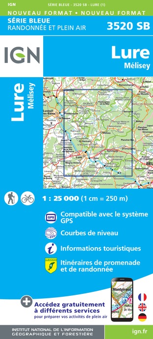
3520SB - LURE MÉLISEY
Editor : IGN
Collection : TOP 25 ET SÉRIE BLEUE
Scale : 1:25 000
13.90€
TOP75028 - VOSGES DU SUD BALLON D'ALSACE LE HOHNECK
Editor : IGN
Collection : TOP 75
Scale : 1:75 000
9.80€
TOP100D68 - HAUT-RHIN TERRITOIRE DE BELFORT COLMAR MULHOUSE BELFORT PNR DES BALLONS DES VOSGES
Editor : IGN
Collection : TOP 100
Scale : 1:100 000
8.40€
130 VESOUL LANGRES VALLÉE DE LA SAÔNE
Editor : IGN
Collection : TOP 100
Scale : 1:100 000
8.40€
TOP100D88 - VOSGES ÉPINAL NEUFCHÂTEAU ST-DIÉ-DES-VOSGES GÉRARDMER PNR DES BALLONS DES VOSGES
Editor : IGN
Collection : TOP 100
Scale : 1:100 000
8.40€
TOP100D70 - HAUTE-SAÔNE VESOUL LURE VALLÉE DE LA SAÔNE
Editor : IGN
Collection : TOP 100
Scale : 1:100 000
8.40€
201 ALSACE MASSIF DES VOSGES
Editor : IGN
Collection : TOP 200
Scale : 1:200 000
6.80€
89032 - LA TRAVERSEE DES VOSGES
Editor : IGN
Collection : DECOUVERTE DES CHEMINS
Scale : 1:100 000
9.10€
89026 - GRANDES TRAVERSÉES DU JURA - GTJ
Editor : IGN
Collection : DECOUVERTE DES CHEMINS
Scale : 1:105 000
9.10€
D67-68 BAS-RHIN HAUT-RHIN
Editor : IGN
Collection : CARTES DÉPARTEMENTALES IGN
Scale : 1:150 000
5.90€
D70-88-90 HAUTE-SAÔNE VOSGES TERRITOIRE DE BELFORT
Editor : IGN
Collection : CARTES DÉPARTEMENTALES IGN
Scale : 1:150 000
5.90€
NR09 BOURGOGNE FRANCHE-COMTÉ
Editor : IGN
Collection : CARTES RÉGIONALES IGN
Scale : 1:250 000
6.80€
SUISSE
Editor : IGN
Collection : DÉCOUVERTE DES PAYS DU MONDE IGN
Scale : 1:303 000
7.00€
EUROPE
Editor : IGN
Collection : DÉCOUVERTE DES PAYS DU MONDE IGN
Scale : 1:2 500 000
7.00€
ALLEMAGNE
Editor : IGN
Collection : DÉCOUVERTE DES PAYS DU MONDE IGN
Scale : 1:800 000
7.00€

What to visit in GITES LE CREUX

See more suggestions
Walk along the picturesque streets of GITES LE CREUX.
See more suggestions

Where to eat in GITES LE CREUX

See more suggestions
The flavors of GITES LE CREUX await you.
See more suggestions

Where to sleep in GITES LE CREUX

See more suggestions
Explore hostels and hotels in GITES LE CREUX.
See more suggestions
Caution!
We have no information on the difficulty of this circuit. You may encounter some surprises along the way. Before you go, please feel free to inquire more and take all necessary precautions. Have a good trip! 🌳🥾