Alert
Alerts
The hills of Saint Hilaire Les Monges
Description
A pleasant trail mainly over open ground with wide views over the Combrailles. The heritage is concentrated in the village of Saint-Hilaire-les-Monges: church, biface cross, well, wash-house, etc.
Technical Information
Altimetric profile
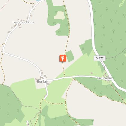
Starting point
Additional information
Updated by
Office de Tourisme des Combrailles - 02/06/2026
www.combrailles-auvergne-tourisme.fr/
Report a problem
Open period
All year round daily.
Contact
Phone : 04 73 79 91 23
Email : mairie.sthilairemonges@wanadoo.fr
Location complements
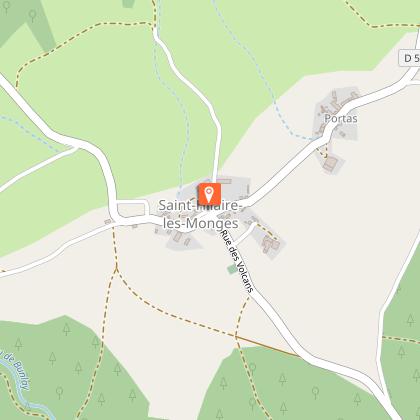
Place de l'église, Saint-Hilaire-les-Monges
Reception complements
For your own safety, always take a bottle of water, a hat, warm clothing and footwear suitable for walking.
Depending on the weather conditions, some routes are not recommended in bad weather (fog) or are not practicable, or even forbidden, during the winter season.
Some sites are fragile, so stay on the marked paths. Avoid picking wild flowers and disturbing wildlife. Pick up your rubbish.
Guidebook with maps/step-by-step
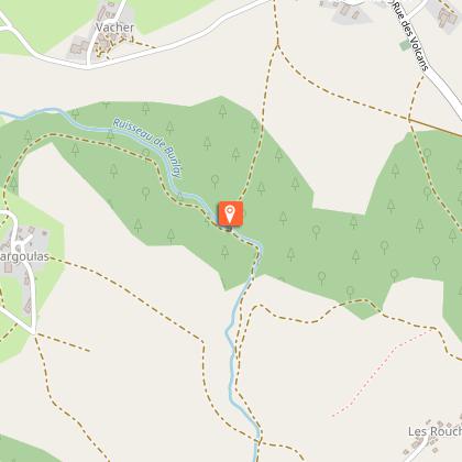
From the start sign (picnic area and toilets nearby), head towards the church forecourt. With your back to the entrance, walk down Rue de la Fontaine to a road. Turn right onto this road. At the fork in the road, continue straight ahead (Rue du Noyer) and immediately turn left. Take the first track on the right. Leave a forest track on the right. Cross a stream and go as far as the fork.
1 - Go up to the right. Cross a road (called Fargoulas) and continue along the track opposite. At the next junction, turn left up the road for 100m, then right onto a road that becomes a track. At the junction of 4 tracks, turn left. Continue along the main path, ignoring the side paths, until you reach a road.
2 - Turn right onto the track. Cross a stream. Start to climb to the left and then turn right into the forest. Continue straight ahead until you reach a crossroads. Turn left down this road.
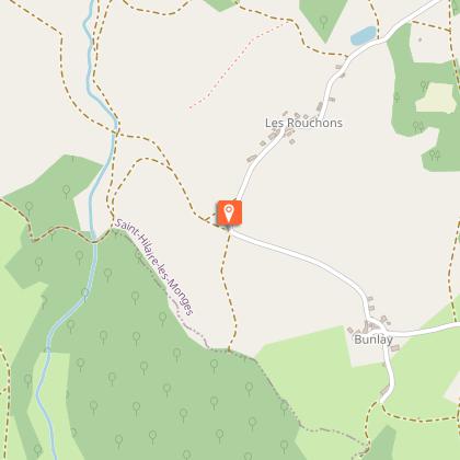
At the first houses, follow the road to the right. At the T-junction, take the road on the left. At the next crossroads, go left for 100m, then turn right. Continue (180° view of the Combrailles hills) to the first road on the left. Go down this road and then turn left. The road runs alongside a pond (shelter). Continue as far as the entrance to Les Rouchons.
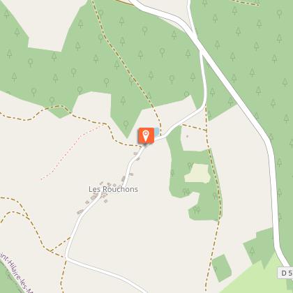
3 - Take the track on the right. Turn right at the fork. At the junction, go right down
(hairpin bend). Cross a stream. At the intersection (point 1), turn right and continue straight ahead until you reach Rue du Noyer. Turn right to get back to the starting point.
Animals
Yes. Dogs must be kept on a lead
