Alert
Alerts
Nature et détente


Description
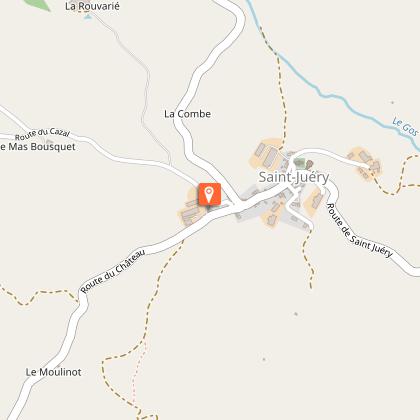
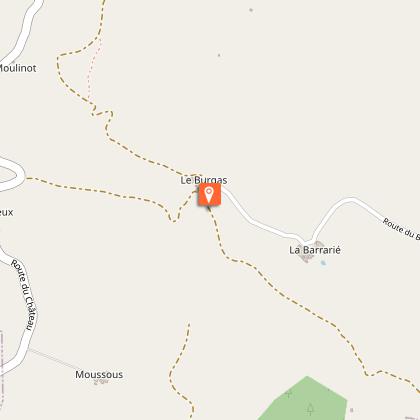
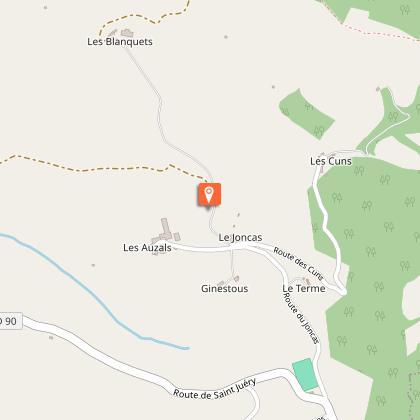
Like a walk through the fields, this calm and peaceful hiking loop takes place in an agricultural landscape which is composed of small valleys and gentle slopes and is at the same time a biodiversity pool and the setting of an appealing built heritage.When leaving the community hall (Hiking Information Point), take the communal road to your right towards the Château for 100 m. Fork to the left onto a stone pathway that rises gently up the hill, before slopping down. Leave an ascending path to your left and ford a small brook.Start walking up a gentle rise (leaving two tracks to your right), until you reach the hamlet of Brugas. Immediately after the houses, take the first path to your right. This path leads a few meters down to a left hand track that runs parallel to La gravière stream.Carry on along the track that runs up the valley. Continue straight on passing a good number of tracks on either side. Once you’ve forded the brook, a short but steep slope brings you up below the Castagnole farm. Stay below the level of the farm and fork to the left to make your way down to the same brook and ford it once again. Carry on straight ahead and leave a path to your left. A rather long and shady slope leads you for more than 1 km up to the Gardette road.At the junction with the tarmacked road, walk to the right for 700 m until you reach the D90 road. Head left towards St Juéry up to the football pitch (this part is connected with the Rebourguil loop circuit n°42). Walk along the edge of the pitch towards the “Cuns, Terme, Joncas…” for 800 m.As you arrive to the fork, follow the signboard indicating Les Blanquets. 200 m further on, follow the dirt track to your left which runs along the ridge line. This track joins up with a track running through the undergrowth on a slope down to the left into the Gos valley towards the Curvélarié farm. Walk through the farm and then go up the hill via the St Juéry road.
Technical Information
Altimetric profile
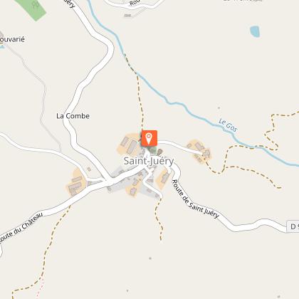
Starting point
Steps
Points of interest


Additional information
Public transport
Se déplacer en bus ou en train : lio.laregion.fr/covoiturage : BlaBlaCar, Rézo Pouce, Mobicoop, Idvroom, LaRoueVerte, Roulez malin
Advice
Box tree moths are active from May to October. During the caterpillar phase, they feed on the leaves of box trees. They crawl down trees and move on long silken threads, although these threads are annoying when hiking they do not pose any health risk.
Advised parking
Park your car in front of the village hall, opposite the grocery store
Access
When driving on the D999 road, between St Affrique and St Sernin, take the D90 Road to your right towards St Juéry and Coupiac. St Juéry is a 7 km drive from this intersection.
Arrival
Park your car in front of the village hall, opposite the grocery store
Ambiance
Starting from Saint-Juéry, this walking tour where downy oaks and green meadows combine with trails and stream crossings, is an invitation to observe the great biodiversity of plant and animal species in the Rougier (numerous orchids, birds of prey…). A pleasant loop, dotted with a whole architectural heritage (castles and churches) and a local small built heritage.
Departure
Park your car in front of the village hall, opposite the grocery store
Data author
