Alert
Alerts
Hiking in the Tannes forest

Description
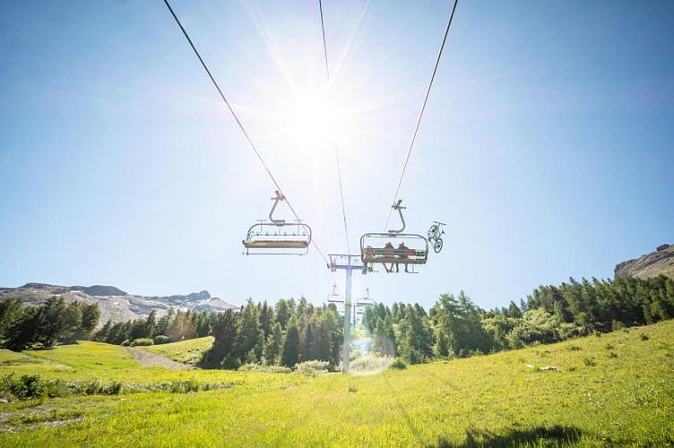
Thanks to the lifts at the Val Cenis Termignon ski resort, you can enjoy a high altitude loop that feels like a real journey. What could be more comfortable than to pull yourself effortlessly up to the open mountain pastures?
The roches blanches chairlift is just waiting for you to start its ascent. With an intrigued eye, you may catch a glimpse of thrill-seeking mountain bikers hurtling down the "blue cheese" enduro track. As soon as you arrive at Replat des canons, the trees reveal the Vanoise glaciers and the majestic Dent Parrachée. At 3697m, it dominates the valley like an emblematic totem. Climb to the top on foot and feast your eyes on the panorama from the Sort de l'Erellaz. A 180° glimpse from Aussois to Termignon offers the luxury of a few luminous photos. The smell of resin and the sight of the famous snow heather will almost make you forget the occasional difficulties of the descent. Don't hesitate to take several refreshment breaks. Listen...to the silence and calm of the forest. After passing under the Tannes ski lift, you may well come across the walkers who link the valley's villages on the aptly named "chemin du petit bonheur".
Technical Information
Altimetric profile
Starting point
Points of interest

Date and time
- From 01/05/2026 to 15/10/2026
- From 01/05/2027 to 15/10/2027
Additional information
Open period
From 01/05 to 15/10 daily.
Accessible by ski lift in summer.
Subject to favorable snow and weather conditions.
Updated by
Communauté de communes Haute Maurienne Vanoise - 20/04/2026
www.cchautemaurienne.com
Report a problem
Environments
Mountain view
Forest location
Mountain location
Village centre
Presence of livestock and guard dogs
Close to a public transportation
Near shuttle stop
Contact
Phone : 04 79 05 99 06
Email : info@hautemaurienne.com
Website :
https://www.haute-maurienne-vanoise.com
http://www.cchautemaurienne.com/jy-vais-en
Type of land
Stone
Ground
Grit
Not suitable for strollers
Location complements
By bus: Line S52 or S53 - Maison de la Vanoise stop.
By car: park in the parking lot next to the Maison de la Vanoise or at the foot of the ski slopes.
Topo guides and map references
Topo guides references :
Map and booklet "Haute Maurienne Vanoise. 120 walks and hikes - 36 trail routes. For all levels" (sold for €12 in Tourist Offices)
Map references :
Map IGN 3634OT - Val Cenis
Reception complements
The duration of hiking trails is calculated using reference paces: 300 m/h ascent, 500 m/h descent and 4 km/h on the flat.
As hazards may occur at any time on the routes, the GPX tracks provided are not contractual. They are given for information only. Riders use them at their own risk, depending on their level of technological proficiency and their understanding of the terrain.
Guidebook with maps/step-by-step
To guide you in the field, consult the "step-by-step" directional diagram provided in pdf.
Animals
Yes. Ski lift not accessible to pets to access the hike.
Pets allowed on leash only on the trail.
Data author
