Alert
Alerts
Hiking: Gex - Vesancy - Chapelle Riantmont - Variant with dogs
Description
Departing from Gex, this gentle family trail leads to the charming village of Vesancy. With its varied landscapes, Riantmont chapel, castle, traditional farms and local heritage, it's a great way to immerse yourself in the authenticity of the Pays de Gex.
Set off from the centre of Gex for a rural escapade to the charming village of Vesancy. This loop, accessible to families and dogs, offers a wide variety of landscapes and an immersion in the heritage of the Pays de Gex.
The route first crosses open meadows before reaching Vesancy, with its restored farmhouses, fountains, château and Saint-Christophe church. A gradual climb then takes you to the heights of Riantmont, offering superb views over the valley and the Geneva basin.
At the summit, the Riantmont chapel, built in 1868, offers a serene pause. This place of pilgrimage, particularly popular on Whit Monday, adds a spiritual touch to the hike.
The descent takes you gently through the surrounding hamlets, for a leisurely return to Gex. It's an ideal way to discover the authenticity of the region while sharing a convivial moment with your four-legged friend.
Technical Information
Altimetric profile
Starting point
Points of interest
Additional information
Contact
Phone : 04 50 28 09 16
Email : contact@paysdegex-tourisme.com
Website : https://www.paysdegex-montsjura.com
Open period
All year round daily.
Subject to favorable snow and weather conditions.
Environments
Mountain view
Panoramic view
Lake view
Type of land
Stone
Ground
Grit
Not suitable for strollers
Topo guides and map references
Topo guides references :
Hiking in Pays de Gex and the Haute Chaine du Jura: on sale at Pays de Gex tourist agencies: 9€.
Map references :
3327ET - MOREZ LES ROUSSES
Updated by
Office de Tourisme du Pays de Gex - 16/04/2026
www.paysdegex-montsjura.com
Report a problem
Reception complements
▶ Before setting off :
Check the general and local weather forecast, and make sure there's no precipitation.
Find out about the approach route, the height of the itinerary, the time it will take to complete the climb, and any possible escapes (IGN map, GPS, topo-guide, etc.).
Evaluate possible risks by asking mountain professionals, mountain huts and gîtes.
Inform someone close to you of your objective, and contact them again in the event of any changes: departure and return times, number of participants with telephone numbers for each, vehicle(s), parking, etc.
Avoid setting off alone, and use equipment that is suitable for the activity, adjusted and in good condition: headlamp, complete first-aid kit, survival blanket, etc.
In the event of a problem, call 112 (European emergency number).
Guidebook with maps/step-by-step
(1) From the center of Gex, on Place Perdtemps, take the avenue on the right to the end. Continue on Chemin du Crêt, keeping to the right. Walk along the housing developments to the end of the street. At the Creux du Loup crossroads, turn left, then immediately right onto Rue de la Forêt de Disse, which leads to a place called Pérsoset.
(2) Continue straight ahead. At the fork, turn right between the hedges onto Chemin de l'Ouche de la Croix. About ten meters further on, the path turns left, crosses the Oudar river, and runs alongside it for a short distance. Then continue left towards Vesancy, between hedgerows and fields. The path becomes a road at the entrance to the village.
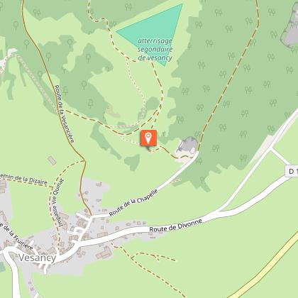
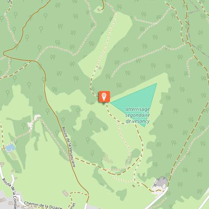
(3) Enter Vesancy via Route de Bottenay, continue straight ahead until you reach Rue du Château, which crosses the village in front of the castle. Continue to the intersection with Route de Divonne, then turn left onto Route de la Chapelle. It climbs gently. At the next intersection, keep to the right. Follow the signs for Chapelle de Riantmont. After about 500 m, the path branches off to the left and reaches the chapel.
(4) You will be treated to a beautiful panoramic view. Three orientation tables provide a better understanding of the landscape. Take advantage of this peaceful spot to take a break. The trail continues behind the chapel, stays to the left at the next three intersections, then crosses the Vesancière road. It runs along the edge of the forest, branches off to the left, then descends towards a reservoir. At the crossroads below, continue straight on along the Route de la Combette, then take the path on the right. This forest path passes in front of the houses of La Ganguillette and La Pinière before reaching the hamlet of Saint Martin.
(5) Turn right to go back down to the road and quickly reach the hamlet of Le Chaumois.
(6) Continue straight ahead, then take the Route de la Forêt de Disse on the right. Follow this road, cross the Oudar River again and return to Le Pérsoset. From there, take the same route as on the way out to return to the center of Gex, on Place Perdtemps.
Animals
Yes. Dogs are not allowed in the Haute chaîne du Jura National Nature Reserve.
Data author
