Alert
Alerts
La Bouble
Description
Set in a wooded landscape of hills topped by hamlets and valleys on either side of the Bouble (the ‘petite’ and the ‘grande’), this route follows a series of gentle ascents and descents, with the Colettes forest dominating the eastern horizon.
Technical Information
Altimetric profile
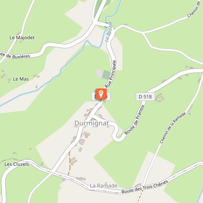
Starting point

Additional information
Updated by
Office de Tourisme des Combrailles - 02/06/2026
www.combrailles-auvergne-tourisme.fr/
Report a problem
Open period
All year round daily.
Contact
Phone : 04 73 52 72 72
Email : accueil@paysdesainteloy.fr
Location complements
Car park in front of Durmignat town hall, 18 rue Principale.
Reception complements
For your own safety, always take a bottle of water, a hat, warm clothing and footwear suitable for walking.
Depending on the weather conditions, some routes are not recommended in bad weather (fog) or are not practicable, or even forbidden, during the winter season.
Some sites are fragile, so stay on the marked paths. Avoid picking wild flowers and disturbing wildlife. Pick up your rubbish.
Guidebook with maps/step-by-step
Start: Opposite the town hall, turn left into ‘rue Principale’ and then right. Pass
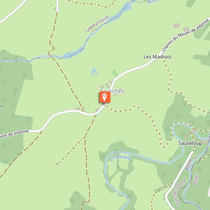
in front of the cemetery and then, at the end of the descent, turn right onto chemin de la Faye. At the fork in the road, go left to. At the hamlet, continue uphill to the right for 150 m. At the crossroads, take the path opposite. At the road (D518a), turn left for around 100 metres. As you enter the right-hand bend, turn left onto a track that leads down to the Bouble. Cross the river by the footbridge and head uphill to the hamlet of Les Fourches, level with the second house.
1 - Turn right onto a track. At the bottom of the descent, walk right alongside the Bouble, then cross the river by a footbridge, level with an old ruined mill. Go up the grassy path and join a wide track. Go up to the right and reach the ‘route de Sauteloup’. Follow it to the right, at towards the hamlet of Le Proche. Take the first turning on the left, which quickly becomes a path leading down to the Petite Bouble. After the footbridge, follow the path as it curves upwards.
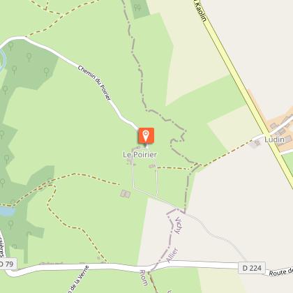
When you reach the flat, ignore a footpath to the left and turn right at the T-junction. Reach a small road and climb it to the left. Walk across the plateau (with a view of the Colettes forest to the east) to the first house in the hamlet of Le Poirier.
2 - Continue straight on until you reach a T-junction. Turn right and follow this small road as far as a large farm building. Follow the path downhill. Follow the path past two ponds and back to the Petite Bouble, which is crossed by a footbridge. Climb up to the village of Pranoix, ignoring the adjacent streets. Continue on the D518 towards Durmignat. At the stop sign after
l'église, turn right to get back to the starting point.
Animals
Yes. Dogs must be kept on a leash
