To see around
See more
Open
Close
Show
Show
Show
Show
Show
Show
Show
Show
Show
Show
Show

Oups... It would appear that Cirkwi does not have permission to use your location.

Description
Map
Steps
Ratings and reviews
See around

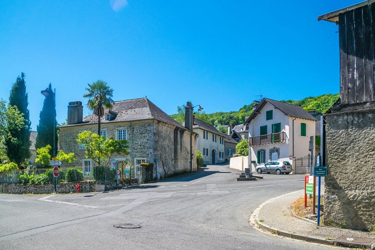
Arbus - Les coteaux du bois de bas

photo-rando-arbus-coteaux-du-bois-de-bas3
photo-rando-arbus-coteaux-du-bois-de-bas4
photo-rando-arbus-coteaux-du-bois-de-bas6
photo-rando-arbus-coteaux-du-bois-de-bas1
photo-rando-arbus-coteaux-du-bois-de-bas7

Description

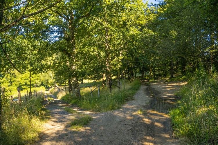
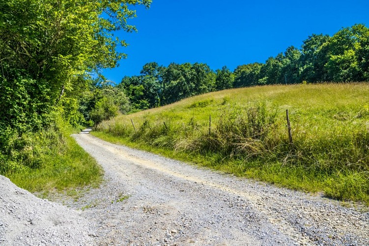
This loop will allow you to enjoy magnificent views of the hillsides, the Pyrenees chain and more particularly the Pic d'Anie. You will evolve in the heart of the forest but also in the middle of vineyards.
Departure: Town Hall car park - 4, rue du Général Pommies - Arbus
Yellow Pedestrian Marks (Route n°18)

Technical informations

This circuit was updated on: 22/04/2024
9.3 km
3 h 30 mn
max. 267 m
min. 132 m
399 m
399 m
Styles : BaladeDiscoveryIn the country
Public : Family

Altimetric profile

Starting point

Parking de la mairie - 4 Rue du Général Pommies , 64230 ARBUS
Lat : 43.334685387641Lng : -0.50677879260673

Steps

image du object
1

Departure - Town hall car park

Leave the car park and go past the "Maison pour tous" and the entrance to the town hall. At the crossroads, turn right towards Rue de l'Eglise. Just before a wall made of large boulders, turn right on a dirt path that climbs. At the cross, take the track that goes to the right and follow it. Arrive at a crossroads of 4 tracks and take the one that goes to the right. Stay on the main road until you reach the asphalted road. At the junction with the RD 229, turn left, then immediately right towards Château d'Abos. Continue straight on the asphalted road which becomes a dirt road. At the first fork, turn left for 50m to reach a new fork.

- Pau Pyrénées Tourisme -
Consulter
image du object
2

"Barraqué" hamlet

Take the downhill track to the left again. On the right, a house in ruins, opposite a plot of vines. Turn left and continue straight on the main road. Walk along the vineyard then the path passes between two plots of vines. The path, while remaining at the same altitude, turns right. At the end of the last parcel of vines, turn left on the path that descends to the asphalted road. Turn left on the RD 229, then 20m further on the right, to take a wide track. Continue straight until near the place called “Barraqué”.

- Pau Pyrénées Tourisme -
Consulter
image du object
3

Back to the car park

Before the house, turn left on the track that climbs to become an asphalted road. Stay on it until the place called “Chige”. At the junction with a asphalted road, turn left on Chemin Lapouble. Continue straight to arrive on a plateau constituting a remarkable point of view of the Pyrenees. On the right is a house bordered by a hedge of cedars. Turn right on the dirt track that passes between the houses. The track goes down and then up to the barn. Go to the left and continue straight on the main track which descends. At the crossroads, turn right and return to the route oh the beginning in reverse to go down to the village of Arbus.

- Pau Pyrénées Tourisme -
Consulter

Additional information

Balisage

Yellow
Pédestre

Typologie de l'itinéraire

Loop

Thèmes

Natural

Contact

Fixed telephone : +33 5 59 27 27 08
Pau Pyrénées Tourisme
Web site (URL) : www.rando-pau.com
e-mail : contactrandos@tourismepau.fr

Animaux bienvenus ?

Oui

Ratings and reviews

To see around
See more
Open
Close
Show
Show
Show
Show
Show
Show
Show
Show
Show
Show
Show