Alert
Alerts
Hiking - Étang du Chevalet
Description
A family trail to discover the Charensat forest and the Etang du Chevalet.
Explanatory signs accompany walkers along the route to introduce them to the flora and fauna.
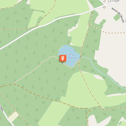
Take a short break at the Etang du Chevalet and relax on a bench (with picnic table). Further on, you'll discover a source of drinking water and pass under huge white fir trees before arriving at the starting point. Another picnic area also invites you to take a rest under tall fir trees.
These educational trails under the trees (white firs, Douglas firs, oaks and beeches) are great to do when the weather is warm, but also in autumn to discover the mushrooms and enjoy the colours of the forest. The trails are accessible with an all-terrain pushchair and have been designed and built by local schools to teach people about the forest. Ideal for all the family.
Technical Information
Altimetric profile
Starting point
Additional information
Updated by
Office de Tourisme des Combrailles - 02/06/2026
www.combrailles-auvergne-tourisme.fr/
Report a problem
Open period
All year round daily.
Contact
Phone : 04 73 52 72 72
Email : accueil@paysdesainteloy.fr
Location complements
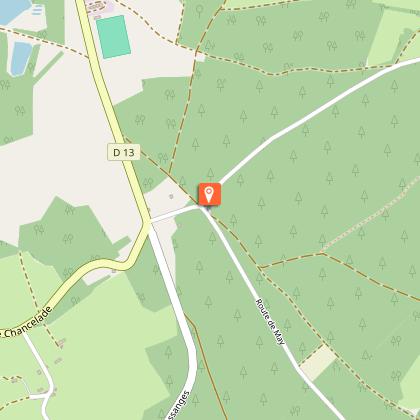
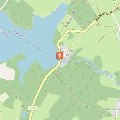
North-west of Clermont-Ferrand, in Charensat, car park 100m from the D13/D60 junction towards La Faye.
Reception complements
Beware of tree felling along the route.
For your own safety, always take a bottle of water, a hat, warm clothing and footwear suitable for walking.
Depending on the weather conditions, some routes are not recommended in bad weather (fog) or are not practicable, or even forbidden, during the winter season.
Some sites are fragile, so stay on the marked paths. Avoid picking wild flowers and disturbing wildlife. Pick up your rubbish.
Guidebook with maps/step-by-step
Start: Opposite the start sign, turn right onto the wide forest track. Turn left at
. At the crossroads, go left for 100m along a track
, which may be damp, until you find a path on the right.
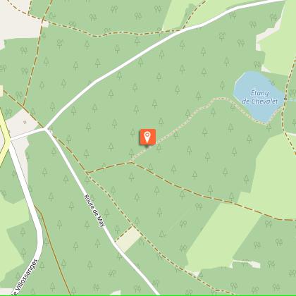
1 - Take this path and continue straight ahead. At the T-junction, turn left. 50m from
the pond, the path veers right and then joins the edge of the pond. Follow the path to the left (picnic table
, country views). After the pond, the path continues into the forest, partly overlapped by a logging road (
). Continue along this path until you come to a junction with a path
on the right, located on a small rise.
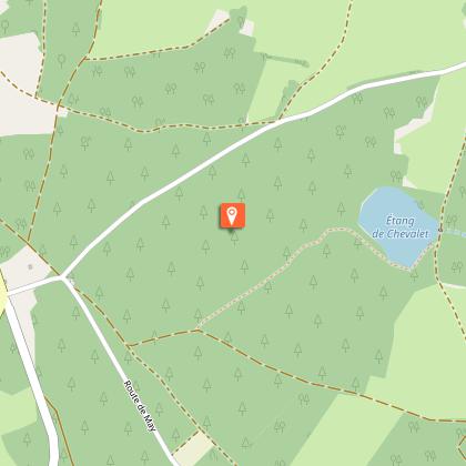
2 - Follow this path to the right. Go past a water intake on the right and continue along a wide gravel path at
. Cross a road and continue straight ahead on the forestry path. A
logging road partially overtakes the forest path, which then climbs back up to the
starting point.
Animals
Yes. Dogs must be kept on a lead
