Alert
Alerts
The Durance by bike

Description
The Durance by Bike is an invitation to explore the cycling route (V862) along the Durance Valley.
In the Hautes-Alpes, the route descends towards Briançon through the Guisane Valley to meet the course of the Durance, whose source lies upstream of the fortified city (a UNESCO World Heritage Site), on the heights of the Col du Montgenèvre, at an altitude of 2,390 m. The cycling route then follows the Durance through high mountain landscapes as far as Embrun, via the citadel of Mont-Dauphin, then along a balcony overlooking Lac de Serre-Ponçon, before heading towards Gap and then Sisteron.
The mountain scenery gradually gives way to agricultural plains, orchards and lavender fields. A cycling route that passes through remarkable historical sites and unique landscapes offering exceptional biodiversity, as well as several regional towns, making it suitable for daily commuting needs as well. A good number of railway stations are also spread along the route, including several in the upper Durance valley, offering an alternative means of ensuring continuity for all.
Technical Information
Altimetric profile
Starting point
Points of interest




Additional information
Public transport
Train: The TER network in the Hautes-Alpes offers the following stations (from North to South): BriançonL'Argentière-La-BesséeMontdauphin-GuillestreEmbrunChorgesGapSisteronBus: The LER network of the Région Sud Zou
Advice
Waymarking : The route is continuously waymarked from Briançon to Sisteron with standard cycling route signage featuring the "Durance à Vélo" logo. Surface / Safety : The Durance by Bike is a cycling route that follows a network of paved secondary roads. You will be sharing the road with motor vehicles. This is not a dedicated cycle path itinerary.
Access
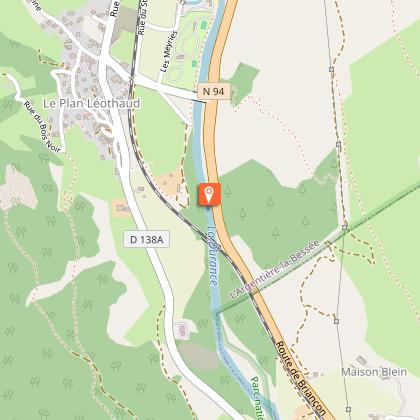
The Durance by Bike follows the roads below (from North to South): D1091 (between Le Monêtier-les-Bains and Briançon)N94 (between Briançon and Gap)N85 (between Gap and Sisteron)
Ambiance
Between Briançon (Hautes-Alpes) and Avignon (Vaucluse), covering a distance of 438 km, the cycling route (V862) crosses 4 départements of the Région Sud over 9 stages. 5 stages cross the Département des Hautes-Alpes. Take the time to discover and savour the magnificent ever-changing landscapes, from high mountain scenery to rolling hillsides, from forests to lavender fields… Welcome to follow the course of the longest river in Provence… You can find all the information presented here on the website La Durance à Vélo.
Arrival
Tallard
Departure
Le-Monêtier-Les-Bains
Data author
