Alert
Alerts
Les Eyssuches (no. 18)


Description
A circuit rated as difficult running on both sides of the Durance, starting from L'Argentière-la-Bessée.
The circuit starts right in the centre of town, not far from the bridge spanning the Durance. In fact, you need to cross this bridge to get to the main road
When you reach the main road, go straight across and up to the cemetery. Skirt around the cemetery on the north side, following a forest track
Where the tracks intersect, continue due south on the forest track
At the next intersection, go past the tank on your left and continue downhill on the track, heading due south
Leave the track, turning left onto a narrow path which runs through the forest and drops down to La Roche-de-Rame
After the chapel of Saint Roch de Géro, cross the mountain stream and take the narrow road on your right
Upstream from the main road, turn left into the bridge underpass
Carry on due south past the old waste collection site
At the bridge (Pont de Traverses), rejoin the road on the right-hand bank of the Durance and this brings you back to Plan Léothaud
Go right under the railway line and then left towards the leisure centre ("Base de loisirs")
You then rejoin the green route ("Voie Verte") and this brings you back to the starting point of the circuit
Technical Information
Altimetric profile
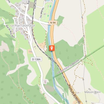
Starting point
Points of interest


Additional information
Public transport
Public transports >> www.pacamobilite.frconsider car-sharing >> www.blablacar.fr For more information, ask at the Tourist Information Office nearest to the trail starting point >> www.paysdesecrins.com
Advice
>Rescue services contact details: Secours Montagne (Mountain Rescue): +33 (0)4 92 22 22 22 or 112 Take your litter home Do not take shortcuts across pastureland
Herd protection dogs - ATV
In mountain pastures, protection dogs are there to protect the herds from predators (wolves, etc.). When mountain biking, I adapt my behavior by going around the herd, pausing and getting off the bike so the dog can identify me. Find out more about the actions to adopt with the article "Protection dogs: a context and actions to adopt". Tell us about your meeting by answering this survey.
Advised parking
Car park of the Place du kiosque, L’Argentière-la-Bessée
Access
16 km from Briançon, take the N94.
Arrival
Place du kiosque, L’Argentière-la-Bessée
Ambiance
This circuit runs above the town of L'Argentière-la-Bessée. Stunning views of its industrial past (Pechiney factory), its exploitation of water (the hydroelectric power station) and the iconic ridge, the Crête de la Rortie. Then, a stretch running close to the Canyon de l'Ascension via La Roche-de-Rame and back along the right-hand bank of the Durance.
Departure
Place du kiosque, L’Argentière-la-Bessée
Data author
