Alert
Alerts
Puy Aillaud (trail route no. 19)


Description
An ascent through pine woods, a descent through an oak wood and a short, hidden stretch to reach Puy Aillaud.
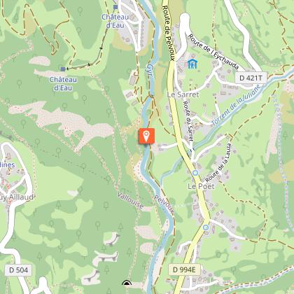
When you come to the the Vallouise bridge ("Pont de Vallouise"), take the track leading up the left-hand bank of the Gyr leading towards Pelvoux.
Cross the Gyr over a wide footbridge and after a short distance, on a hairpin in the track, take a path running below a stable and soon after this take the path on the right to Puy Aillaud.
After the Pas d'Aval, a short narrow stretch through boulders, follow the yellow or white painted posts until you reach the road. Turn left onto the road to pass below the village of Puy Aillaud and the take the track towards the chapel of Saint-Jean.
Turn left back onto the road for a hundred metres or so, leaving the walking trail that leads away straight ahead.
After the hairpin, you plunge onto a steep path edged with deciduous trees running straight down the slope. The path runs through a forest of oak and pine trees, and you continue the descent until you reach Vallouise. The descent can be slippery in places.
Technical Information
Altimetric profile
Starting point
Points of interest


Additional information
Public transport
Public transport >> www.pacamobilite.fr Consider car-sharing >> www.blablacar.fr For more information, ask at the Tourist Information Office nearest to the trail starting point.
Advice
Before setting off, it is very important to check the opening periods for this route on the website: stationdetrail.com/fr/stations/le-pays-des-ecrins/parcours Share your photographs on social networks with #stationdetrailecrins Check weather conditions before setting off. Rescue services contact details: Secours Montagne (Mountain Rescue): +33 (0)4 92 22 22 22 or 112 Show consideration for the work of farmers, livestock keepers and owners Close all gates behind you Take your litter home Do not take shortcuts across pastureland The trail routes are also suitable for walking
Advised parking
Camping Huttopia car park, Vallouise
Access
10 km from L'Argentière-La Bessée, take the D994E.
Arrival
Camping Huttopia, Vallouise
Ambiance
“Emerging onto the plateau of Puy Aillaud amidst the meadows, passing below this tranquil hamlet and then dropping back down along an old track to the charming chapel of Saint-Jean almost makes you forget the great features of the rest of the route.” Marie-Geneviève Nicolas, park ranger at the Parc National des Écrins
Departure
Camping Huttopia, Vallouise
Data author
