Alert
Alerts
Les Eyssarts
Description
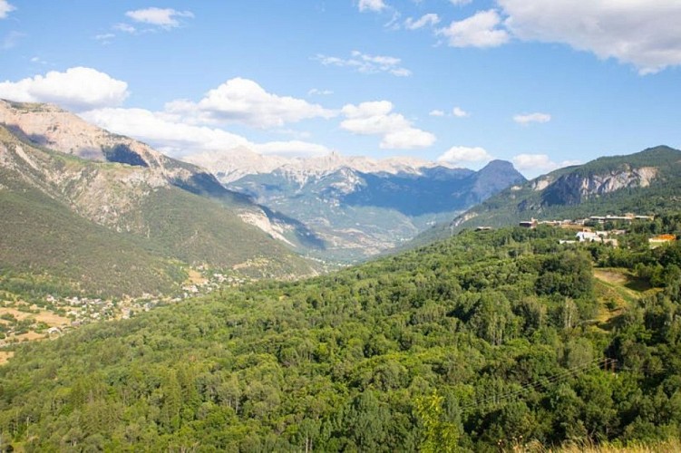
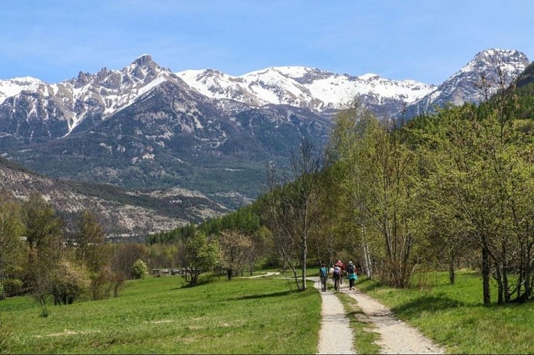
A walk through forest for the most part, its high point being a panoramic view over the Vallouise valley.
The route starts at Le Pont du Rif, from the car park on the right-hand bank of the Gyronde. Take the paved road heading towards the campsite «Le Courounba»
Before you reach the campsite, go left onto a path which runs just above it
At the intersection, continue straight ahead towards Les Eyssarts (Snowshoe track ("Piste de raquettes") no. 10)
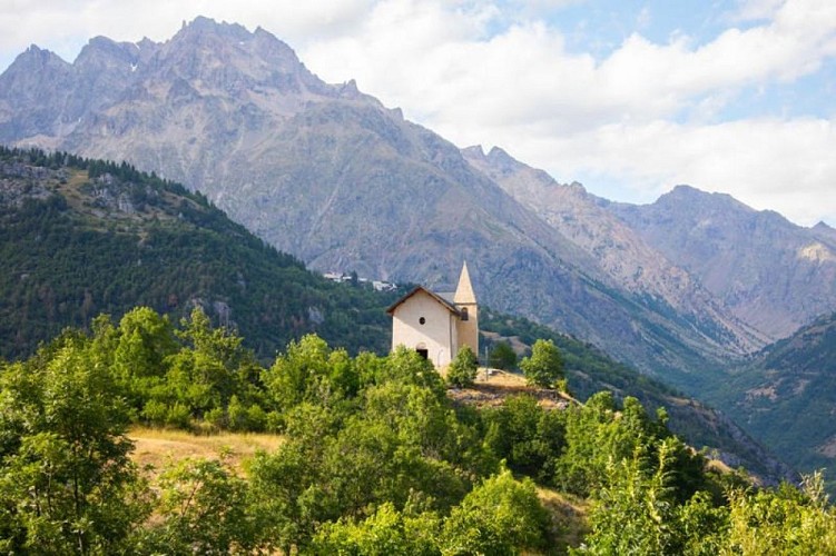
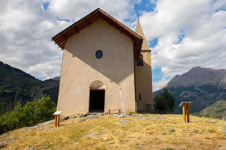
At the end of the path, turn left and after 150 metres head right onto the heritage path ("Sentier du patrimoine") towards the chapel of Saint-Romain
Turn right and after another 150 metres turn left which takes you up a short incline. At the end of the path, where you reach the D4, head right and after 15 metres turn right again onto a track leading to the chapel of Saint-Romain
At the chapel of Saint-Romain, retrace your steps until you are back on the road, then turn left again and start the descent, following signs for Vallouise, via the "Sentier du facteur" (postman's path)
At the end of the track, head left to continue downhill on a new track which brings you to the D4 again. Carry on downhill and at the intersection turn right towards the Park Centre ("Maison du Parc")
Leave the road going right to follow the Gyronde towards Champ Clément, Les Parchers and La Chambon. After 350 metres, turn left and continue in the same direction
Turn right again, following the first part of the trail in reverse, to skirt around the campsite and back to your starting point
Technical Information
Altimetric profile
Starting point
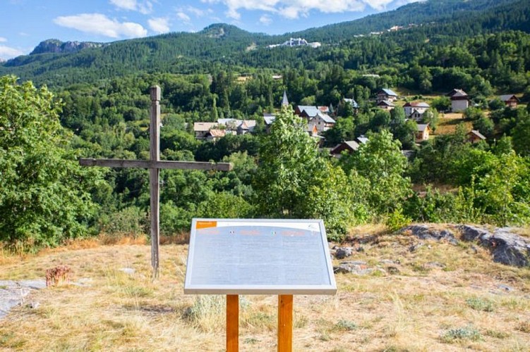
Points of interest


Additional information
Public transport
Public transports >> www.pacamobilite.frconsider car-sharing >> www.blablacar.fr For more information, ask at the Tourist Information Office nearest to the trail starting point >> www.paysdesecrins.com
Advice
Check weather conditions before setting off. Rescue services contact details: Secours Montagne (Mountain Rescue): +33 (0)4 92 22 22 22 or 112 Show consideration for the work of farmers, livestock keepers and owners Close all gates behind you Take your litter home Do not take shortcuts across pastureland
Advised parking
Car park close to the Pont du Rif (right-hand bank of the Gyronde), Les Vigneaux
Access
4.7 km from L'Argentière-La Bessée, take the D994E.
Arrival
Pont du Rif (right-hand bank of the Gyronde), Les Vigneaux
Ambiance
This itinerary introduces you to three villages in the territory - Les Vigneaux, Puy Saint-Vincent and Vallouise-Pelvoux - all in tranquil surroundings and which time seems to have passed by. On top of this, the circuit offers a panoramic view from the chapel of Saint-Romain, a fine example of the historical, iconic architecture of the municipality of Puy Saint-Vincent.
Departure
Pont du Rif (right-hand bank of the Gyronde), Les Vigneaux
Data author
