Alert
Alerts
Type of practice
Walking
Hard
Presentation
Description
Map
Steps
Ratings and reviews
See around
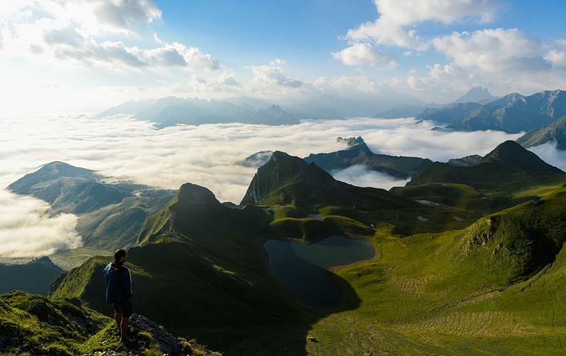
N°33 Lac du Montagnon par le Col d'Iseye


Description
Nestled between the Mardas, Montagnon and Escala ridges, what sets the Montagnon d'Iseye Lake apart is its heart shape and isolation. It's a long way to go to reach this natural wonder. Highly original trail.
Technical Information
Walking
Difficulty
Hard
Dist.
20 km
Type of practice
Walking
Hard
Show more
Altimetric profile
Starting point
Terminus de la route Aulet
,
64490
ACCOUS
Lat : 42.974682Lng : -0.599055
Steps


Additional information
Balisage
Yellow
Trait
Typologie de l'itinéraire
Return
Thèmes
Natural
Data author

proposed by
Communauté de Communes du Haut-Béarn
12 place Jaca 64400 Oloron-Sainte-Marie Cedex France
Ratings and reviews
To see around