Alert
Alerts
Type of practice
Walking
Hard
5h50mn
Presentation
Description
Map
Steps
Points of interest
Ratings and reviews
See around
N°17 Plateau d'Ourdinse


Description
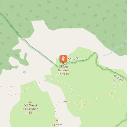
The ascent to the Ourdinse Plateau requires serious effort. The trail climbs up from the first steps of the ascent so getting a steady pace is key. No pain no gain: the sharp narrow ridge of the Pic des Teulères, a floral plateau and a real haven of peace.
Technical Information
Walking
Difficulty
Hard
Duration
5h50mn
Dist.
9.2 km
Type of practice
Walking
Hard
5h50mn
Show more
Altimetric profile
Starting point
Table d'Orientation de Bedous
,
64490
BEDOUS
Lat : 42.9959062Lng : -0.6035748
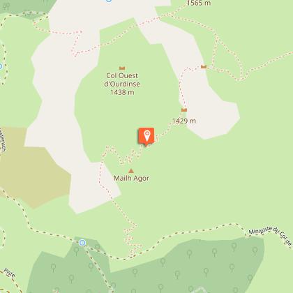
Points of interest

Additional information
Balisage
Yellow
trait
Typologie de l'itinéraire
Loop
Thèmes
Natural
Durée moyenne de l'expérience
Over 4 hours
Data author

proposed by
Communauté de Communes du Haut-Béarn
12 place Jaca 64400 Oloron-Sainte-Marie Cedex France
Ratings and reviews
To see around