Alert
Alerts
2-day walking circuit around Saint-Sigismond - Stage 2
IGN cards


Description
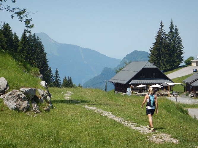
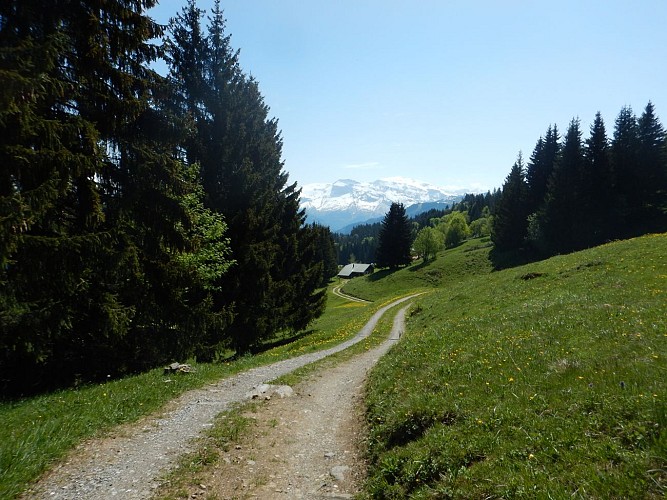
The day begins with a leisurely descent from Chevran along a different trail, offering you new views. You'll make your way back down to the valley, taking in the beauty of the scenery, before returning to your starting point.
On the second day, you'll take a different path back down to the valley, offering new views of the Chevran. A pleasant descent in the heart of nature, taking you gently back to the starting point, while enjoying the soothing and varied scenery of this beautiful loop.
Technical Information
Altimetric profile
Starting point

Date and time
- From 15/04/2026 to 01/11/2026
Additional information
Open period
From 15/04 to 01/11.
Subject to favorable snow and weather conditions.
Updated by
Cluses Arve & montagnes Tourisme - 24/11/2025
www.cluses-montagnes-tourisme.com
Report a problem
Environments
In the country
Riverside
Forest location
Mountain view
Mountain location
Village 2 km away
Waterside
Panoramic view
Contact
Phone : 04 50 96 69 69
Email : tourisme@cluses-montagnes.com
Website : https://www.cluses-montagnes-tourisme.com
Facebook : https://www.facebook.com/Cluses-Arve-montagnes-Tourisme-104007097700091/
Type of land
Not suitable for strollers
Location complements
Park in the Claude Anthoine car park in Cluses. Return to the start of the walk by taking the rue du 8 mai, crossing the railway line and continuing along the Boulevard du Chevran until you reach the junction which rises on the right just behind the ‘Chevran’ bus stop.
Topo guides and map references
Topo guides references :
Hiking guide on sale for €10 at the tourist office.
Reception complements
Whatever you choose to do, remember to pack cereal bars, plenty of water, sunglasses, sun cream, a small first-aid kit and the right clothes for your outing, depending on the season and weather forecast.
Guidebook with maps/step-by-step
Reach the finish point of stage 1: ‘Croix du Chêne’.
From Croix du Chêne to Pont de la Motte:
Follow the signs for ‘Pont de la Motte’: this is a downhill path that crosses the main road and then the local road as far as ‘Chez Bouvier’. From here, follow the route from stage 1 in the opposite direction as far as Pont de la Motte.
From Pont de la Motte to Cluses :
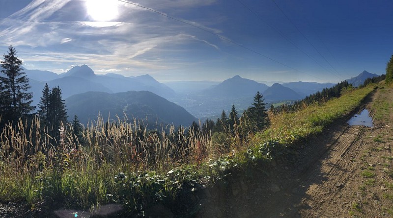
Follow the signs for Panorama du Chevran until you reach it: enjoy the view over the Arve valley. Then retrace your steps to reach the ‘Alpage de Chevran’ signpost. From here, start your final descent towards ‘Montoulivet (Cluses) par Le May (Ruine)’. You'll come to the same intersection as on the first day: join the Boulevard du Chevran and turn left. Cross the Chemin de Fer, take the Rue du 8 Mai, walk past the chocolate factory and you'll see the tourist office: the arrival point.
Animals
Yes
Data author
