Alert
Alerts
A 2-Day Hiking Loop Around Saint-Sigismond - Stage 1: Cluses - Croix du Chêne
Description
Starting from Le Chevran, you’ll hike along the trails through the forest, enjoying a magnificent view of the Arve Valley. After a steep climb, you’ll reach the Plateau d’Agy, before continuing on to Saint-Sigismond, a peaceful haven high in the mountains.
This first stage immerses you in nature with a gradual climb beneath the deciduous trees of Chevran. The reward: a breathtaking panoramic view of the Arve Valley. Continue on to the Plateau d’Agy, a vast alpine expanse perfect for hiking, where you can admire varied landscapes ranging from alpine meadows to forests. The day ends in the quiet, authentic village of Saint-Sigismond, at an elevation of 900 m. It’s the perfect place to recharge in the heart of nature.
Recommended accommodations for the night (subject to availability):
- Romarica Bed and Breakfast – 2 people:
450, Les Bas Choseaux – 74 300 SAINT-SIGISMOND
+33(0)4 50 34 37 74 / mf.bielicki@wanadoo.fr / www.romarica.com
- La Ferme des Cousines *** Vacation Rental – 8 people:
826, route des Alluaz – 74 300 SAINT-SIGISMOND
+33(0)6 10 23 25 27 / lafermedescousines@gmail.com / www.lafermedescousines.com
Technical Information
Altimetric profile
Starting point
Date and time
- From 15/04/2026 to 01/11/2026
- From 15/04/2027 to 01/11/2027
Additional information
Open period
From 15/04 to 01/11 daily.
Subject to favorable snow and weather conditions.
Distinctions
Listed PDIPR
Updated by
Cluses Arve & montagnes Tourisme - 18/09/2026
www.cluses-montagnes-tourisme.com
Report a problem
Environments
In the country
Riverside
Forest location
Mountain view
Mountain location
Village -2 km away
Waterside
Panoramic view
Contact
Phone : 04 50 96 69 69
Email : tourisme@cluses-montagnes.com
Website : https://www.cluses-montagnes-tourisme.com
Facebook : https://www.facebook.com/Cluses-Arve-montagnes-Tourisme-104007097700091/
Type of land
Not suitable for strollers
Location complements
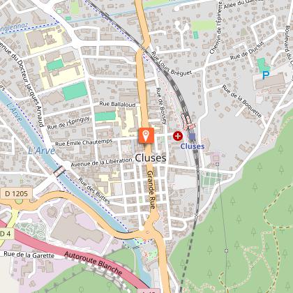
Park in the Claude Anthoine parking lot in Cluses. Then head to the trailhead by returning to Rue du 8 Mai, crossing the railroad tracks, and continuing along Boulevard du Chevran until you reach the intersection that goes up to the right, just behind the “Chevran” bus stop.
Topo guides and map references
Topo guides references :
Hiking guide on sale for €10 at the tourist office.
Reception complements
No matter what hike you're planning, be sure to pack cereal bars, plenty of water, sunglasses, sunscreen, a small first-aid kit, and clothing appropriate for your outing based on the season and the forecast.
Guidebook with maps/step-by-step
From Cluses to Pont de la Motte:
From the Tourist Office, take Rue du 8 Mai (to the right of City Hall), pass by the Zanin chocolate shop, cross the railroad tracks, and continue straight ahead on Boulevard du Chevran. At the “Michel Vaillant” company, take the Chemin de St-Sigismond, which climbs into the forest. At the top of the path, take the trail on the left. You’ll pass the “La Perrière” signposts and then arrive at the “Pont de la Motte.”
From the Pont de la Motte to the Croix de la Joux:
From there, follow the signs for “Chez Bouvier,” crossing the local road at several points. Walk through the fields until you reach a vehicle-accessible path, where you’ll turn left to reach Le Planey. Take the Route du Planey on your right, then take the path through the fields on your right a few meters further on. You’ll reach the county road; cross it by turning right and continue for 50 meters until you reach the dirt road that climbs to your left. You’ll arrive at the Croix de la Joux.
From the Croix de la Joux to the Chalets de Fimaloz:
Take the road to the left (opposite the cross), then turn right at the intersection. Follow Route des Alluaz. At the signpost marked “Chemin du Jourdil” on your left, follow the direction for “Agy (La Croix).” At the next signpost named “La Pierre du Crêt,” follow “Agy (La Croix) via Les Granges de la Frasse.” The trail then runs through the shade of the woods. When you reach Les Granges, follow the signs for “Agy (La Croix)” again. You’ll arrive at Les Chalets de Fimaloz, where you can enjoy a beautiful view.
From the Chalets de Fimaloz to Agy (La Croix):
When you reach the signpost marked “Fimaloz,” follow the signs for “Agy (La Croix) via La Bordaz.” Then continue toward “Agy (La Croix).” You’ll pass by the La Tanière restaurant and the cross-country ski center. Once you’ve passed the parking lot, you’ll arrive at Agy (La Croix).
From Agy (La Croix) to La Croix du Chêne:
To descend from La Croix, retrace your steps. Return to the departmental road and follow the path to the left, which goes down below the road. After about 500 meters, cross the road again and continue downhill to the village of Agy. The trail crosses the road several times before reaching the hamlet of Les Hauts Choseaux. At the intersection, go straight toward La Croix du Chêne until you reach the end of your first stage at the “Croix du Chêne” signpost.
If your lodging is further down in the village of Saint-Sigismond, take the paved road on the left until it ends. This road turns into a dirt path: turn left at the intersection to reach the Saint-Sigismond Town Hall.
Animals
Yes
Data author
