Alert
Alerts
Type of practice
Walking
Very easy
2h30mn
Presentation
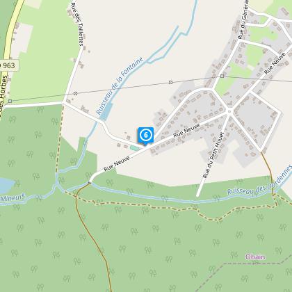
Map
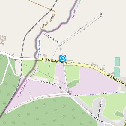
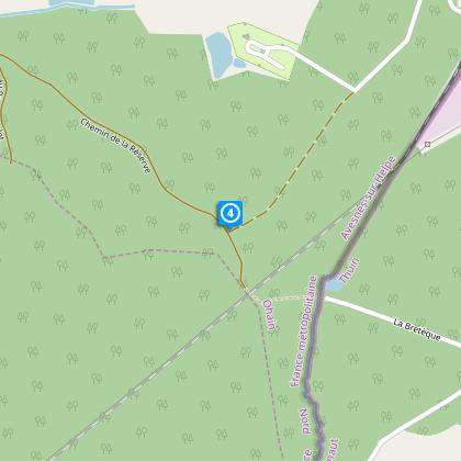
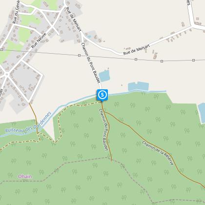
Steps
Cirkwi brief's
Ratings and reviews
See around
Smugglers' Route

Credit : Nord Tourisme
The Cirkwi brief
Explore the Smugglers' Trail in OHAIN: A Scenic Hiking Adventure
Embark on a unique journey through the picturesque countryside of OHAIN, offered by Nord Tourisme. The Smugglers' Trail promises an enthralling experience, blending natural beauty and a touch of adventure. As you meander through lush forests and sprawling fields, keep an eye out for the local wildlife, including the elusive squirrel. The path, marked with yellow signs, weaves its story as it guides you through landscapes that whisper tales of yesteryears. Perfect for those seeking to immerse themselves in nature, this trail offers more than just a walk; it offers an experience to remember.
Brief Technical Overview of the Trail
This carefully mapped out Smugglers' Trail spans approximately 10.9 km, with an elevation fluctuation between 221 and 256 meters. The total positive altitude change remains within the 100-meter range, making this track manageable for most. Due to its moderate elevation changes and clear yellow markings, the trail offers a balance between physical challenge and scenic exploration. Ground conditions, while generally stable, can become demanding in wet weather, indicating the importance of appropriate footwear. This technical brief underlines the trail's accessibility yet reminds of readiness for natural terrain shifts.
Seasonal Tips for Trail Goers
Regardless of the season, the Smugglers' Trail in OHAIN presents unique challenges and splendors. During spring and summer, lightweight clothing and sun protection are advisable, along with sturdy, waterproof footwear to navigate the occasional muddy patch. Autumn, resplendent with changing leaves, may require layers to adjust to variable temperatures. Winter calls for insulated gear and caution on slippery paths. Always pack water and a snack, and notably in rainier months, ensure your footwear offers adequate grip and water resistance for a safe and enjoyable hike.
The Heart of OHAIN: Its Historical Essence
OHAIN, with its smuggling trails, is steeped in rich history and folklore. Located in the Nord department, this area once served as a bustling passage for smugglers, weaving through its countryside and forests to evade authorities. Besides its notorious past, OHAIN stands as a testament to the rural charm and enduring spirit of the region. This trail not only invites adventurers to explore its natural beauty but also to reflect on the historical tapestry that has shaped this land and its communities throughout the centuries.
Weather Patterns and Optimal Visits
OHAIN's climate, characterized by mild temperatures and ample rainfall, plays a pivotal role in the Smugglers' Trail's year-round allure. Spring and early fall often present the most favorable conditions for hiking, with moderate temperatures and less precipitation, allowing for an enjoyable exploration of the trail's full beauty. While summer offers longer days and lush landscapes, readiness for rain is advised. Winter, though colder, still captivates with frost-adorned scenery, demanding suitable cold-weather attire for those venturing the trail during this season.
Automatically generated.
Technical Information
Walking
Difficulty
Very easy
Duration
2h30mn
Dist.
11 km
Type of practice
Walking
Very easy
2h30mn
Show more
Altimetric profile
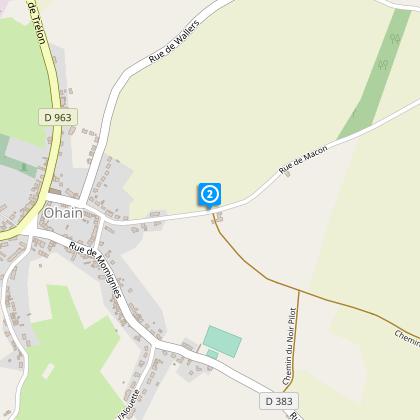
Starting point
2
Mairie
,
59222
OHAIN
Lat : 50.0392098114Lng : 4.11867562139
Steps

Data author

Ratings and reviews
To see around